
Lake St Clair or leeawulenna is a natural freshwater lake located in the Central Highlands area of Tasmania, Australia. The lake forms the southern end of the Cradle Mountain-Lake St Clair National Park. It has an area of approximately 45 square kilometres (17 sq mi), and a maximum depth of 215 metres (705 ft), making it Australia's deepest lake.
Newnham is a residential locality in the local government area (LGA) of Launceston in the Launceston LGA region of Tasmania. The locality is about 7 kilometres (4.3 mi) north of the town of Launceston. The 2016 census recorded a population of 6453 for the state suburb of Newnham. It is a suburb of Launceston. Newnham is located on the East Tamar Highway, on the eastern side of the Tamar River.
Trial Harbour is a rural locality in the local government area (LGA) of West Coast in the North-west and west LGA region of Tasmania. The locality is about 20 kilometres (12 mi) south-west of the town of Zeehan. The 2016 census has a population of 24 for the state suburb of Trial Harbour.
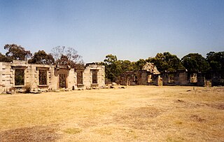
Saltwater River is a rural locality in the local government area (LGA) of Tasman in the South-east LGA region of Tasmania. The locality is about 14 kilometres (8.7 mi) north of the town of Nubeena. The 2016 census has a population of 123 for the state suburb of Saltwater River.

Central Plateau Conservation Area is an animal and plant conservation area in Tasmania, Australia. It is adjacent to the Walls of Jerusalem National Park.

Mount Roland is a locality, a mountain, and a conservation area in the north west coast region of Tasmania, Australia.
Guildford is a rural locality in the local government area (LGA) of Waratah–Wynyard in the North-west and west LGA region of Tasmania. The locality is about 81 kilometres (50 mi) south of the town of Wynyard. The 2016 census has a population of nil for the state suburb of Guildford.
Kellevie is a rural locality in the local government area (LGA) of Sorell in the South-east LGA region of Tasmania. The locality is about 28 kilometres (17 mi) east of the town of Sorell. The 2016 census has a population of 164 for the state suburb of Kellevie.

Fingal is a rural locality in the local government area (LGA) of Break O'Day in the North-east LGA region of Tasmania. The locality is about 56 kilometres (35 mi) south-west of the town of St Helens. The 2016 census recorded a population of 405 for the state suburb of Fingal.
Mountain River is a rural locality in the local government area (LGA) of Huon Valley in the South-east LGA region of Tasmania. The locality is about 15 kilometres (9.3 mi) north-east of the town of Huonville. The 2016 census recorded a population of 559 for the state suburb of Mountain River. The locality increasingly is a lifestyle destination, being only about 30 minutes south of the Tasmanian capital Hobart by road.

Glengarry is a rural locality in the local government area of West Tamar in the Launceston region of Tasmania. The locality is about 26 kilometres (16 mi) south-east of the town of Beaconsfield. The 2016 census has a population of 525 for the state suburb of Glengarry.
Clarence Point is a locality in northern Tasmania about 3 kilometres (2 mi) southwest of George Town across the Tamar River. Most of its population is settled along the riverbank. Clarence Point is also the name of the regional area that includes the village, which is part of the West Tamar Municipal Area. In the 2016 census, Clarence Point had a population of 226, with a median age of 56.

South Burnie is a locality and suburb of Burnie in the local government area of City of Burnie, in the North West region of Tasmania. It is located about 2.5 kilometres (1.6 mi) south-east of the town of Burnie. The Bass Highway passes from south-east to north-west along the shore of Bass Strait, which forms part of the northern boundary. The Emu River forms part of the eastern boundary. The 2016 census determined a population of 331 for the state suburb of South Burnie.
Emu Heights is a locality and suburb of Burnie in the local government area of City of Burnie, in the North West region of Tasmania. It is located about 3.8 kilometres (2.4 mi) south-east of the town of Burnie. The Emu River forms the eastern boundary, and the railway tracks of the Melba line form most of the western. The 2016 census determined a population of 180 for the state suburb of Emu Heights.
Gawler is a locality and small rural community in the local government area of Central Coast, in the North West region of Tasmania. It is located about 8 kilometres (5.0 mi) south of the town of Ulverstone. The 2021 census determined a population of 703 for the state suburb of Gawler.
Black River is a locality and small rural community in the local government area of Circular Head, in the North West region of Tasmania. It is located about 46 kilometres (29 mi) north-west of the town of Wynyard. Bass Strait forms most of the northern boundary, while the stream named “Black River” forms the western boundary. The 2016 census determined a population of 35 for the state suburb of Black River.
The Don River is a perennial river for most of its length, located in the north-western region of Tasmania, Australia.
The Emu River is a perennial river for most of its length, located in the north-western region of Tasmania, Australia. It was named by Henry Hellyer, an early explorer who saw emu tracks in the vicinity.
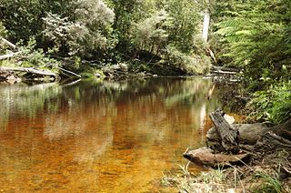
The Black River is a perennial river for most of its length, located in the north-western region of Tasmania, Australia.
Deviot is a locality and small rural community in the local government area of West Tamar, in the Western Tamar Valley region of Tasmania. It is located about 35 kilometres (22 mi) north-west of the town of Launceston. The Tamar River forms the eastern and north-eastern boundaries. The 2016 census determined a population of 337 for the state suburb of Deviot.

