
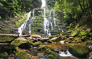
Tasmania, is an island state of Australia. It is located 240 km (150 mi) to the south of the Australian mainland, separated from it by Bass Strait. The state encompasses the main island of Tasmania, the 26th-largest island in the world, and the surrounding 1000 islands. It is Australia's least populated state, with 541,965 residents as of March 2021. The state capital and largest city is Hobart, with around 40 percent of the population living in the Greater Hobart area.
Franklin-Gordon Wild Rivers is a national park in Tasmania, 117 km west of Hobart. It is named after the two main river systems lying within the bounds of the park - the Franklin River and the Gordon River.

The River Derwent is a river located in Tasmania, Australia. It is also known by the palawa kani name timtumili minanya. The river rises in the state's Central Highlands at Lake St Clair, and descends more than 700 metres (2,300 ft) over a distance of more than 200 kilometres (120 mi), flowing through Hobart, the state's capital city, before emptying into Storm Bay and flowing into the Tasman Sea. The banks of the Derwent were once covered by forests and occupied by Aboriginal Tasmanians. European settlers farmed the area and during the 20th century many dams were built on its tributaries for the generation of hydro-electricity.

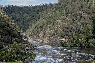
Launceston is a city in the north of Tasmania, Australia, at the confluence of the North Esk and South Esk rivers where they become the Tamar River (kanamaluka). Launceston has a population of 110,472 in the significant urban area (2020). Launceston is the second most populous city in Tasmania after the state capital, Hobart, As of 2020, Launceston is the 17th largest city in Australia. Launceston is third-largest inland city and the ninth-largest non-capital city in Australia. Launceston is the most liveable regional city, and was one of the most popular regional cities to move to in Australia from 2020 to 2021.

Lake Pedder, once a glacial outwash lake, is a man-made impoundment and diversion lake located in the southwest of Tasmania, Australia. In addition to its natural catchment from the Frankland Range, the lake is formed by the 1972 damming of the Serpentine and Huon rivers by the Hydro Electric Commission of Tasmania for the purposes of hydroelectric power generation.
The history of Tasmania begins at the end of the most recent ice age when it is believed that the island was joined to the Australian mainland. Little is known of the human history of the island until the British colonisation in the 19th century.

The Gordon River is a major perennial river located in the central highlands, south-west, and western regions of Tasmania, Australia.
Dorset Council is a local government body in Tasmania, located in the far north-east of the state mainland. Dorset is classified as a rural local government area and has a population of 6,652, the major towns and localities of the region include Bridport, Derby and Ringarooma with Scottsdale the regional centre.
Scottsdale, formerly known as Ellesmere, is a town in the north-east of Tasmania, Australia. It lies on the Tasman Highway, around 63 kilometres (39 mi) north-east of Launceston and 22 km (14 mi) south-east of the coastal town of Bridport. It is part of the Dorset Council.

Hydro Tasmania, known for most of its history as the Hydro-Electric Commission (HEC) or The Hydro, is the trading name of the Hydro-Electric Corporation, a Tasmanian Government business enterprise which is the predominant electricity generator in the state of Tasmania, Australia. The Hydro was originally oriented towards hydro-electricity, due to Tasmania's dramatic topography and relatively high rainfall in the central and western parts of the state. Today Hydro Tasmania operates thirty hydro-electric and one gas power station, and is a joint owner in three wind farms.

The Tasmanian giant freshwater crayfish, also called Tasmanian giant freshwater lobster, is the largest freshwater invertebrate and the largest freshwater crayfish species in the world. The species is only found in the rivers below 400 metres (1,300 ft) above sea level in northern Tasmania, an island-state of Australia. It is listed as an endangered species on the IUCN Red List due to overfishing and habitat degradation, and it has been prohibited to catch the crayfish since 1998.

Lake Burbury is a man-made water reservoir created by the Crotty Dam inundating the upper King River valley that lies east of the West Coast Range. Discharge from the reservoir feeds the John Butters Hydroelectric Power Station, owned and operated by Hydro Tasmania.
The South Esk River, the longest river in Tasmania, is a major perennial river located in the northern region of Tasmania, Australia.

Derby is a small Australian town located in the northeast of Tasmania.

The Edgar Dam is an earthfill embankment saddle dam without a spillway, located offstream in the South West region of Tasmania, Australia.

The Hobart Rivulet, part of the River Derwent catchment, is an urban stream located in the Hobart hinterland and flows through and underneath the city, in Tasmania, Australia.
The most deadly floods on record in Tasmania's history occurred in April 1929 when 22 people were killed and 40 injured.

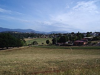
Branxholm is a scenic rural town on the banks of the Ringarooma River in north east Tasmania located 93 km north east of Launceston on the Tasman Highway. It is notable for its saw mill, hop fields and tourism. It has a sprawling street pattern which makes the small town spread across the valley floor.

The Liffey River is a river in Northern Tasmania, Australia.
The Ringarooma River is a perennial river located in the north-east region of Tasmania, Australia.
