The Walls of Jerusalem National Park is a national park located in the Central Highlands region of Tasmania, Australia. The park is located approximately 144 km (89 mi) northwest of Hobart, east of the Cradle Mountain-Lake St Clair National Park, and west of the Central Plateau Conservation Area. It is south of Mole Creek, Tasmania, and Rowallan Lake. The national park forms part of the Tasmanian Wilderness World Heritage Area.

Lake St Clair or leeawulenna is a natural freshwater lake located in the Central Highlands area of Tasmania, Australia. The lake forms the southern end of the Cradle Mountain-Lake St Clair National Park. It has an area of approximately 45 square kilometres (17 sq mi), and a maximum depth of 215 metres (705 ft), making it Australia's deepest lake.
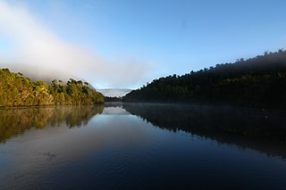
The Pieman River is a major perennial river located in the west coast region of Tasmania, Australia.

The Melba Line is a 1,067 mm narrow-gauge railway on the West Coast of Tasmania. The line was originally constructed as a private railway line named the Emu Bay Railway and was one of the longest-lasting and most successful private railway companies in Australia. While at present the line travels from Burnie to Melba Flats, it previously ran through to Zeehan carrying minerals and passengers as an essential service for the West Coast community.

Mount Roland is a locality, a mountain, and a conservation area in the north west coast region of Tasmania, Australia.
Guildford is a rural locality in the local government area (LGA) of Waratah–Wynyard in the North-west and west LGA region of Tasmania. The locality is about 81 kilometres (50 mi) south of the town of Wynyard. The 2016 census has a population of nil for the state suburb of Guildford.
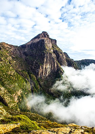
South West Tasmania is a region in Tasmania that has evoked curiosity and wonder during the period of European presence on the island.
Bonnet Hill is a residential locality in the local government area (LGA) of Kingborough in the Hobart LGA region of Tasmania, Australia. The locality is about 2 kilometres (1.2 mi) east of the town of Kingston. The 2016 census recorded a population of 505 for the state suburb of Bonnet Hill.

Lake Rosebery is a man-made water reservoir located in the West Coast region of Tasmania, Australia. The lake is situated within the northern part of Tasmania's West Coast Range and is fed by the dammed Mackintosh and Murchison rivers.

Magra is a rural residential locality in the local government areas (LGA) of Brighton (7%), Southern Midlands (9%) and Derwent Valley (84%) in the Hobart, Central and South-east LGA regions of Tasmania. The locality is about 26 kilometres (16 mi) west of the town of Brighton. The 2016 census recorded a population of 699 for the state suburb of Magra. It is in the Derwent Valley a few kilometres north of New Norfolk.
Montello is a suburb of the city of Burnie in North West Tasmania. It is about 2 kilometres (1.2 mi) south-west of the centre of Burnie, and recorded a population of 1217 in the 2016 census.
Wivenhoe is a locality and suburb of Burnie in the local government area of City of Burnie, in the North West region of Tasmania. It is located about 3 kilometres (2 mi) south-east of the town of Burnie. The northern boundary is formed by Bass Strait, and the western by the Emu River. The 2016 Australian census determined a population of 220 for the state suburb of Wivenhoe.

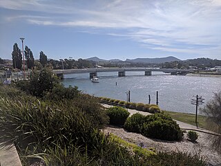
South Burnie is a locality and suburb of Burnie in the local government area of City of Burnie, in the North West region of Tasmania. It is located about 2.5 kilometres (1.6 mi) south-east of the town of Burnie. The Bass Highway passes from south-east to north-west along the shore of Bass Strait, which forms part of the northern boundary. The Emu River forms part of the eastern boundary. The 2016 census determined a population of 331 for the state suburb of South Burnie.
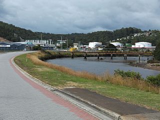
Emu Heights is a locality and suburb of Burnie in the local government area of City of Burnie, in the North West region of Tasmania. It is located about 3.8 kilometres (2.4 mi) south-east of the town of Burnie. The Emu River forms the eastern boundary, and the railway tracks of the Melba line form most of the western. The 2016 census determined a population of 180 for the state suburb of Emu Heights.
Red Hills is a locality and suburb in the local government area of Meander Valley, in the Launceston region of Tasmania. It is located about 7 kilometres (4.3 mi) west of the town of Deloraine. The Meander River forms part of the south-eastern boundary, while its tributary Western Creek forms the remainder. The railway tracks of the Western line pass through the north-eastern corner of the locality, crossing the B12 route at Lemana Junction. The 2016 census determined a population of 120 for the state suburb of Red Hills.
The Don River is a perennial river for most of its length, located in the north-western region of Tasmania, Australia.
The River Leven is a perennial river for most of its length, located in the north-western region of Tasmania, Australia. It was named by the Van Diemen's Land Company after the River Leven in Scotland.
The Black River is a perennial river for most of its length, located in the north-western region of Tasmania, Australia.
Highclere is a locality and small rural community in the local government area of Burnie in the North West region of Tasmania. It is located about 18 kilometres (11 mi) south-west of the town of Burnie. The 2016 census determined a population of 120 for the state suburb of Highclere.
East Ridgley is a rural locality in the local government area (LGA) of Burnie in the North-west and west LGA region of Tasmania, Australia. The locality is about 18 kilometres (11 mi) south of the town of Burnie. The 2016 census recorded a population of 103 for the state suburb of East Ridgley.

