Protected areas of Tasmania consist of protected areas located within Tasmania and its immediate onshore waters, including Macquarie Island. It includes areas of crown land managed by Tasmanian Government agencies as well as private reserves. As of 2016, 52% of Tasmania's land area has some form of reservation classification, the majority is managed by the Tasmania Parks & Wildlife Service. Marine protected areas cover about 7.9% of state waters.
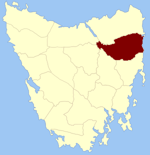
Dorset Council is a local government body in Tasmania, located in the far north-east of the state mainland. Dorset is classified as a rural local government area and has a population of 6,652. The major towns and localities of the region include Bridport, Derby and Ringarooma with Scottsdale the regional centre. Dorset was placed under a board of inquiry on 2 August 2023 and is currently under the supervision of commissioner Wardlaw. The current general manager is John Marik.

The Tasmanian giant freshwater crayfish, also called Tasmanian giant freshwater lobster, is the largest freshwater invertebrate and the largest freshwater crayfish species in the world. The species is only found in the rivers below 400 metres (1,300 ft) above sea level in northern Tasmania, an island-state of Australia. It is listed as an endangered species on the IUCN Red List due to overfishing and habitat degradation, and it has been prohibited to catch the crayfish since 1998.

The North Esk River is a major perennial river located in the northern region of Tasmania, Australia.

Avoca is a rural locality in the local government areas (LGA) of Northern Midlands (99%) and Break O'Day (1%) in the Central and North-east LGA regions of Tasmania. The locality is about 69 kilometres (43 mi) south-east of the town of Longford. The 2021 census recorded a population of 192 for Avoca.

The Eldon Range is a mountain range located in the west coast region of Tasmania, Australia.

St Marys is a small township nestled at the junction of the Tasman Highway and the Esk Highway on the East Coast of Tasmania, Australia approximately 10 kilometres from the coast.
The Cascade River, part of the Ringarooma River catchment, is a perennial river located in the north-east region of Tasmania, Australia.
Cornwall Land District is one of the twenty land districts of Tasmania which are part of the Cadastral divisions of Tasmania. It contains most of Launceston. It was formerly Cornwall County, one of the 18 counties of Tasmania and one of the first eleven proclaimed in 1836. It was named after the then southwestern county of England.

Fingal is a rural locality in the local government area (LGA) of Break O'Day in the North-east LGA region of Tasmania. The locality is about 56 kilometres (35 mi) south-west of the town of St Helens. The 2016 census recorded a population of 405 for the state suburb of Fingal.
The Serpentine River is a major perennial river located in the south-west and western regions of Tasmania, Australia.

Ringarooma is a small town in north-eastern Tasmania. It is located just east of the Ringarooma River and is about 12 km (7.5 mi) south-west from Derby and 55 km (34 mi) east-northeast from Launceston. The area around Ringarooma is known for dairy farming and timber harvesting. The locality is in the Dorset Council local government area, except for about 2.5% which is in the Break O'Day Council area.
The Electoral district of Selby was a single-member electoral district of the Tasmanian House of Assembly. It centred on the town of Lilydale in Tasmania's northeastern region, and extended into what are today considered Launceston's outer eastern suburbs.

Pioneer is a rural locality in the local government area (LGA) of Dorset in the North-east LGA region of Tasmania. The locality is about 50 kilometres (31 mi) north-east of the town of Scottsdale. The 2016 census recorded a population of 89 for the state suburb of Pioneer.

Somerset Land District is one of the twenty land districts of Tasmania which are part of the Cadastral divisions of Tasmania. It was formerly one of the 18 counties of Tasmania.
James Goodwin was a convict escapee and explorer in Van Diemen's Land. In March 1828, he escaped from the notorious Sarah Island prison with fellow convict Thomas Connolly, and the two were the first white men to pass through the Lake St Clair region. Assuming Goodwin was then taken on to Hobart, he is the first white man to have traversed Tasmania from west to east.

The Flood Plain Lower Ringarooma River wetlands is a wetland site comprises the floodplain of the lower Ringarooma River in north-eastern Tasmania, Australia. In 1982 it was designated a wetland of international importance under the Ramsar Convention.
The Ringarooma River is a perennial river located in the north-east region of Tasmania, Australia.