Strahan is a small town and former port on the west coast of Tasmania. It is now a significant locality for tourism in the region.
Margate is a small seaside town on the Channel Highway between North-West Bay and the Snug Tiers, 7 kilometres (4 mi) south of Kingston in Tasmania, Australia. It is mostly in the Kingborough Council area, with about 4% in the Huon Valley Council LGA. Margate is also part of the Greater Hobart statistical area.

Huon Valley Council is a local government body in Tasmania, covering most of the south of the state. Huon Valley is classified as a rural local government area and has a population of 17,219, towns and localities of the region include Cygnet, Dover, Franklin, Geeveston, Southport and the largest principal town, Huonville.

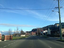
Huonville is a town on the Huon River, in the south-east of Tasmania, Australia. It is the seat of the Huon Valley Council area and lies 38 km south of Hobart on the Huon Highway. At the 2016 census, Huonville had a population of 2,714 and at the 2011 census had a population of 1,741.
Cressy is a small town 35 kilometres (22 mi) south-west of Launceston, Tasmania. It came into existence in the 1850s to service the surrounding wheat farms. At the 2006 census, Cressy had a population of 670. It is known as Tasmania's "Trout capital" for the good fishing in the area. It is also home to an extensive agriculture research facility for the Tasmanian Institute of Agricultural Research.

Woodbridge is a semi-rural locality in the local government area (LGA) of Kingborough in the Hobart LGA region of Tasmania. The locality is about 26 kilometres (16 mi) south of the town of Kingston. The 2021 Census recorded a population of 547 for the state suburb of Woodbridge, with the median age being 54. There are 180 families living in Woodbridge, with a mean of 1.8 children per household. It is located 38 kilometres (24 mi) south of the state capital, Hobart.
Cygnet is a town in the Huon Valley, south of Huonville, Tasmania.

The Huon Valley, or simply the Huon, is a valley and geographic area located in southern Tasmania, Australia. The largest town is Huonville, with other smaller towns spread across the area. It includes Australia's most southern permanent settlement at Southport. The Huon Valley Council area had a population of 15,140 in 2011. Famed for its apple growing, the Valley was first settled by British colonists in the 1820s; prior to settlement the Huon Valley area was inhabited by the Mouheneenner, Nuenonne, Mellukerdee and Lyluequonny people.
Cradoc is a rural residential locality in the local government area of Huon Valley in the South-east region of Tasmania. It is located about 11 kilometres (6.8 mi) south-west of the town of Huonville. The 2016 census has a population of 445 for the state suburb of Cradoc.
Lapoinya is a small agricultural centre on the north-west coast of Tasmania west of Wynyard. The name is Tasmanian Aboriginal word for "fern tree", a plant that abounds in those surviving untouched parts of the original temperate rainforest. At the 2006 census, Lapoinya had a population of 368.

Geeveston is a small town in the south of Tasmania in Australia near the Huon River, 62 km (39 mi) south west of Hobart, making it Australia's most southerly administrative centre. The town takes its name from William Geeves, an English settler who was given a land grant by Lady Jane Franklin in the area then known as Lightwood Bottom. The settlement Geeves set up was renamed Geeves Town in 1861, and the name eventually became Geeveston. Geeveston is for local government purposes included in the area of the Huon Valley Council and is part of the division of Franklin for both Australian House of Representatives and Tasmanian House of Assembly electoral purposes.
Mountain River is a rural locality in the local government area (LGA) of Huon Valley in the South-east LGA region of Tasmania. The locality is about 15 kilometres (9.3 mi) north-east of the town of Huonville. The 2016 census recorded a population of 559 for the state suburb of Mountain River. The locality increasingly is a lifestyle destination, being only about 30 minutes south of the Tasmanian capital Hobart by road.
Grove is a rural locality in the local government area (LGA) of Huon Valley in the South-east region of Tasmania, Australia. The locality is 35 km southwest of Hobart and 7 km north-east of the town of Huonville. As a rural locality, there are no urban settlements in Grove. The 2016 census does not provide a population for the locality of Grove. It covers an area of approximately 30.8 km². The postcode for Grove is 7109.

Sandfly is a suburb in the Kingborough Council local government area in Tasmania, Australia. A region of the Franklin Electorate, Sandfly is a historic area that sits between the suburbs of Longley, Lower Longley, Allens Rivulet, Margate, Leslie Vale and Kaoota. The population of Sandfly in 2011 was 156.
Glen Huon is a rural residential locality in the local government area of Huon Valley in the South-east region of Tasmania. It is located about 10 kilometres (6 mi) west of the town of Huonville. The 2016 census has a population of 661 for the state suburb of Glen Huon.

Ranelagh is a township in the Huon Valley of Tasmania, Australia. It is a satellite town of Huonville, to which it is adjacent, and is a former agricultural area and now a tourist town and residence for workers who commute to other areas for work. At the 2011 census, Ranelagh had 1,027 people.
Woodstock is a rural locality in the local government area of Huon Valley in the South-east region of Tasmania. It is located about 7 kilometres (4.3 mi) south-west of the town of Huonville. The 2016 census has a population of 33 for the state suburb of Woodstock.
Abels Bay is a rural locality in the local government area (LGA) of Huon Valley in the South-east LGA region of Tasmania. The locality is about 32 kilometres (20 mi) south of the town of Huonville. The 2021 census recorded a population of 127 for Abels Bay.
Petcheys Bay is a rural locality in the local government area (LGA) of Huon Valley in the South-east LGA region of Tasmania. The locality is about 26 kilometres (16 mi) south of the town of Huonville. The 2021 census recorded a population of 194 for the locality of Petcheys Bay.
Port Huon is a rural locality in the local government area (LGA) of Huon Valley in the South-east LGA region of Tasmania. The locality is about 22 kilometres (14 mi) south-west of the town of Huonville. The 2016 census recorded a population of 428 for the state suburb of Port Huon.