
A suspension bridge is a type of bridge in which the deck is hung below suspension cables on vertical suspenders. The first modern examples of this type of bridge were built in the early 1800s. Simple suspension bridges, which lack vertical suspenders, have a long history in many mountainous parts of the world.

The Trent is the third longest river in the United Kingdom. Its source is in Staffordshire, on the southern edge of Biddulph Moor. It flows through and drains the North Midlands into the Humber Estuary. The river is known for dramatic flooding after storms and spring snowmelt, which in the past often caused the river to change course.

West Bridgford is a town and the administrative centre of the Borough of Rushcliffe, in the county of Nottinghamshire, England. It lies south of Nottingham city centre, east of Wilford, north of Ruddington and west of Radcliffe-on-Trent; it is also south-west of Colwick and south-east of Beeston, which are on the opposite bank of the River Trent. The town is part of the Nottingham Urban Area and had a population of 36,487 in the 2021 Census.
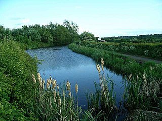
The Nottingham Canal is a canal in the English counties of Nottinghamshire and Derbyshire. As built, it comprised a 14.7-mile (23.7 km) long main line between the River Trent just downstream of Trent Bridge in Nottingham and Langley Mill in Derbyshire. At the same time as the main line of the canal was built by its proprietors, the separate Trent Navigation Company built the Beeston Cut, from the main line at Lenton in Nottingham to rejoin the River Trent upstream of Nottingham, thus bypassing the difficult section of navigation through Trent Bridge. The section of the main line between Trent Bridge and Lenton, together with the Beeston Cut, is still in use, forming part of the navigation of the River Trent and sometimes referred to as the Nottingham & Beeston Canal. The remainder of the main line of the canal beyond Lenton has been abandoned and partially filled.

The Welsh Bridge is a masonry arch viaduct in the town of Shrewsbury, England, which crosses the River Severn. It connects Frankwell with the town centre. It is a Grade II* listed building.
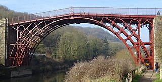
The Iron Bridge is a cast iron arch bridge that crosses the River Severn in Shropshire, England. Opened in 1781, it was the first major bridge in the world to be made of cast iron. Its success inspired the widespread use of cast iron as a structural material, and today the bridge is celebrated as a symbol of the Industrial Revolution.
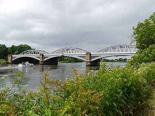
Barnes Railway Bridge is a Grade II listed railway bridge in the London Borough of Richmond upon Thames and the London Borough of Hounslow. It crosses the River Thames in London in a northwest to southeast direction at Barnes. It carries the South Western Railway's Hounslow Loop Line, and lies between Barnes Bridge and Chiswick stations. It can also be crossed on foot, and is one of only three bridges in London to combine pedestrian and rail use; the others being Hungerford Bridge and Golden Jubilee Bridges and Fulham Railway Bridge.

Nottingham City Transport (NCT) is the major bus operator of the city of Nottingham, England. NCT operates extensively within Nottingham as well beyond the city boundaries into Nottinghamshire county. Publicly-owned, it is today the second largest municipal bus company in the United Kingdom after Lothian Buses in Edinburgh, Scotland.
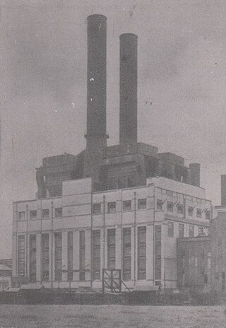
Wilford power station was a coal-fired electricity generating station situated on the north bank of the River Trent, at Nottingham in the East Midlands.
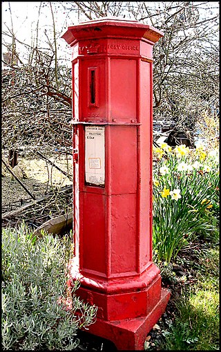
Andrew Handyside and Company was an iron founder in Derby, England, in the nineteenth century.
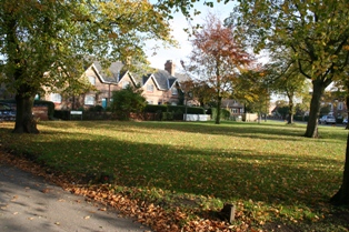
Wilford is a village and former civil parish in the Nottingham district in the ceremonial county of Nottinghamshire, England. The village is to the northeast of Clifton, southwest of West Bridgford, northwest of Ruddington and southwest of Nottingham city centre. It is at a meander of the River Trent.

Trent Bridge is an iron and stone road bridge across the River Trent in Nottingham, England. It is the principal river crossing for entrance to the city from the south, although the upstream Clifton Bridge is both larger and busier.

Wilford Toll Bridge, locally referred to as the 'Halfpenny Bridge', is a tram, pedestrian and cycle bridge in Nottingham, England. It crosses the River Trent between the Meadows and Wilford. It originally opened as a toll bridge for general traffic in 1870, but was closed when declared unsafe in 1974. Following demolition of the central span, a narrower footbridge and cycleway was opened in 1980. The bridge was once again widened to accommodate an extension of the Nottingham Express Transit network in 2015.

The Meadows or Meadows is an area of Nottingham, England, south of the city centre, close to the River Trent and connected to West Bridgford in the Borough of Rushcliffe by Trent Bridge and the Wilford Suspension Bridge. Victoria Embankment runs alongside the River Trent to the south of the Meadows and is home to the Nottingham War Memorial Gardens.

The City of Nottingham Water Department (1912–1974), formerly the Nottingham Corporation Water Department (1880–1912), was responsible for the supply of water to Nottingham from 1880 to 1974. The first water supply company in the town was the Nottingham Waterworks Company, established in 1696, which took water from the River Leen, and later from springs at Scotholme, when the river became polluted. Other companies were set up in the late 18th century and in 1824, while in 1826 the Trent Water Company was established. They employed Thomas Hawksley as their engineer, who became one of the great water engineers of the period, and Nottingham had the first constant pressurised water supply system in the country. The various companies amalgamated in 1845, and Hawksley remained as the consulting engineer until 1879.

Victoria Bridge in Bath, England, was built in 1836 across the River Avon. The bridge has been recognised as a Grade II* listed building.

Tadcaster Bridge or Wharfe Bridge spans the River Wharfe in Tadcaster, North Yorkshire, England. The road bridge is believed to date from around 1700. It is the main route connecting the two sides of the town and one of two road crossings in the town, the other being the bridge for the A64 bypass. Tadcaster Bridge partially collapsed on 29 December 2015 after flooding that followed Storm Eva, and reopened on 3 February 2017.

Ferry Bridge is a Victorian pedestrian bridge over the River Trent in Staffordshire, England. The bridge and its extension, the Stapenhill Viaduct, link Burton upon Trent town centre to the suburb of Stapenhill half a mile away on the other side of the river.

The Bridge of Oich is a taper principle suspension bridge, designed by James Dredge, across the River Oich near Aberchalder in Highland, Scotland. The bridge opened in 1854 and was used to take the main road traffic over the river until 1932.

The Old Como railway bridge is a heritage-listed former railway bridge and now footbridge and water main carrier over the Georges River between Como and Oatley in the Sutherland Shire Council and Georges River Council local government areas of New South Wales, Australia. It was designed by John Whitton and Dept of Railways and built from 1883 to 1885 by C. and E. Millar. The property is owned by Sydney Water, an agency of the Government of New South Wales. It was added to the New South Wales State Heritage Register on 15 November 2002.


