
Kew East is a suburb of Melbourne, Victoria, Australia, 8 km east from Melbourne's Central Business District. Its local government area is the City of Boroondara. At the 2011 Census, Kew East had a population of 6,017.

Woodville is a rural suburb in the Hunter Region of New South Wales, Australia that is shared between the Port Stephens and Maitland local government areas (LGA). Most of the suburb lies to the east of the Paterson River in the Port Stephens LGA while a small area of approximately 1.3 square kilometres (0.5 sq mi), to the west of the Paterson, is within the boundaries of the Maitland LGA.

Greta is a suburb of the Cessnock and Maitland local government areas in the Hunter Region of New South Wales, Australia. Most of the population lives in the town of the same name, located in the north of the suburb, which is bisected by the New England Highway. At the 2011 census the town had a population of 2,483. It is largely a commuter town located midway between Cessnock, Singleton and Maitland. The town is linked to nearby Branxton especially during community events. Greta is close to major grape-growing areas of the Hunter Region.
Thornton is a suburb in the City of Maitland, New South Wales, Australia. It is bisected by the New England Highway.
Telarah is a suburb in the City of Maitland, New South Wales, Australia. The suburb was formerly known as Homeville, however use of this name was abandoned in the 1950s. It is located on the New England Highway and is also the site of a major rail junction, where the North Coast line and the once extensive, privately owned South Maitland Railway system meet the Main North line. A station on the North Coast line opened in 1911 and is served by NSW TrainLink's Hunter Line, with services to Newcastle and Dungog. Telarah has its own fire brigade as well as bowling club, supermarket, pharmacy, takeaway shop and newsagents.

Tarro is a north-western suburb of the Newcastle City Council local government area in the Hunter Region of New South Wales, Australia. It, and parts of nearby Beresfield, was originally known as Upper Hexham, "lower" Hexham being an older settlement located about 5 kilometres (3 mi) to the east on the Hunter River. The name "Tarro" reportedly means "stone" in an Aboriginal language.

Woodberry is one of the eastern-most suburbs of the City of Maitland in the Hunter Region of New South Wales, Australia. At the 2011 census, Woodberry's population was 3,155. Most of the population lives in residential subdivisions while almost 84% of the suburbs land is rural in nature. Rental accommodation is occupied by 33.33% of the residents.

Lorn is a suburb of Maitland in New South Wales, Australia. It is located across the Hunter River from Maitland by the Belmore Bridge.
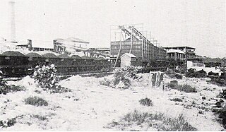
Pelaw Main is a hamlet a few kilometres south-west of Kurri Kurri, in the Hunter Region of New South Wales, Australia. It owes its origins entirely to the colliery there of the same name. It had a population of 1,027 in 2011

Rutherford is a suburb in the City of Maitland in the Hunter Region of New South Wales, Australia. At the 2016 census, Rutherford was home to almost 12,000 residents, making it one of the most populated suburbs. The suburb consists of mixed residential development, bulky goods retail, light industry and manufacturing plants. It also has its own small commercial centre. Rutherford is served by a number of schools within the suburb. These are Rutherford Public School, St. Paul's Primary School and Rutherford Technology High School. There are also a range of indoor and outdoor sporting facilities.
Tenambit is a suburb of the city of Maitland, a city and local government area in the Hunter Region of New South Wales, Australia. It is located approximately 5 kilometres (3 mi) east of the Maitland CBD. The suburb is on sloping ground, which decreases from approximately 40 metres (131 ft) AMSL in the west to 10 m (33 ft) AMSL at the eastern edge of the suburb. At the 2016 census it had a population of approximately 2,900.
Gillieston Heights is a suburb of the City of Maitland local government area in the Hunter Region of New South Wales, Australia, approximately 5.1 km (3.2 mi) from the Maitland CBD. Prior to 1967, the village was named East Greta however this was changed to honour former Maitland mayor and member of the New South Wales Legislative Assembly John Gillies following a poll of residents. At the 2016 census, Gillieston Heights had a population of over 3,000.
Windermere is a suburb of the City of Maitland local government area in the Hunter Region of New South Wales, Australia, approximately 14 km (8.7 mi) from the Maitland CBD. It is named after the Windermere estate.
Oswald is a suburb of the City of Maitland local government area in the Hunter Region of New South Wales, Australia, approximately 15 km (9 mi) from the Maitland CBD.
Horseshoe Bend is an inner city suburb in the City of Maitland in the Hunter Region of New South Wales, Australia. It is named for the shape made by the Hunter River flowing through the area as it was observed by early European settlers. It is sometimes colloquially referred to by residents as "The Bend". One of the earliest settled areas in Maitland, it is characterised by narrow streets and laneways, as well as a mixture of architectural styles spanning the 19th and 20th centuries. The suburb was amongst the worst affected areas in the 1955 Hunter Valley floods, with the loss of many homes, leading to a decline in its popularity as a residential area. Maitland City Council planning strategies have identified Horseshoe Bend as a future growth area, outlining flood mitigation measures and evacuation plans to protect residents.
South Maitland is an inner city suburb in the City of Maitland in the Hunter Region of New South Wales, Australia. It is located immediately south of the New England Highway and Main North railway line, which separate the suburb from the Maitland central business district. Pedestrian overpasses are provided to cross the highway allowing access to both High Street and Maitland stations from South Maitland. The suburb contains a mixture of parkland, rural and residential development, with a population of 471 in 2016.
Farley is a former rural village in the City of Maitland in the Hunter Region of New South Wales, Australia. Early settler Captain Emanuel Hungerford arrived in New South Wales in 1828 before purchasing an established 2,000 acres (810 ha) property named Lochdon. Here he built a homestead he called Farley House, from which Farley takes its name, after his ancestral home of Farleigh Hungerford, Somerset. Farley is currently being redeveloped into a residential suburb of Maitland, with many new estates planned and land available from 400sqm. This is a continuation of nearby Rutherford and is across the wetlands from Gillieston Heights,places which are similar new western suburbs of Maitland Farley is bordered to the north by the Main North railway line, and a station served the surrounding area from 1860 until 1975 The Farley Wastewater Treatment Works is located in a rural area south of the village.
Chisholm is a suburb in the City of Maitland, New South Wales, Australia. It is 23 kilometres (14 mi) north-northwest from Newcastle, and 7 kilometres (4 mi) south-east from Maitland.


