Woodruff Place, Indianapolis

Last updated

Woodruff Place
Woodruff Indy 1887 a1.jpg
A private residence in Woodruff Place
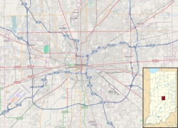
Location map Indianapolis.png
Red pog.svg
USA Indiana location map.svg
Red pog.svg
Usa edcp location map.svg
Red pog.svg
Location Indianapolis, Indiana
Coordinates 39°46′40″N86°7′42.5″W / 39.77778°N 86.128472°W / 39.77778; -86.128472
Architectural styleLate 19th and 20th Century Revivals, Late Victorian
NRHP reference No. 72000012 [1]
Added to NRHPJuly 31, 1972

Woodruff Place is a neighborhood in Indianapolis, Indiana, located about a mile east of downtown Indianapolis. It was established in the 1870s by developer James O. Woodruff as an early suburb of Indianapolis. Woodruff Place's boundaries are: 10th Street on the north, Woodruff Place West Drive on the west, Michigan Street on the south, and Woodruff Place East Drive on the east. Woodruff Place was incorporated in 1876 and remained an independent town even as the city of Indianapolis grew and expanded around it, enclosing the community well within the city limits. In1962 it became one of the final municipalities to be annexed by the city of Indianapolis prior to the merger of city and county governments under Unigov in 1969.

Woodruff Place is bounded on the west by the campus of Arsenal Technical High School, which opened in 1912 on the site of the former Indianapolis Arsenal and still uses several historic buildings from the arsenal.

Postcard depicting an entrance to Woodruff Place (ca. 1900) Entrance to Drive in Woodruff Place, Indianapolis, Ind (NYPL b12647398-68408).tiff
Postcard depicting an entrance to Woodruff Place (ca. 1900)

Woodruff Place was once considered to be one of Indianapolis's more affluent neighborhoods before beginning a gradual decline as the automobile led to the development of newer upscale subdivisions starting in the late 1910s. By the 1950s, many of the grand homes had been subdivided into apartments. Previously, the neighborhood had only a modest collection of duplexes and smaller apartment buildings that had been added beginning in the early 1910s. The neighborhood reached its lowest point in the 1960s, prompting community organizing in the early 1970s to encourage neighborhood revitalization. The 1980s and 1990s saw extensive neighborhood rehabilitation, and Woodruff Place is now considered a highly desirable historic inner-city address.

Its design reflects the developer's plan to build a prestigious enclave. Most of the homes in Woodruff Place are expansive, Victorian style homes from the late 19th century. The layout of the neighborhood is simple; three drives that run north-south (appropriately named East, West, and Middle) and a cross drive (not surprisingly, named Cross Drive). The streets are lined with magnolia and oak trees and, except for Cross Drive, have central medians. A fountain sits at each one of the intersections. Smaller fountains line the medians. [2]

Woodruff Place was the inspiration behind Indianapolis native Booth Tarkington's successful novel The Magnificent Ambersons . [3] [4] Artist T. C. Steele's son Brandt, a noted designer and architect in his own right, and his family were also Woodruff Place residents, living in a home designed by Brandt Steele.

James O. Woodruff also created "Hendricks Place". In the spring of 1872, Thomas A. Hendricks was elected governor of Indiana. He sold his property, the Bates-Hendricks House, to Woodruff, who then created his first Victorian neighborhood, Hendricks Place, surrounding the house. In the fall of that year, Woodruff created Woodruff Place, but few homes were built because a depression in 1873 stopped construction in both neighborhoods for almost twenty years.

In 1972, Woodruff Place was added to the National Register of Historic Places. In 2001, the neighborhood was officially designated a local historic preservation district by the city of Indianapolis.
Related Research Articles

<span class="mw-page-title-main">Booth Tarkington</span> American novelist (1869–1946)

Newton Booth Tarkington was an American novelist and dramatist best known for his novels The Magnificent Ambersons (1918) and Alice Adams (1921). He is one of only four novelists to win the Pulitzer Prize for Fiction more than once, along with William Faulkner, John Updike, and Colson Whitehead. In the 1910s and 1920s he was considered the United States' greatest living author. Several of his stories were adapted to film.

<span class="mw-page-title-main">Streeterville</span> Neighborhood in Chicago

Streeterville is a neighborhood in the Near North Side community area of Chicago, Illinois, United States, north of the Chicago River. It is bounded by the river on the south, the Magnificent Mile portion of Michigan Avenue on the west, and Lake Michigan on the north and east, according to most sources, although the City of Chicago only recognizes a small portion of this region as Streeterville. Thus, it can be described as the Magnificent Mile plus all land east of it. The tourist attraction of Navy Pier and Ohio Street Beach extend out into the lake from southern Streeterville. To the north, the East Lake Shore Drive District, where the Drive curves around the shoreline, may be considered an extension the Gold Coast. The majority of the land in this neighborhood is reclaimed sandbar.

<i>The Magnificent Ambersons</i> 1918 novel by Booth Tarkington

The Magnificent Ambersons is a 1918 novel by Booth Tarkington, the second in his Growth trilogy after The Turmoil (1915) and before The Midlander. It won the Pulitzer Prize for fiction.

<span class="mw-page-title-main">Kings Highway Conservation District, Dallas</span> Historic district in Texas, United States

King's Highway is located in the Oak Cliff area of Dallas, Texas (USA). The district is bounded by Stewart Drive on the north, Davis Street on the south, Tyler Street on the east and Mary Cliff Road on the west. It is in Dallas Council District 3.

<span class="mw-page-title-main">Fletcher Place</span> United States historic place

Fletcher Place is a historic district and neighborhood in the city of Indianapolis, Indiana named after Calvin Fletcher, a prominent local banker, farmer and state senator.

Butler–Tarkington is a neighborhood on the north side of Indianapolis, Indiana, United States. It is bordered by 38th Street and Crown Hill Cemetery to the south, the Indiana Central Canal and Westfield Boulevard to the north, Michigan Road to the west, and Meridian Street to the east.

<span class="mw-page-title-main">T. C. Steele</span> American painter

Theodore Clement Steele was an American Impressionist painter known for his Indiana landscapes. Steele was an innovator and leader in American Midwest painting and is one of the most famous of Indiana's Hoosier Group painters. In addition to painting, Steele contributed writings, public lectures, and hours of community service on art juries that selected entries for national and international exhibitions, most notably the Universal Exposition (1900) in Paris, France, and the Louisiana Purchase Exposition (1904) in Saint Louis, Missouri. He was also involved in organizing pioneering art associations, such as the Society of Western Artists.

<span class="mw-page-title-main">Fountain Square, Indianapolis</span> Neighborhood and cultural district in Indianapolis, Indiana, U.S.

Fountain Square is one of seven designated cultural districts in Indianapolis, Indiana. Located just outside the city's downtown district, Fountain Square is home to three designated national historic districts, the Laurel and Prospect, the State and Prospect, and the Virginia Avenue districts, all of which were listed on the National Register of Historic Places in 1983. The neighborhood derives its name from the successive fountains that have been prominently featured at the intersection of Virginia Avenue, East Prospect Street, and Shelby Street.

<span class="mw-page-title-main">James Whitcomb Riley Museum Home</span> National Historic Landmark in Indianapolis, Indiana, U.S.

The James Whitcomb Riley Museum Home, one of two homes known as the James Whitcomb Riley House on the National Register of Historic Places, is a historic building in the Lockerbie Square Historic District of Indianapolis, Indiana. It was named a National Historic Landmark in 1962 for its association with poet James Whitcomb Riley (1849-1916), known as the "Hoosier poet".

The Bates–Hendricks neighborhood is situated just south and east of the downtown commercial district of Indianapolis, Indiana. The Fountain Square business district is just to the east.

<span class="mw-page-title-main">Herron–Morton Place Historic District</span> Historic district in Indiana, United States

Herron–Morton Place is a historic district in Indianapolis, Indiana, United States. The boundaries of the neighborhood are East 16th Street on the south, East 22nd Street on the north, North Pennsylvania Street on the west, and Central Avenue on the east.

<span class="mw-page-title-main">Old Northside Historic District</span> Historic district in Indiana, United States

Old Northside is a residential neighborhood near downtown in Indianapolis, Indiana. It is bordered by 16th Street on the north, Pennsylvania Street on the west, Interstate I-65 on the south, and Bellefontaine Street on the east. The Monon Trail runs along the eastern edge of The Frank and Judy O'Bannon Old Northside Soccer Park.

<span class="mw-page-title-main">Gold Coast Historic District (Chicago)</span> Historic district in Illinois, United States

The Gold Coast Historic District is a historic district in Chicago, Illinois. Part of Chicago's Near North Side community area, it is roughly bounded by North Avenue, Lake Shore Drive, Oak Street, and Clark Street.

<span class="mw-page-title-main">Washington Park Historic District (Indianapolis, Indiana)</span> Historic district in Indiana, United States

The Washington Park Historic District is a national historic district located in Indianapolis, Indiana. It was listed on the National Register of Historic Places on June 24, 2008. It comprises nearly 60 acres (240,000 m2) and is located 4 miles (6.4 km) north of downtown Indianapolis, in the south-central part of the Meridian-Kessler neighborhood. The district includes all properties south of 43rd Street and north of 40th Street, and west of Central Avenue and east of the alley running north and south between Pennsylvania and Meridian Streets; Washington Boulevard runs north-south through the center of the district. It includes 110 contributing buildings, ranging mostly from mansions to small bungalows, and three non-contributing buildings.

<span class="mw-page-title-main">Meridian Street (Indianapolis)</span> Primary north-south street in Indianapolis, Indiana, U.S.

Meridian Street is the primary north–south street in Indianapolis, Indiana.

The Pleasant Run Greenway, also known as the Pleasant Run Trail, is a shared-use path in Indianapolis, Indiana. It runs for 6.9 miles (11.1 km) from Ellenberger Park, through Christian Park, to Garfield Park. It follows the general course of Pleasant Run Creek as it flows to the south and west. Most of the greenway is located within the parkway on one side or the other of the creek; the parkway itself is part of the historic Indianapolis Park and Boulevard System. In several places, the greenway is routed on sidewalks of city streets due to existing structures and facilities that make the parkway itself discontinuous.

<span class="mw-page-title-main">Cottage Home Historic District</span> Historic district in Indiana, United States

The Cottage Home Historic District is a historic district and neighborhood located on the near east side of Indianapolis, Indiana. A small portion of Cottage Home is listed on the National Register of Historic Places while a larger area is listed on the state and local levels. Known for its preponderance of "cottage-style" homes built with strong Victorian influences, Cottage Home has historically been a working class neighborhood. Numerous industrial buildings are also scattered throughout the district, providing a base of economic activity. Today, however, many of these buildings are vacant, providing a special challenge to preservation and urban renewal efforts.

<i>Pampered Youth</i> 1925 film

Pampered Youth is a 1925 American silent drama film directed by David Smith and starring Cullen Landis, Alice Calhoun, and Allan Forrest. It is an adaption of the 1918 novel The Magnificent Ambersons by Booth Tarkington. It was one of the final films produced by Vitagraph Studios before the firm was absorbed into Warner Bros.

References

  1. "National Register Information System". National Register of Historic Places . National Park Service. March 15, 2006.
  2. "Indiana State Historic Architectural and Archaeological Research Database (SHAARD)" (Searchable database). Department of Natural Resources, Division of Historic Preservation and Archaeology. Retrieved August 1, 2016.Note: This includes Nellie M. Coates (March 1972). "National Register of Historic Places Inventory Nomination Form: Woodruff Place Historic District" (PDF). Retrieved August 1, 2016., Site Map, and Accompanying photographs
  3. V. F. Perkins. (August 2000). "The Magnificent Ambersons (book review)". University of Nottingham . Retrieved July 13, 2008. Woodruff Place in Indianapolis, Indiana can't be found on a tourist map, but it would probably interest anyone who is familiar with Orson Welles's adaptation of Booth Tarkington's The Magnificent Ambersons
  4. "Historic Districts". City of Indianapolis . Retrieved July 13, 2008. Woodruff Place was the city's first "suburb" and was the setting for Booth Tarkington's Pulitzer Prize winning novel, The Magnificent Ambersons

Commons-logo.svg Media related to Woodruff Place, Indianapolis at Wikimedia Commons