Melli is a town on the West Bengal-Sikkim border near the River Teesta. The town consists of two markets, one lying on NH10 in Kalimpong district of West Bengal and the other in Namchi district of Sikkim. Melli Railway Station of Sevoke-Rangpo Railway Line lies in Melli at Kalimpong district, West Bengal.

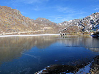
Teesta River is a 414 km (257 mi) long river that rises in the Pauhunri Mountain of eastern Himalayas, flows through the Indian states of Sikkim and West Bengal and subsequently enters Bangladesh through Rangpur division. In Bangladesh, it falls into Brahmaputra River which after meeting some other major rivers of Bengal delta finally falls into the Bay of Bengal. It drains an area of 12,540 km2 (4,840 sq mi). In India, it flows through Mangan District, Gangtok District, Pakyong District, Kalimpong district, Darjeeling District, Jalpaiguri District, Cooch Behar districts and the cities of Rangpo, Jalpaiguri and Mekhliganj. In Bangladesh, it flows through Lalmonirhat District, Rangpur District, Kurigram District and Gaibandha District. It joins the Brahmaputra River at Phulchhari Upazila in Bangladesh. 305 km (190 mi) of the river lies in India and 109 km (68 mi) in Bangladesh. Teesta is the largest river of Sikkim and second largest river of West Bengal after the Ganges.
Gangtok District, is an administrative district of the Indian state of Sikkim. It was renamed in 2021 as a result of administrative reorganisation of the state, which also saw three subdivisions of the East Sikkim district spawned off as a separate Pakyong district.

Rangpo is a Municipal town in Pakyong district in the Indian state of Sikkim. The town borders West Bengal's Kalimpong district and is situated along the Teesta river and Rangpo River. It is the first town of Sikkim lying on National Highway 10 that links Siliguri to Gangtok. It is about 300 m above sea level with a sub-tropical climate. It is the 'Gateway to Sikkim' and all vehicles entering Sikkim have to stop at the Rangpo Police check-post. Foreign tourists require documents to enter Sikkim state and have to show them at the police check post.

Singtam is a town which lies mostly in Gangtok District and partly in Pakyong District in the Indian state of Sikkim about 30 kilometres (19 mi) from the state capital Gangtok. The town lies on the banking of the rivers Teesta and Ranikhola, which join together just below the town. NH10 and NH510 meet in Singtam. The Indreni Bridge and Sherwani Bridge over the river Teesta are in the town. Singtam District Hospital, the district hospital of Pakyong District, lies at Golitar, Singtam.

Sevoke is a small town near Siliguri in the Darjeeling district of West Bengal state of India near the border with Sikkim state. Situated in Dooars, Sevoke lies on the bank of River Teesta and has two bridges − namely Coronation Bridge and Sevoke Railway Bridge over it. Indian Army and Border Security Force camps are located in the area. The Mahananda Wildlife Sanctuary is situated in this area. National Highway NH10 passes through the town and connects Sevoke town to Gangtok and Siliguri. National Highway 17 originates from Sevoke near Coronation Bridge and terminates in Guwahati.

Pakyong is a city and district headquarters of Pakyong district in the Indian state of Sikkim, located in the foothills of the Himalayas. It holds many Government Offices. Pakyong Airport is the only airport of Sikkim. The "National Research Centre for Orchids" is also located here.

Rhenock is a town in the Pakyong District in Sikkim, India, located on the border with the Kalimpong district of West Bengal. It lies 63 kilometres east of Gangtok, and 47 kilometres north of Kalimpong on the way to Jelepla Pass at an altitude of 1,040 metres. The word Rhe-nock means Black Hill. Situated in the extreme east of Sikkim, Rhenock witnessed the establishment of the first police outpost in the state.
Ranipool is a small suburban town located in the bank of river Ranikhola at the junction of National Highway 10 and National Highway 717A in Gangtok District of the Indian state of Sikkim. It is 12 km before from Gangtok main town. It has three roads which lead to Singtam, Pakyong and Gangtok. It falls under the Gangtok Municipal Corporation. It is named after the Bridge which Connects the National highway to Gangtok and holds quite a significant role in traffic communications.
Rorathang is a town situated in the bank of Rangpo River on National Highway-717A, in Pakyong District of Sikkim, India.

Dikchu is a small town in the Gangtok District of the Indian state of Sikkim. The town lies at the confluence of the Dikchu River with the Teesta River and is the site of the 96 MW Dikchu River Hydroelectric Power Project as well as 510 MW Teesta V Hydroelectric Power Project. Dikchu is the last town of Gangtok District that lies on the North Sikkim Highway connecting Singtam to Chungthang, after crossing the town we enter Mangan District. Small market north of river Dikchu also lies on Mangan District.
Rongli or Rangli is a town in the Pakyong District of the Indian state of Sikkim. It lies on the banks of Rangpo River around 69 kilometres (43 mi) by road south of the state capital Gangtok. Rongli is also the headquarter of Rongli Subdivision of Pakyong District. Rongli is one of the oldest market of Sikkim that lies on the trade route between Kalimpong and Tibet.

Sivok railway station is a junction railway station in Darjeeling district, West Bengal. Its code is SVQ. It serves Sevoke town. The station consists of two platforms. The station lies on New Jalpaiguri–Siliguri–New Mal Junction–Hasimara–Alipurduar Junction route under Alipurduar division of Northeast Frontier Railway. It is also the originating point of the Sevoke-Rangpo Railway Line which is under construction. This railway station is a scenic railway station as it falls under Mahananda Wildlife Sanctuary just ahead of Sevoke Railway Bridge over river Teesta.
National Highway 717A, commonly referred to as NH 717A is a National Highway in India which is a part of the Bharatmala Pariyojana of Ministry of Road Transport and Highways, Government of India. NH 717-A starts from National Highway 17 at Bagrakote and ends in Gangtok. NH-717A traverses the states of West Bengal and Sikkim in India. It runs through two districts of West Bengal namely Jalpaiguri district, Kalimpong district and two districts of Sikkim, which are Pakyong District and Gangtok District. The highway is being constructed and maintained by the National Highways and Infrastructure Development Corporation Limited (NHIDCL).
Sivok-Rangpo Railway Line is a line currently under construction to connect the Indian states of West Bengal and Sikkim. It branches out from New Jalpaiguri–Alipurduar–Samuktala Road line at Sivok railway station, Sevoke Town near Siliguri in Darjeeling district and runs through villages and towns of Kalimpong district of West Bengal and terminates in Rangpo Railway Station in Rangpo, Pakyong District of Sikkim. In the second phase of construction, this line will be extended till Gangtok, the capital of Sikkim, and later to the Nathu La pass, along the border with Tibet. This railway line lies under Northeast Frontier Railway zone Alipurduar railway division. The total length of this railway line is 44.96 Kilometres.
Pakyongdistrict is a district in the Indian state of Sikkim, administered from Pakyong. The district was formed in 2021 from three former subdivisions of the East Sikkim district, viz., Pakyong Subdivision, Rangpo Subdivision and Rongli Subdivision. The remaining Gangtok Subdivision of the former district was named as the Gangtok district, which now bounds the Pakyong district in the northwest. In addition, the district is now bounded by the Kalimpong district of West Bengal, Bhutan, and the Namchi district of Sikkim.
Melli Railway Station lies in the town of Melli, Kalimpong district, West Bengal. The station lies in the under construction Sivok-Rangpo Railway Line. Melli Railway Station serves city of Kalimpong in West Bengal, and Namchi District, Geyzing District and Soreng District of Sikkim. The station is currently under construction by IRCON company.
Riyang Railway Station/Raing Railway Station is the railway station which serves Rambi Bazar and nearby areas in Kalimpong district of West Bengal. It is currently under construction on the Sivok–Rangpo line of the Northeast Frontier Railway, Alipurduar railway division.
Tista Bazaar Railway Station is the railway station which serves Teesta Bazaar and nearby areas like Kalimpong, Tribeni, Lopchu, Peshok, Chitrey etc in Kalimpong district of West Bengal. It is an Underground Railway Station which is under construction on Sivok–Rangpo line of Northeast Frontier Railway, Alipurduar railway division.
Makha is an important town lying on the bank of Teesta River in Gangtok district of Sikkim, India. Makha lies between Singtam and Dikchu.


