 | ||||
|---|---|---|---|---|
 Map of National Highway 339 in red | ||||
| Route information | ||||
| Length | 34 km (21 mi) | |||
| Major junctions | ||||
| From | Nowgong | |||
| To | Srinagar | |||
| Location | ||||
| Country | India | |||
| Highway system | ||||
| ||||
National Highway 339 (NH 339) is a National Highway in India. [1]
| | ||||
|---|---|---|---|---|
| Map of National Highway 339 in red | ||||
| Route information | ||||
| Length | 34 km (21 mi) | |||
| Major junctions | ||||
| From | Nowgong | |||
| To | Srinagar | |||
| Location | ||||
| Country | India | |||
| Highway system | ||||
| ||||
National Highway 339 (NH 339) is a National Highway in India. [1]

State Route 39 is a state highway in the U.S. state of California that travels through Orange and Los Angeles counties. Its southern terminus is at Pacific Coast Highway, in Huntington Beach. SR 39's northern terminus is at Islip Saddle on Angeles Crest Highway in the Angeles National Forest, but its northernmost 4.5-mile (7.2 km) segment has been closed to the public since 1978 due to a massive mud and rockslide. It would cost a total of $100 million USD to repair the road.

Radium Hot Springs, informally and commonly called Radium, is a village of 1,339 residents situated in the East Kootenay region of British Columbia. The village is named for the hot springs located in the nearby Kootenay National Park. From Banff, Alberta, it is accessible via Highway 93.

State Route 339 (SR 339) is a 3.5-mile-long (5.6 km) state highway completely within Towns County near Young Harris, Georgia, in the North Georgia mountains, just south of the North Carolina state line. It is locally known as Crooked Creek Road.

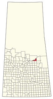
The Rural Municipality of Leroy No. 339 is a rural municipality (RM) in the Canadian province of Saskatchewan within Census Division No. 10 and SARM Division No. 5. It is located east of Saskatoon.

Oregon Route 339 is an Oregon state highway running from the Washington state line near Ferndale to Milton-Freewater. OR 339 is known as the Freewater Highway No. 339. It is 3.43 miles (5.52 km) long and runs north–south, entirely within Umatilla County.

State Route 339 (SR 339) is a north–south state highway in southeastern Ohio, a U.S. state. The southern terminus of SR 339 is at SR 618 approximately 2 miles (3.2 km) west of Belpre, and less than 0.50 miles (0.80 km) south of the U.S. Route 50 (US 50)/SR 7/SR 32 expressway. The highway's northern terminus is a T-intersection with SR 821 about 0.75 miles (1.21 km) south of Dexter City.
State Route 676 (SR 676) is a 26.53-mile (42.70 km) long east–west state highway in the southeastern portion of the U.S. state of Ohio. The western terminus of SR 676 is at a T-intersection with SR 555 approximately 3 miles (4.8 km) southeast of the village of Chesterhill. Its eastern terminus is at a T-intersection with SR 7 in the southwestern portion of the city of Marietta.

Pennsylvania Route 339 is a 32.8-mile-long (52.8 km), north–south state highway located in Schuylkill, Columbia, and Luzerne counties in Pennsylvania. The southern terminus is at PA 54 in Mahanoy City. The northern terminus is at PA 93 in Nescopeck. The route is a two-lane road that passes through mountainous areas in the eastern part of the state. PA 339 runs north through the Coal Region to Brandonville, where it heads northwest to follow the Catawissa Creek to Mainville. From Mainville, the route passes through farmland to Mifflinville, where it follows the Susquehanna River to Nescopeck. PA 339 forms a concurrency with PA 924 in Brandonville and has an interchange with Interstate 80 (I-80) in Mifflinville.
Highway 339 is a highway in the Canadian province of Saskatchewan. It runs from Highway 334 at Avonlea to Highway 39, 10 km (6 mi) north-west of Drinkwater. Highway 339 is about 49 km (30 mi) long.
National Route 101 is a national highway of Japan connecting the capitals of Aomori and Akita prefectures, Aomori and Akita in northern Japan, with a total length of 241.6 kilometers (150.1 mi). The majority of the highway travels along the coast of the Sea of Japan, paralleling the more inland National Route 7. The present-day highway largely follows the path of the Ōmagoe-kaidō, an Edo period road that linked the Kubota and Hirosaki feudal domains.
National Route 339 is a national highway of Japan that traverses the western side of Aomori Prefecture, traveling south to north. The 108.4-kilometer (67.4 mi) highway begins as a concurrent route with National Route 7 in central Hirosaki, it then leaves National Route 7 in Fujisaki and travels north through the municipalities of Itayanagi, Tsuruta, Goshogawara, and Nakadomari before ending at an intersection with National Route 280 in Sotogahama. In a unique feature, a 0.4-kilometer-long (0.25 mi) section of the route on Cape Tappi is a staircase.

The Rural Municipality of Cote No. 271 is a rural municipality (RM) in the Canadian province of Saskatchewan within Census Division No. 9 and SARM Division No. 4.

The Rural Municipality of Turtle River No. 469 is a rural municipality (RM) in the Canadian province of Saskatchewan within Census Division No. 17 and SARM Division No. 6.
The Rural Municipality of Nipawin No. 487 is a rural municipality (RM) in the Canadian province of Saskatchewan within Census Division No. 14 and SARM Division No. 4.

Wyoming Highway 339 (WYO 339) is a short 1.02-mile-long (1.64 km) east-west Wyoming State Road located in north-central Sheridan County.
National Highway 339B, commonly referred to as NH 339B is a national highway in India. It is a spur road of National Highway 39. Bamitha to khajwa. NH-339B traverses the state of Madhya Pradesh in India.

State Route 339 is a 23.1 miles (37.2 km) long east-west state highway in the mountains of East Tennessee, connecting Cherokee Hills with Cosby. For the majority of its length, SR 339 is known as Jones Cove Road, but other short sections are known as Long Springs Road and Old Newport Highway.
Highway 339 is a short state highway in Woodruff County, Arkansas. The highway is maintained by the Arkansas Department of Transportation (ArDOT).
Secondary routes of National Highway 39 | ||
|---|---|---|
| |  | |
| Secondary Routes of NH 39 | ||


