
Cape Town is South Africa's oldest city. It serves as the country's legislative capital, being the seat of the South African Parliament. It is the country's second-largest city and the largest in the Western Cape. The city is part of the City of Cape Town metropolitan municipality.

Cape Cod is a hook-shaped peninsula extending into the Atlantic Ocean from the southeastern corner of Massachusetts, in the northeastern United States. Its historic, maritime character and ample beaches attract heavy tourism during the summer months. The name Cape Cod, coined in 1602 by Bartholomew Gosnold, is the ninth oldest English place-name in the U.S.

Barnstable County is a county located in the U.S. state of Massachusetts. At the 2020 census, the population was 228,996. Its shire town is Barnstable. The county consists of Cape Cod and associated islands.

Milnrow is a town within the Metropolitan Borough of Rochdale, in Greater Manchester, England. It lies on the River Beal at the foothills of the South Pennines, and forms a continuous urban area with Rochdale. It is 2 miles (3.2 km) east of Rochdale town centre, 10 miles (16.1 km) north-northeast of Manchester, and spans from Windy Hill in the east to the Rochdale Canal in the west. Milnrow is adjacent to junction 21 of the M62 motorway, and includes the village of Newhey, and hamlets at Tunshill and Ogden.

The N1 is a national route in South Africa that runs from Cape Town through Bloemfontein, Johannesburg, Pretoria and Polokwane to Beit Bridge on the border with Zimbabwe. It forms the first section of the famed Cape to Cairo Road.

Somerset West is a town in the Western Cape, South Africa. Organisationally and administratively it is included in the City of Cape Town metropolitan municipality as a suburb of the Helderberg region . The vehicle registration code for Somerset West is CFM and the post code is 7130 for street addresses, and 7129 for post office boxes.

Kuils River is a town in the Western Cape, South Africa, 25 km east of Cape Town CBD at the gateway of the Cape Winelands. It is also the name of the main tributary of the Eerste River, and forms part of the Eastern Suburbs of the City of Cape Town.

Kraaifontein is a town in the Western Cape province of South Africa. Organisationally and administratively it is included in the City of Cape Town Metropolitan Municipality as a Northern Suburb. The name originated from large number of crows that nest in the region.
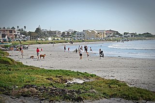
Melkbosstrand is a coastal town located on the South West Coast of South Africa, 30 km north of Cape Town. It forms part of the City of Cape Town Metropolitan Municipality, the municipality governing Cape Town and its greater metropolitan area.

Helderberg refers to a planning district of the City of Cape Town metropolitan municipality, the mountain after which it is named, a wine-producing area in the Western Cape province of South Africa, or a small census area in Somerset West.

The N12 is a national route in South Africa which runs from George through Beaufort West, Kimberley, Klerksdorp and Johannesburg to eMalahleni.

The Cape Fold Belt is a fold and thrust belt of late Paleozoic age, which affected the sequence of sedimentary rock layers of the Cape Supergroup in the southwestern corner of South Africa. It was originally continuous with the Ventana Mountains near Bahía Blanca in Argentina, the Pensacola Mountains, the Ellsworth Mountains and the Hunter-Bowen orogeny in eastern Australia. The rocks involved are generally sandstones and shales, with the shales persisting in the valley floors while the erosion resistant sandstones form the parallel ranges, the Cape Fold Mountains, which reach a maximum height of 2325 m at Seweweekspoortpiek.
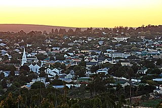
Malmesbury is a town of approximately 36,000 inhabitants in the Western Cape province of South Africa, about 65 km north of Cape Town.

The A640 is a road in England which runs between Rochdale in Greater Manchester and Huddersfield in West Yorkshire.
Firgrove is a townland in the Barony of Ormond Lower, County Tipperary, Ireland. Firgrove is located approximately 6 km west of Borrisokane.
Ormond Lower is a barony in County Tipperary, Ireland. This geographical unit of land is one of 12 baronies in County Tipperary. Its chief town is Nenagh. The barony lies between Ormond Upper to the south-east and Owney and Arra to the south-west. As a "peninsula", it is surrounded on three sides by counties Galway and Offaly.

Hopefield is a settlement in West Coast District Municipality in the Western Cape province of South Africa on the R45 between Malmesbury and Vredenburg. The town is east of Saldanha Bay and Langebaan, 40 km (25 mi) southeast of Vredenburg and 120 km (75 mi) north of Cape Town.

The Overberg branch line is a railway line in the Western Cape, South Africa. It runs from Cape Town through Somerset West and Caledon to Bredasdorp.

The M9 is a long metropolitan route in the City of Cape Town, South Africa. It connects Sir Lowry's Pass Village with Wynberg via Somerset West, Firgrove, Macassar, Khayelitsha and Nyanga.


