Richmond Heights, Florida

Last updated

Richmond Heights, Florida
Miami-Dade County Florida Incorporated and Unincorporated areas Richmond Heights Highlighted.svg
Location in Miami-Dade County and the state of Florida
Richmond Heights.gif
U.S. Census Bureau map showing CDP boundaries
Coordinates: 25°38′0″N80°22′21″W / 25.63333°N 80.37250°W / 25.63333; -80.37250
Country Flag of the United States.svg  United States of America
State Flag of Florida.svg  Florida
County Flag of Miami-Dade County, Florida.png Miami-Dade
Area
[1]
  Total1.61 sq mi (4.17 km2)
  Land1.59 sq mi (4.13 km2)
  Water0.01 sq mi (0.04 km2)
Elevation
10 ft (3 m)
Population
 (2020) [2]
  Total8,944
  Density5,611.04/sq mi (2,166.62/km2)
Time zone UTC-5 (Eastern (EST))
  Summer (DST) UTC-4 (EDT)
ZIP codes
33157, 33176, 33186 (Miami)
Area code(s) 305, 786, 645
FIPS code 12-60225 [3]
GNIS feature ID0289685 [4]

Richmond Heights is a census-designated place (CDP) in Miami-Dade County, Florida, United States. It is part of the Miami metropolitan area of South Florida. The population was 8,944 at the 2020 census.

Contents

History

At the beginning of World War II, the United States Navy purchased 2,500 acres (1,000 ha) of land in southwestern Dade (now called Miami-Dade) County for the purpose of constructing an airship base. The land was owned by the Richmond Timber Company, a major supplier of Dade County Pine (a denser, harder, sub-species of Pinus palustris, or longleaf pine). The base was named Naval Air Station Richmond, after the lumber company, and was home to the 25 ships of ZP-21 (Patrol, Airship Squadron 21 and Airship Wing 2). NAS Richmond was the second largest airship base in the United States, NAS Lakehurst in New Jersey being the largest. NAS Richmond was destroyed by a hurricane and fire in September 1945.

After the end of World War II, Captain Frank C. Martin, a Pan American pilot, purchased farmland adjacent to the base in rural southwest Dade County. With this purchase he created Richmond Heights, as a new community for returning African American veterans.

Of the original 2,500 acres (1,000 ha) he purchased in 1949, the federal government had used 800 acres (320 ha) to build the headquarters of Naval Air Station Richmond, a blimp base constructed in the early months of World War II Richmond, and was eventually home to 25 K-series blimps, three hangars, and 3,000 men. The hangars were 16 stories tall, built of Douglas fir brought in by train. The blimps protected ship convoys in the Florida Straits, and Richmond was the headquarters for the fight against U-boats operating in the Caribbean.

Geography

Richmond Heights is located 16 miles (26 km) southwest of downtown Miami at 25°38′0″N80°22′21″W / 25.63333°N 80.37250°W / 25.63333; -80.37250 (25.633415, -80.372362). [5] It is bordered to the north and east by Kendall, to the south by Palmetto Estates, and to the west by Three Lakes.

According to the United States Census Bureau, the CDP has a total area of 1.6 square miles (4.1 km2), of which 0.02 square miles (0.05 km2), or 0.93%, are water. [1]

Demographics

Historical population
CensusPop.Note
1960 4,311
1970 6,66354.6%
1980 8,57728.7%
1990 8,5830.1%
2000 8,479−1.2%
2010 8,5410.7%
2020 8,9444.7%
U.S. Decennial Census [6]

2010 and 2020 census

Richmond Heights CDP, Florida – Racial and ethnic composition
Note: the US Census treats Hispanic/Latino as an ethnic category. This table excludes Latinos from the racial categories and assigns them to a separate category. Hispanics/Latinos may be of any race.
Race / Ethnicity (NH = Non-Hispanic)Pop 2010 [7] Pop 2020 [8] % 2010% 2020
White (NH)2513142.94%3.51%
Black or African American (NH)5,9614,64569.79%51.93%
Native American or Alaska Native (NH)16110.19%0.12%
Asian (NH)36450.42%0.50%
Pacific Islander or Native Hawaiian (NH)120.01%0.02%
Some other race (NH)23600.27%0.67%
Mixed race or Multiracial (NH)1171081.37%1.21%
Hispanic or Latino (any race)2,1363,75925.01%42.03%
Total8,5418,944100.00%100.00%

As of the 2020 United States census, there were 8,944 people, 2,635 households, and 2,133 families residing in the CDP. [9]

As of the 2010 United States census, there were 8,541 people, 2,566 households, and 2,058 families residing in the CDP. [10]

2000 census

As of the census [3] of 2000, there were 8,479 people, 2,653 households, and 2,101 families living in the CDP. The population density was 5,124.3 inhabitants per square mile (1,978.5/km2). There were 2,771 housing units at an average density of 1,674.7 per square mile (646.6/km2). The racial makeup of the CDP was 12.45% White (3.4% were Non-Hispanic White), [11] 82.83% African American, 0.22% Native American, 0.83% Asian, 0.01% Pacific Islander, 2.00% from other races, and 1.65% from two or more races. Hispanic or Latino of any race were 12.47% of the population.

As of 2000, there were 2,653 households, out of which 32.5% had children under the age of 18 living with them, 42.4% were married couples living together, 30.1% had a female householder with no husband present, and 20.8% were non-families. 17.9% of all households were made up of individuals, and 8.3% had someone living alone who was 65 years of age or older. The average household size was 3.16 and the average family size was 3.55.

In 2000, the CDP, the population was spread out, with 29.0% under the age of 18, 9.0% from 18 to 24, 26.3% from 25 to 44, 21.8% from 45 to 64, and 14.0% who were 65 years of age or older. The median age was 35 years. For every 100 females, there were 83.8 males. For every 100 females age 18 and over, there were 77.9 males.

In 2000, the median income for a household in the CDP was $38,191, and the median income for a family was $44,095. Males had a median income of $31,286 versus $27,882 for females. The per capita income for the CDP was $15,824. About 14.0% of families and 15.1% of the population were below the poverty line, including 23.0% of those under age 18 and 14.8% of those age 65 or over.

As of 2000, speakers of English as a first language accounted for 87.29% of residents, while Spanish as a mother tongue made up 12.70% of the population. [12]

Attractions

Annually, people travel back to Miami-Dade County to celebrate the Historic Weekend hosted by the Historic Society. [13]

The Richmond Heights 49ers was funded in part by a grant from the Florida Humanities Council, National Endowment of the Arts, Miami-Dade County Cultural Arts Department, and the Greater Miami Convention & Visitors Bureau. [14]

Related Research Articles

<span class="mw-page-title-main">Brownsville, Florida</span> Census-designated place in Florida

Brownsville is an unincorporated community and census-designated place (CDP) that is part of the Miami metropolitan area of South Florida. As of the 2020 US census, the population was 16,583, up from 15,313 in 2010. After three decades of population loss, Brownsville gained population for the first time in over 40 years in the 2010 US Census.

<span class="mw-page-title-main">Coral Terrace, Florida</span> Census-designated place in Florida

Coral Terrace is a suburban unincorporated community and census-designated place (CDP) in Miami-Dade County, Florida, United States. It is part of the Miami metropolitan area of South Florida. The population was 23,142 at the 2020 census, down from 24,376 in 2010.

<span class="mw-page-title-main">Country Walk, Florida</span> Census-designated place in Florida

Country Walk is a census-designated place (CDP) in Miami-Dade County, Florida, United States. It is part of the Miami metropolitan area of South Florida. The population was 16,951 at the 2020 census, up from 15,997 at the 2010 census.

<span class="mw-page-title-main">Gladeview, Florida</span> Census-designated place in Florida

Gladeview is a census-designated place (CDP) in Miami-Dade County, Florida, United States. It is part of the Miami metropolitan area of South Florida. The population was 14,927 at the 2020 census, up from 11,535 in 2010.

<span class="mw-page-title-main">Glenvar Heights, Florida</span> Census-designated place in Florida

Glenvar Heights is a census-designated place (CDP) and neighborhood in Miami-Dade County, Florida, United States. It is part of the Miami metropolitan area of South Florida. The population was 20,786 at the 2020 US census, up from 16,898 in 2010 US census.

<span class="mw-page-title-main">Golden Glades, Florida</span> Census-designated place in Florida

Biscayne Gardens is a census-designated place (CDP) in Miami-Dade County, Florida, United States. It is part of the Miami metropolitan area of South Florida. The population was 32,499 at the 2020 US census.

<span class="mw-page-title-main">Goulds, Florida</span> Census-designated place in Florida

Goulds is an unincorporated community and census-designated place (CDP) in Miami-Dade County, Florida, United States. The area was originally populated as the result of a stop on the Florida East Coast Railroad. The railroad depot was located near the current Southwest 224th Street. The community was named after its operator, Lyman Gould, who cut trees for railroad ties. It is part of the Miami metropolitan area of South Florida. As of the 2020 US census, the population stood at 11,446, up from 10,103 in 2010 US census.

<span class="mw-page-title-main">Ives Estates, Florida</span> Census-designated place in Florida

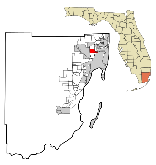
Ives Estates is a census-designated place (CDP) in Miami-Dade County, Florida. It is part of the Miami metropolitan area of South Florida. The population was 25,005 at the 2020 census, up from 19,525 in 2010.

<span class="mw-page-title-main">Olympia Heights, Florida</span> Census-designated place in Florida

Olympia Heights is a census-designated place in Miami-Dade County, Florida, United States. It is located in the Miami metropolitan area of South Florida. The population was 12,873 at the 2020 census.

<span class="mw-page-title-main">Palmetto Estates, Florida</span> Census-designated place in Florida

Palmetto Estates is an unincorporated area and census-designated place (CDP) in Miami-Dade County, Florida, United States. It is part of the Miami metropolitan area of South Florida. The population was 13,498 at the 2020 census.

<span class="mw-page-title-main">Pinewood, Florida</span> Census-designated place in Florida

Pinewood is an unincorporated community and census-designated place (CDP) in Miami-Dade County, Florida, United States. It is part of the Miami metropolitan area of South Florida. The population was 17,246 at the 2020 census.

<span class="mw-page-title-main">Richmond West, Florida</span> Census-designated place in Florida

Richmond West is a census-designated place (CDP) in Miami-Dade County, Florida, United States. It is part of the Miami metropolitan area of South Florida. The population was 35,884 at the 2020 census, up from 31,973 at the 2010 census.

<span class="mw-page-title-main">Sunset, Florida</span> Census-designated place in Florida

Sunset is a census-designated place (CDP) in Miami-Dade County, Florida, United States. It is part of the Miami metropolitan area of South Florida. The population was 15,912 at the 2020 census. The U.S. Postal Service uses the ZIP Codes of 33173 and 33183 for Sunset.

<span class="mw-page-title-main">The Crossings, Florida</span> CDP in Florida

The Crossings is a census-designated place (CDP) and suburb of Miami in Miami-Dade County, Florida, United States. It is part of the Miami metropolitan area of South Florida. The CDP includes the neighborhoods of The Crossings, Devon Aire, and Calusa. The population was 23,276 at the 2020 census.

<span class="mw-page-title-main">Three Lakes, Florida</span> Census-designated place in Florida

Three Lakes is a census-designated place (CDP) and planned community in Miami-Dade County, Florida, United States. It is part of the Miami metropolitan area of South Florida. The population was 16,540 at the 2020 census, up from 15,047 in 2010.

<span class="mw-page-title-main">West Little River, Florida</span> CDP in Miami-Dade County, Florida, US

West Little River is a census-designated place (CDP) in Miami-Dade County, Florida, United States. It is part of the Miami metropolitan area of South Florida. The population was 34,128 at the 2020 census.

<span class="mw-page-title-main">West Perrine, Florida</span> Census-designated place in Florida

West Perrine is a census-designated place (CDP) in Miami-Dade County, Florida, United States. It is part of the Miami metropolitan area of South Florida. The population was 10,602 at the 2020 census, up from 9,460 in 2010.

<span class="mw-page-title-main">Westchester, Florida</span> Census-designated place in Florida

Westchester is a census-designated place (CDP) and neighborhood in Miami-Dade County, Florida. It is part of the Miami metropolitan area of South Florida. Prior to the 2020 U.S. Census, the neighboring University Park CDP was merged into Westchester CDP, effectively doubling its geography and population. Per the 2020 census, the population was 56,384.

<span class="mw-page-title-main">Westwood Lakes, Florida</span> Census-designated place in Florida

Westwood Lakes is a census-designated place and unincorporated community of Miami-Dade County, Florida, United States. It is part of the Miami metropolitan area of South Florida. The population was 11,373 at the 2020 census.

<span class="mw-page-title-main">South Miami Heights, Florida</span> Census-designated place in Florida

South Miami Heights is a census-designated place (CDP), originally known as Eureka, in Miami-Dade County, Florida. It is part of the Miami metropolitan area of South Florida. The population was 36,770 as of the 2020 census.

References

  1. 1 2 "2022 U.S. Gazetteer Files: Florida". United States Census Bureau. Retrieved January 13, 2023.
  2. "P1. Race – Richmond Heights CDP, Florida: 2020 DEC Redistricting Data (PL 94-171)". U.S. Census Bureau. Retrieved January 13, 2023.
  3. 1 2 "U.S. Census website". United States Census Bureau . Retrieved January 31, 2008.
  4. "US Board on Geographic Names". United States Geological Survey. October 25, 2007. Retrieved January 31, 2008.
  5. "US Gazetteer files: 2010, 2000, and 1990". United States Census Bureau. February 12, 2011. Retrieved April 23, 2011.
  6. "Decennial Census of Population and Housing by Decades". US Census Bureau.
  7. "P2 HISPANIC OR LATINO, AND NOT HISPANIC OR LATINO BY RACE - 2010: DEC Redistricting Data (PL 94-171) - Richmond Heights CDP, Florida". United States Census Bureau .
  8. "P2 HISPANIC OR LATINO, AND NOT HISPANIC OR LATINO BY RACE - 2020: DEC Redistricting Data (PL 94-171) - Richmond Heights CDP, Florida". United States Census Bureau .
  9. "S1101 HOUSEHOLDS AND FAMILIES - 2020: Richmond Heights CDP, Florida". United States Census Bureau .
  10. "S1101 HOUSEHOLDS AND FAMILIES - 2010: Richmond Heights CDP, Florida". United States Census Bureau .
  11. "Demographics of Richmond Heights, FL". MuniNetGuide.com. Retrieved November 8, 2007.
  12. "MLA Data Center Results of Richmond Heights, FL". Modern Language Association . Retrieved November 8, 2007.
  13. "Richmond Heights: Historic weekend". The Miami Times . Retrieved October 15, 2016.
  14. "Richmond Heights". WFLV . Retrieved October 15, 2016.