| |||||
| Decades: | |||||
|---|---|---|---|---|---|
| See also: | Other events in 1906 · Timeline of Icelandic history | ||||

Events in the year 1906 in Iceland .
| |||||
| Decades: | |||||
|---|---|---|---|---|---|
| See also: | Other events in 1906 · Timeline of Icelandic history | ||||
Events in the year 1906 in Iceland .

The Isle of Man has an extensive communications infrastructure consisting of telephone cables, submarine cables, and an array of television and mobile phone transmitters and towers.

CANTAT-3 was the third Canadian transatlantic telecommunications cable, in regular operation from 1994 to 2010, carrying 3 x 2.5 Gbit/s between Canada and Europe. It branches to both Iceland and the Faroe Islands. It is out of normal service for international bandwidth and is currently operated by Føroya Tele to service oil platforms in the North Sea.

A submarine communications cable is a cable laid on the seabed between land-based stations to carry telecommunication signals across stretches of ocean and sea. The first submarine communications cables were laid beginning in the 1850s and carried telegraphy traffic, establishing the first instant telecommunications links between continents, such as the first transatlantic telegraph cable which became operational on 16 August 1858.
Telecommunications in Iceland is a diversified market.

The Mid-Atlantic Ridge is a mid-ocean ridge located along the floor of the Atlantic Ocean, and part of the longest mountain range in the world. In the North Atlantic, the ridge separates the North American from the Eurasian Plate and the African Plate, north and south of the Azores Triple Junction. In the South Atlantic, it separates the African and South American plates. The ridge extends from a junction with the Gakkel Ridge northeast of Greenland southward to the Bouvet Triple Junction in the South Atlantic. Although the Mid-Atlantic Ridge is mostly an underwater feature, portions of it have enough elevation to extend above sea level, for example in Iceland. The ridge has an average spreading rate of about 2.5 centimetres (1 in) per year.

Transatlantic telegraph cables were undersea cables running under the Atlantic Ocean for telegraph communications. Telegraphy is now an obsolete form of communication, and the cables have long since been decommissioned, but telephone and data are still carried on other transatlantic telecommunications cables. The first cable was laid in the 1850s from Valentia Island off the west coast of Ireland to Bay of Bulls, Trinity Bay, Newfoundland. The first communications occurred on August 16th 1858, but the line speed was poor, and efforts to improve it caused the cable to fail after three weeks.

Commercial Pacific Cable Company was founded in 1901, and ceased operations in October 1951. It provided the first direct telegraph route from America to the Philippines, China, and Japan.

Valentia Island is one of Ireland's most westerly points. It lies off the Iveragh Peninsula in the southwest of County Kerry. It is linked to the mainland by the Maurice O'Neill Memorial Bridge at Portmagee. A car ferry also departs from Reenard Point to Knightstown, the island's main settlement, from April to October. Another, smaller village named Chapeltown sits at roughly the midpoint of the island, three kilometres from the bridge. Valentia Island's permanent population is 658. It is about 11 kilometres long by almost three kilometres wide, making it the fifth-biggest island off the Irish coast.

The Electric Telegraph Company (ETC) was a British telegraph company founded in 1846 by William Fothergill Cooke and John Ricardo. It was the world's first public telegraph company. The equipment used was the Cooke and Wheatstone telegraph, an electrical telegraph developed a few years earlier in collaboration with Charles Wheatstone. The system had been taken up by several railway companies for signalling purposes, but in forming the company Cooke intended to open up the technology to the public at large.

Waterville, historically known as Coirean, is a village in County Kerry, Ireland, on the Iveragh Peninsula. The town is sited on a narrow isthmus, with Lough Currane on the east side of the town, and Ballinskelligs Bay on the west, and the Currane River connecting the two.

The Icelandic Coast Guard is the Icelandic defence service responsible for search and rescue, maritime safety and security surveillance, national defense, and law enforcement. The Coast Guard maintains the Iceland Air Defence System which conducts ground-based surveillance of Iceland's air space and operate Keflavik airbase. It is also responsible for hydrographic surveying and nautical charting.

The All Red Line was a system of electrical telegraphs that linked much of the British Empire. It was inaugurated on 31 October 1902. The informal name derives from the common practice of colouring the territory of the British Empire red or pink on political maps.

A cable layer or cable ship is a deep-sea vessel designed and used to lay underwater cables for telecommunications, for electric power transmission, military, or other purposes. Cable ships are distinguished by large cable sheaves for guiding cable over bow or stern or both. Bow sheaves, some very large, were characteristic of all cable ships in the past, but newer ships are tending toward having stern sheaves only, as seen in the photo of CS Cable Innovator at the Port of Astoria on this page. The names of cable ships are often preceded by "C.S." as in CS Long Lines.

Siemens Brothers and Company Limited was an electrical engineering design and manufacturing business in London, England. It was first established as a branch in 1858 by a brother of the founder of the German electrical engineering firm Siemens & Halske. The principal works were at Woolwich where cables and light-current electrical apparatus were produced from 1863 until 1968. The site between the Thames Barrier and Woolwich Dockyard has retained several buildings of historic interest. New works were built at Stafford in 1903 and Dalston in 1908.
Síminn hf., previously named Landssíminn and Póstur og Sími, is an Icelandic telecommunications company. It offers communication services for both private and corporate clients, including mobile (2G/3G/4G/5G), landline (VoIP/POTS), Internet (ADSL/VDSL/FTTH) and IPTV services. Síminn also operates multiple TV channels and streaming services. Síminn is listed on the Icelandic stock exchange.
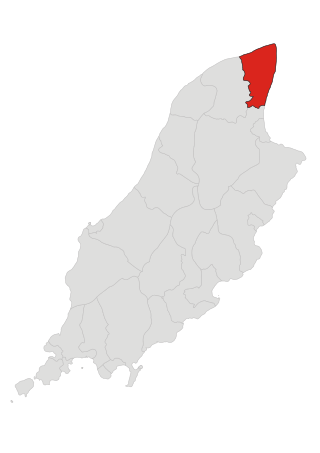
Bride is one of the seventeen parishes of the Isle of Man.

Íslandspóstur or simply Pósturinn is the national postal service of Iceland. It dates back to the year 1776 when Christian VII, king of Denmark ordered a mail service to be established in the country. Two years later, regular postal sailings began between Iceland and Denmark, once a year. The first Icelandic postage stamps were published in 1873, and at the same time, the Icelandic postal system was being organised under a special board and the first post offices being established. In 1935, the postal service and the national telephone company were merged under the name Póstur og sími. In 1998, that governmental company was split up into two companies, Landssími Íslands and Íslandspóstur. Landssími Íslands has since been privatized. Íslandspóstur has one of the greatest numbers of employees in Iceland, at nearly 1,200. Many new post offices throughout the country are being planned to widen the distribution net and better the services of the company.
The second CS Faraday was a cable ship built by Palmers Shipbuilding and Iron Company, Hebburn-on-Tyne, in 1922–23, as a replacement for the ageing CS Faraday built in 1874. Design of the new ship was influenced by long experience with the original ship.

Greenland Connect is a submarine communications cable system that connects Canada, Greenland, and Iceland. The cable contains two fibre pairs specified for 128*10 Gbit/s wavelength each. Initial lit capacity is 1*10 Gbit/s for each fibre pair. Two additional 10 Gbit/s Wavelength were installed in the summer of 2010. The cable has cable landing points at:

The British and Irish Magnetic Telegraph Company was founded by John Brett in 1850. The Magnetic was the principal competitor to the largest telegraph company in the United Kingdom, the Electric Telegraph Company. The Magnetic was the leading company in Ireland, while the Electric was the leading company in mainland Britain. Between them, they dominated the market until the telegraph was nationalised in 1870.