
Hampshire County Council (HCC) is the upper-tier local authority for the non-metropolitan county of Hampshire in England. The council was created in 1889. The county council provides county-level services to eleven of the thirteen districts geographically located within the ceremonial county of Hampshire. The county council acts as the upper tier of local government to approximately 1.4 million people. It is one of 21 county councils in England.
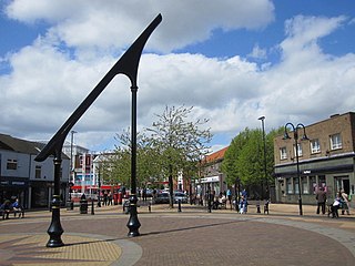
Ashfield is a local government district in Nottinghamshire, England. The council is based in Kirkby-in-Ashfield, but the largest town is neighbouring Sutton-in-Ashfield. The district also contains the town of Hucknall and a few villages. The district is mostly urban, with some of its settlements forming parts of both the Nottingham and Mansfield Urban Areas.

Bassetlaw is a local government district in north Nottinghamshire, England. Its council is based in the town of Worksop; the other towns in the district are Retford, Tuxford and Harworth Bircotes. The district also contains numerous villages and surrounding rural areas.

Broxtowe is a local government district with borough status in Nottinghamshire, England. It lies immediately west of the city of Nottingham, and most of the built-up areas of the borough form part of the Nottingham Urban Area. The council is based in Beeston and the borough also includes the towns of Eastwood, Kimberley and Stapleford and surrounding villages and rural areas.

Newark and Sherwood is a local government district in Nottinghamshire, England. It is the largest district by area in the county. The council is based in Newark-on-Trent, the area's largest town. The district also includes the towns of Southwell and Ollerton along with a large rural area containing many villages. Much of the district lies within the ancient Sherwood Forest and there are also extensive forestry plantations in the area.
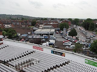
Rushcliffe is a local government district with borough status in south Nottinghamshire, England. Its council is based in West Bridgford. The borough also includes the towns of Bingham and Cotgrave as well as numerous villages and surrounding rural areas. Some of the built-up areas in the north-west of the borough, including West Bridgford, form part of the Nottingham Urban Area.

Gedling is a local government district with borough status in Nottinghamshire, England. The council is based in Arnold. The borough also includes Carlton along with villages and rural areas to the north-east of Nottingham. The main built-up part of the borough around Arnold and Carlton forms part of the Nottingham Urban Area.

Mansfield District is a local government district in Nottinghamshire, England. It is named after the town of Mansfield, where the council is based. The district also contains Mansfield Woodhouse and Warsop.
The Local Government Act 1972 is an act of the Parliament of the United Kingdom that reformed local government in England and Wales on 1 April 1974. It was one of the most significant Acts of Parliament to be passed by the Heath Government of 1970–74.

Isle of Wight Council, known between 1890 and 1995 as Isle of Wight County Council, is the local authority for the Isle of Wight in England. Since 1995 it has been a unitary authority, being a county council which also performs the functions of a district council. It is based at County Hall in Newport. The council has been under no overall control since 2021, being led by a coalition of independent, Green, and Our Island councillors called the Alliance Group.

Nottingham City Council is the local authority for the city of Nottingham, in the ceremonial county of Nottinghamshire in the East Midlands region of England. Nottingham has had a council from medieval times, which has been reformed on numerous occasions. Since 1998 the council has been a unitary authority, being a district council which also performs the functions of a county council. Since 2024 the council has been a member of the East Midlands Combined County Authority.

Derbyshire County Council is the upper-tier local authority for the non-metropolitan county of Derbyshire in England. The non-metropolitan county is smaller than the ceremonial county, which additionally includes Derby. The county council is based at County Hall in Matlock. Since 2017 the council has been under Conservative majority control. The council is a constituent member of the East Midlands Combined County Authority.
The wards and electoral divisions in the United Kingdom are electoral districts at sub-national level, represented by one or more councillors. The ward is the primary unit of English electoral geography for civil parishes and borough and district councils, the electoral ward is the unit used by Welsh principal councils, while the electoral division is the unit used by English county councils and some unitary authorities. Each ward/division has an average electorate of about 5,500 people, but ward population counts can vary substantially. As of 2021 there are 8,694 electoral wards/divisions in the UK. An average area of wards or electoral divisions in the United Kingdom is 28.109 km2 (10.853 sq mi).

Cambridgeshire County Council is the county council for non-metropolitan county of Cambridgeshire, England. The non-metropolitan county is smaller than the ceremonial county, which additionally includes the City of Peterborough. The county council consists of 61 councillors, representing 59 electoral divisions. The council is based at New Shire Hall in Alconbury Weald, near Huntingdon. It is part of the East of England Local Government Association and a constituent member of the Cambridgeshire and Peterborough Combined Authority.
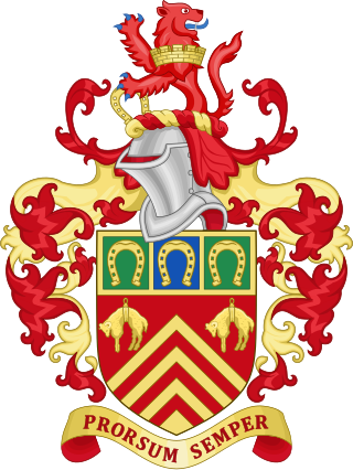
Gloucestershire County Council is the upper-tier local authority for the non-metropolitan county of Gloucestershire, in England. The council was created in 1889. The council's principal functions are county roads and rights of way, social services, education and libraries, but it also provides many other local government services in the area it covers. The non-metropolitan county is smaller than the ceremonial county, the latter additionally including South Gloucestershire. The council went under no overall control following a change of allegiance in May 2024, having previously been under Conservative majority control. It is based at Shire Hall in Gloucester.

Nottinghamshire County Council is the upper-tier local authority for the non-metropolitan county of Nottinghamshire in England. It consists of 66 county councillors, elected from 56 electoral divisions every four years. The most recent election was held in 2021.

Lincolnshire County Council is the county council that governs the non-metropolitan county of Lincolnshire in England. The non-metropolitan county is smaller than the ceremonial county; the latter additionally includes North Lincolnshire and North East Lincolnshire which are both unitary authorities and therefore independent from the county council.

Durham County Council is the local authority which governs the non-metropolitan county of County Durham in North East England. Since 2009 it has been a unitary authority, having taken over district-level functions when the county's districts were abolished. The non-metropolitan county is smaller than the ceremonial county of County Durham, which additionally includes Darlington, Hartlepool and the parts of Stockton-on-Tees north of the River Tees. The county council has its headquarters at County Hall in Durham.
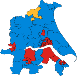
The 1981 Humberside County Council election was held on Thursday, 7 May. Following boundary changes to the county's electoral divisions, the whole council of 75 members was up for election. The Labour Party regained control of the council from the Conservative Party, winning 42 seats.

The Borough of Chesterfield is a non-metropolitan district with borough status in Derbyshire, England. It is named after the town of Chesterfield, its largest settlement, and also contains the town of Staveley and the large village of Brimington. In 2022 it had a population of 104,110.


