 | |
| UTC time | 1976-07-26 02:56:38 |
|---|---|
| ISC event | 711657 |
| USGS-ANSS | ComCat |
| Local date | 26 July 1976 |
| Local time | 10:56 MST (UTC+08:00) [1] |
| Magnitude | 6.3 (Mw ) [2] |
| Depth | 15 km (9.3 mi) [1] |
| Epicenter | 4°57′22″N118°18′29″E / 4.956°N 118.308°E [1] |
| Type | Normal |
| Areas affected | Tawau Division & Sandakan Division, Sabah, East Malaysia |
| Max. intensity | MMI IX (Violent) [3] |
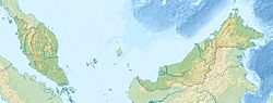
The 1976 Sabah earthquake occurred near Lahad Datu in the eastern portion of Sabah, Malaysia at 10:56:39 (UTC+8) on 26 July 1976. [1] [4] The moment magnitude 6.3 earthquake is one of the strongest in Malaysia to be recorded by seismic instruments. [2] It had a focal mechanism corresponding to strike-slip faulting. [5] While slightly larger than the 2015 Sabah earthquake (Mw 6.0), the 1976 event caused less extensive damage, in the form of cracks on several buildings and ground cracks. [6]