Amisk Lake 184 is an Indian reserve of the Peter Ballantyne Cree Nation in Saskatchewan.

Birch Portage 184A is an Indian reserve of the Peter Ballantyne Cree Nation in Saskatchewan. It is about 30 miles northwest of Flin Flon.

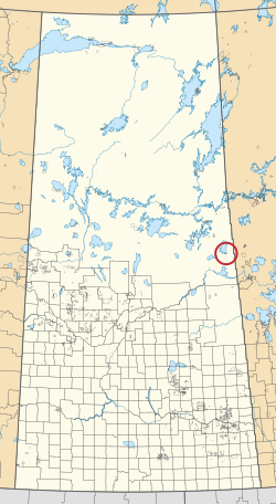
Budd's Point 20D is an Indian reserve of the Cumberland House Cree Nation in Saskatchewan. It is 85 kilometres south of Flin Flon.

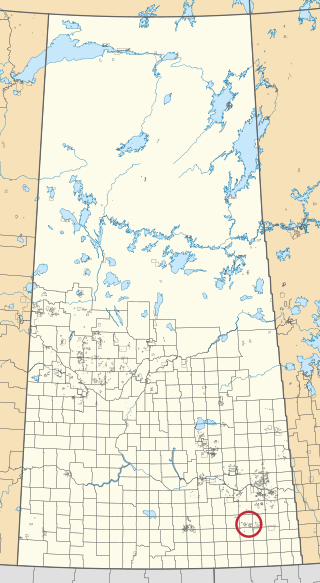
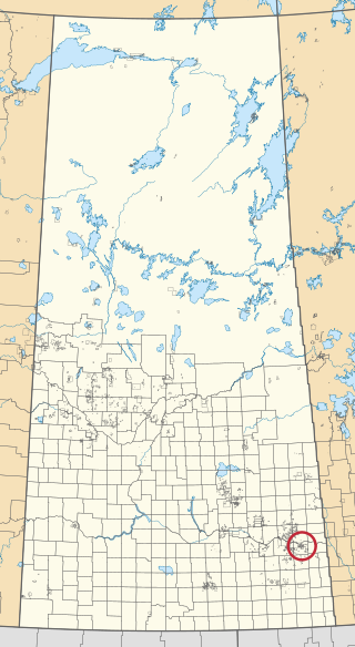
Cowessess 73A is an Indian reserve of the Cowessess First Nation in Saskatchewan. It is 31 kilometres west of Esterhazy.

Cumberland House Cree Nation 20 is an Indian reserve of the Cumberland House Cree Nation in Saskatchewan. The reserve is on Cumberland Island in the Saskatchewan River Delta, about 96 kilometres (60 mi) south-west of Flin Flon.

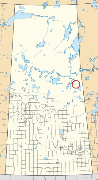
Fox Point 157D is an Indian reserve of the Lac La Ronge Indian Band in Saskatchewan. It is 16 miles south-east of La Ronge, and on the south-west shore of Lac la Ronge.
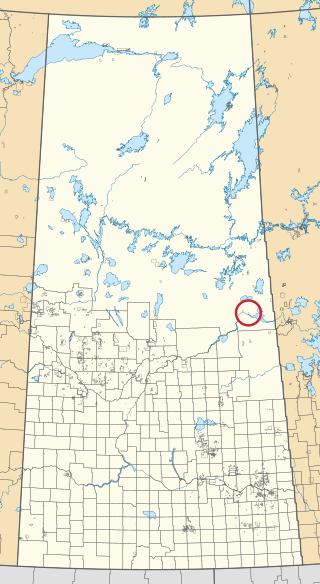
Muskeg River 20C is an Indian reserve of the Cumberland House Cree Nation in Saskatchewan. It is in Township 58, Range 5, west of the Second Meridian.

Nakiskatowaneek 227 is an Indian reserve of the Peter Ballantyne Cree Nation in Saskatchewan. It is near Pelican Junction.

Ocean Man 69F is an Indian reserve of the Ocean Man First Nation in Saskatchewan. In the 2016 Canadian Census, it recorded a population of 0 living in 0 of its 0 total private dwellings.
Ocean Man 69G is an Indian reserve of the Ocean Man First Nation in Saskatchewan. In the 2016 Canadian Census, it recorded a population of 0 living in 0 of its 0 total private dwellings.

Ochapowace 71-7 is an Indian reserve of the Ochapowace Nation in Saskatchewan. It is 11 kilometres northeast of Dubuc. In the 2016 Canadian Census, it recorded a population of 0 living in 0 of its 0 total private dwellings.

Ochapowace 71-10 is an Indian reserve of the Ochapowace Nation in Saskatchewan. It is 16 kilometres northeast of Whitewood. In the 2016 Canadian Census, it recorded a population of 0 living in 0 of its 0 total private dwellings.

Ochapowace 71-18 is an Indian reserve of the Ochapowace Nation in Saskatchewan. It is 14 kilometres northwest of Esterhazy. In the 2016 Canadian Census, it recorded a population of 0 living in 0 of its 0 total private dwellings.
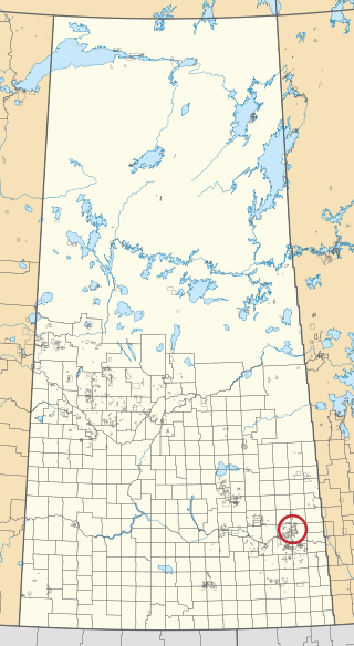
Ochapowace 71-44 is an Indian reserve of the Ochapowace Nation in Saskatchewan. It is 16 kilometres northwest of Esterhazy. In the 2016 Canadian Census, it recorded a population of 0 living in 0 of its 0 total private dwellings.

Ochapowace 71-51 is an Indian reserve of the Ochapowace Nation in Saskatchewan. It is 6 kilometres south of Atwater. In the 2016 Canadian Census, it recorded a population of 0 living in 0 of its 0 total private dwellings.
Ochapowace 71-54 is an Indian reserve of the Ochapowace Nation in Saskatchewan. It is 16 kilometres southeast of Bird's Point. In the 2016 Canadian Census, it recorded a population of 0 living in 0 of its 0 total private dwellings.

Ochapowace 71-70 is an Indian reserve of the Ochapowace Nation in Saskatchewan. It is 14 kilometres south of Whitewood. In the 2016 Canadian Census, it recorded a population of 0 living in 0 of its 0 total private dwellings.

Pine Bluff 20A is an Indian reserve of the Cumberland House Cree Nation in Saskatchewan. It is 60 miles southwest of Flin Flon, and on the north shore of the Saskatchewan River.

Pine Bluff 20B is an Indian reserve of the Cumberland House Cree Nation in Saskatchewan. It is 60 kilometres southwest of Flin Flon, and on the north shore of the Saskatchewan River.
Waskwaynikapik 228 is an Indian reserve of the Peter Ballantyne Cree Nation in Saskatchewan.