
The Chipewyan are a Dene Indigenous Canadian people of the Athabaskan language family, whose ancestors are identified with the Taltheilei Shale archaeological tradition. They are part of the Northern Athabascan group of peoples, and come from what is now Western Canada.

Fond du Lac Dene Nation is a Dene First Nation located in the boreal forest area of northern Saskatchewan, Canada. The main settlement is Fond-du-Lac, situated on the east side of Lake Athabasca. It is a remote fly-in community. The population in 2011 was 874, mainly of Dene and Métis descent. 705 residents selected Dene as their mother tongue in 2011.

Stony Rapids is a northern hamlet in Northern Saskatchewan, Canada. It is located 82 kilometres (51 mi) south of the border to the Northwest Territories, the community is astride the Fond du Lac River. This river connects the community to Fond-du-Lac, Uranium City and Camsell Portage.

Athabasca Sand Dunes Provincial Park was created to protect the Athabasca sand dunes, a unique boreal shield ecosystem located in the far-north Northern Saskatchewan Administration District. The Athabasca sand dunes are the most northerly active sand dune formations on Earth.

Black Lake is a Denesuline First Nations band government in the boreal forest of northern Saskatchewan, Canada. It is located on the northwest shore of Black Lake where the Fond du Lac River leaves the lake to flow to Lake Athabasca.
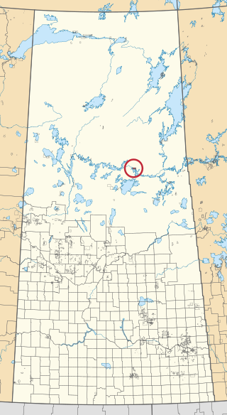
Grandmother's Bay 219 is an Indian reserve of the Lac La Ronge Indian Band in Saskatchewan. Located on Otter Lake, part of the Churchill River system, it is about 77 kilometres (48 mi) north-east of Lac la Ronge. In the 2016 Canadian Census, it recorded a population of 342 living in 101 of its 115 total private dwellings. In the same year, its Community Well-Being index was calculated at 44 of 100, compared to 58.4 for the average First Nations community and 77.5 for the average non-Indigenous community.

Bittern Lake 218 is an Indian reserve of the Lac La Ronge Indian Band in Saskatchewan. It is 8 kilometres east of Prince Albert National Park.

La Plonge 192 is an Indian reserve of the English River First Nation in Saskatchewan. It is 19 kilometres south of Île-à-la-Crosse. In the 2016 Canadian Census, it recorded a population of 148 living in 46 of its 51 total private dwellings. In the same year, its Community Well-Being index was calculated at 59 of 100, compared to 58.4 for the average First Nations community and 77.5 for the average non-Indigenous community.

Chief Philip Morin 232 is an Indian reserve of the Peter Ballantyne Cree Nation in Saskatchewan. It is located inside the city of Prince Albert, making it an urban reserve.

Fond du Lac 227 is an Indian reserve of the Fond du Lac Denesuline First Nation in Saskatchewan. It is at the east end of Lake Athabasca. In the 2016 Canadian Census, it recorded a population of 903 living in 206 of its 231 total private dwellings. In the same year, its Community Well-Being index was calculated at 52 of 100, compared to 58.4 for the average First Nations community and 77.5 for the average non-Indigenous community.

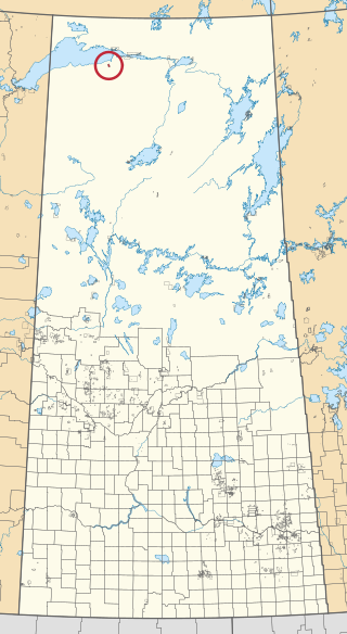
Fond du Lac 228 is an Indian reserve of the Fond du Lac Denesuline First Nation in Saskatchewan.

Fond du Lac 229 is an Indian reserve of the Fond du Lac Denesuline First Nation in Saskatchewan.
Fond du Lac 231 is an Indian reserve of the Fond du Lac Denesuline First Nation in Saskatchewan.

Fond du Lac 233 is an Indian reserve of the Fond du Lac Denesuline First Nation in Saskatchewan.

Four Portages 157C is an Indian reserve of the Lac La Ronge Indian Band in Saskatchewan. It is about 23 miles (37 km) north-east of La Ronge, and on the north shore of Lac la Ronge.

Fox Point 157D is an Indian reserve of the Lac La Ronge Indian Band in Saskatchewan. It is about 16 miles south-east of La Ronge, and on the south-west shore of Lac la Ronge.

Fox Point 157E is an Indian reserve of the Lac La Ronge Indian Band in Saskatchewan. It is about 18 miles south-east of La Ronge, and on an island near the south shore of Lac la Ronge.

Île-à-la-Crosse 192E is an Indian reserve of the English River First Nation in Saskatchewan. It is 5 miles east of Île-à-la-Crosse, on the east shore of Lac Île-à-la-Crosse, Township 74, Range 12, west of the Third Meridian.

Wapachewunak 192D is an Indian reserve of the English River First Nation in Saskatchewan. It is north of Lac Île-à-la-Crosse.

