Little Hills 158B

Last updated

Little Hills 158B
Little Hills Indian Reserve No. 158B
CAN SK Little Hills 158B Locator.svg
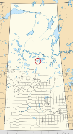
Location in Saskatchewan
First Nation Lac La Ronge Indian Band
Country Canada
Province Saskatchewan
Area
[1]
  Total131.2 ha (324.2 acres)

Little Hills 158B is an Indian reserve of the Lac La Ronge Indian Band in Saskatchewan. [1] [2] It is about 8 miles south-west of La Ronge, and on the south-eastern shore of Bigstone Lake.

See also

Related Research Articles

<span class="mw-page-title-main">CBKA-FM</span> CBC Radio One station in La Ronge, Saskatchewan

CBKA-FM is a Canadian radio station, broadcasting the CBC Radio One network at 105.9 FM in La Ronge, Saskatchewan.

The Lac La Ronge Indian Band is a Woodland Cree First Nation in northern Saskatchewan, it is the largest Cree band government in Canada and the largest First Nation in Saskatchewan. The administrative centre of the Lac La Ronge Indian Band is located in La Ronge.

<span class="mw-page-title-main">Grandmother's Bay 219</span> Indian reserve in Saskatchewan, Canada

Grandmother's Bay 219 is an Indian reserve of the Lac La Ronge Indian Band in Saskatchewan. Located on Otter Lake, part of the Churchill River system, it is about 77 kilometres (48 mi) north-east of Lac la Ronge. In the 2016 Canadian Census, it recorded a population of 342 living in 101 of its 115 total private dwellings. In the same year, its Community Well-Being index was calculated at 44 of 100, compared to 58.4 for the average First Nations community and 77.5 for the average non-Indigenous community.

<span class="mw-page-title-main">Lac La Ronge Provincial Park</span> Provincial park in Saskatchewan, Canada

Lac La Ronge Provincial Park is located in the boreal forest of the north central part of the Canadian province of Saskatchewan within the Canadian Shield. Situated in the Churchill River system, this provincial park has close to 100 lakes and more than 30 canoe routes, many of which follow old fur trade routes. Summer activities include camping, hiking, boating, fishing, and swimming. In the winter, there's cross-country skiing, snowmobiling, and ice fishing. Saskatchewan's highest waterfall is in the park. Nistowiak Falls are located north of Lac La Ronge along the Rapid River.

<span class="mw-page-title-main">Bittern Lake 218</span> Indian reserve in Saskatchewan, Canada

Bittern Lake 218 is an Indian reserve of the Lac La Ronge Indian Band in Saskatchewan. It is 8 kilometres east of Prince Albert National Park.

<span class="mw-page-title-main">Four Portages 157C</span> Indian reserve in Saskatchewan, Canada

Four Portages 157C is an Indian reserve of the Lac La Ronge Indian Band in Saskatchewan. It is about 23 miles (37 km) north-east of La Ronge, and on the north shore of Lac la Ronge.

<span class="mw-page-title-main">Fox Point 157D</span> Indian reserve in Saskatchewan, Canada

Fox Point 157D is an Indian reserve of the Lac La Ronge Indian Band in Saskatchewan. It is about 16 miles south-east of La Ronge, and on the south-west shore of Lac la Ronge.

<span class="mw-page-title-main">Fox Point 157E</span> Indian reserve in Saskatchewan, Canada

Fox Point 157E is an Indian reserve of the Lac La Ronge Indian Band in Saskatchewan. It is about 18 miles south-east of La Ronge, and on an island near the south shore of Lac la Ronge.

<span class="mw-page-title-main">Lac la Ronge 156</span> Indian reserve in Canada, Lac La Ronge

Lac la Ronge 156 is an Indian reserve of the Lac La Ronge Indian Band in Saskatchewan. It is 10 kilometres southwest of Lac la Ronge. In the 2016 Canadian Census, it recorded a population of 2017 living in 441 of its 480 total private dwellings. In the same year, its Community Well-Being index was calculated at 50 of 100, compared to 58.4 for the average First Nations community and 77.5 for the average non-Indigenous community.

<span class="mw-page-title-main">Little Hills 158</span> Indian reserve in Saskatchewan, Canada

Little Hills 158 is an Indian reserve of the Lac La Ronge Indian Band in Saskatchewan. In the 2016 Canadian Census, it recorded a population of 0 living in 0 of its 0 total private dwellings.

<span class="mw-page-title-main">Little Hills 158A</span> Indian reserve in Saskatchewan, Canada

Little Hills 158A is an Indian reserve of the Lac La Ronge Indian Band in Saskatchewan. It is 6 miles south-west of La Ronge, and on the north bank of the Little Hills River.

<span class="mw-page-title-main">Little Red River 106C</span> Indian reserve in Saskatchewan, Canada

Little Red River 106C is an Indian reserve of the Lac La Ronge Indian Band in Saskatchewan. It is about 34 kilometres (21 mi) north of Prince Albert. In the 2016 Canadian Census, it recorded a population of 354 living in 88 of its 98 total private dwellings. In the same year, its Community Well-Being index was calculated at 48 of 100, compared to 58.4 for the average First Nations community and 77.5 for the average non-Indigenous community.

<span class="mw-page-title-main">Little Red River 106D</span> Indian reserve in Saskatchewan, Canada

Little Red River 106D is an Indian reserve of the Lac La Ronge Indian Band in Saskatchewan. It is 25 miles north of Prince Albert, and in Township 53, Range 1, west of the Third Meridian. In the 2016 Canadian Census, it recorded a population of 5 living in 1 of its 3 total private dwellings.

<span class="mw-page-title-main">Morin Lake 217</span> Indian reserve in Canada, Lac La Ronge

Morin Lake 217 is an Indian reserve of the Lac La Ronge Indian Band in Saskatchewan. It is 24 kilometres east of Lac la Ronge. In the 2016 Canadian Census, it recorded a population of 577 living in 135 of its 155 total private dwellings. In the same year, its Community Well-Being index was calculated at 45 of 100, compared to 58.4 for the average First Nations community and 77.5 for the average non-Indigenous community.

<span class="mw-page-title-main">Old Fort 157B</span> Indian reserve in Canada, Lac La Ronge Indian Band

Old Fort 157B is an Indian reserve of the Lac La Ronge Indian Band in Saskatchewan.

<span class="mw-page-title-main">Potato River 156A</span> Indian reserve in Canada, Lac La Ronge Indian Band

Potato River 156A is an Indian reserve of the Lac La Ronge Indian Band in Saskatchewan. It is 6 miles south of La Ronge.

<span class="mw-page-title-main">Stanley 157</span> Indian reserve in Canada, Lac La Ronge Indian Band

Stanley 157 is an Indian reserve of the Lac La Ronge Indian Band in Saskatchewan. It is 56 kilometres northeast of Lac la Ronge. In the 2016 Canadian Census, it recorded a population of 1840 living in 451 of its 466 total private dwellings. In the same year, its Community Well-Being index was calculated at 52 of 100, compared to 58.4 for the average First Nations community and 77.5 for the average non-Indigenous community.

<span class="mw-page-title-main">Stanley 157A</span> Indian reserve in Canada, Lac La Ronge Indian Band

Stanley 157A is an Indian reserve of the Lac La Ronge Indian Band in Saskatchewan, Canada. It is 41 miles north-east of La Ronge, and 7 miles east of Stanley on the south shore of the Churchill River.

<span class="mw-page-title-main">Sucker River 156C</span> Indian reserve in Canada, Lac La Ronge Indian Band

Sucker River 156C is an Indian reserve of the Lac La Ronge Indian Band in Saskatchewan. It is 230 kilometres north of Prince Albert. In the 2016 Canadian Census, it recorded a population of 416 living in 109 of its 124 total private dwellings. In the same year, its Community Well-Being index was calculated at 49 of 100, compared to 58.4 for the average First Nations community and 77.5 for the average non-Indigenous community.

<span class="mw-page-title-main">Bow River (Saskatchewan)</span> River in Saskatchewan, Canada

Bow River is a river in the Northern Administration District of the Canadian province of Saskatchewan. The river begins at Ridge Lake of Bow River chain lakes in Clarence-Steepbank Lakes Provincial Park and flows in a northerly direction into Lac la Ronge and Lac La Ronge Provincial Park. Rapid River connects Lac la Ronge to the Churchill River. There are no communities nor settlements along the river's course.

References

  1. 1 2 "Reserve/Settlement/Village Detail". Crown–Indigenous Relations and Northern Affairs Canada . Government of Canada. 14 November 2008. Retrieved 12 August 2019.
  2. "Canada Lands Survey System - CLSS Map Browser". Natural Resources Canada. 13 December 2013. Retrieved 9 October 2019.

55°01′25″N105°25′24″W / 55.0237°N 105.4233°W / 55.0237; -105.4233 (Little Hills 158B)