
Carrot River is a town located in east-central Saskatchewan in Canada. The administration office for the Rural Municipality of Moose Range No. 486 is located in Carrot River.

The Flying Dust First Nation is a Cree First Nation band government located adjacent to the city of Meadow Lake in Saskatchewan, Canada. Highway 55 goes through the band's reserve community.
Waterhen Lake First Nation is a Cree First Nation band government located in northwestern Saskatchewan, Canada. As of October 2018 the total membership of the Waterhen Lake First Nation was 2,053. There were 983 members living on reserve, 2 on Crown Land and 1,068 members living off reserve. The First Nation is a member of the MLTC Program Services, a regional tribal Chiefs' Council. The First Nation is also a signatory to the Adhesion to Treaty 6 in 1921.
Brabant Lake is an Indian settlement of 102 people located in Northern Saskatchewan, Canada. Brabant Lake is 172 km northeast of La Ronge and 45 km southwest of Southend.
Canoe Lake 165 is an Indian reserve of the Canoe Lake Cree First Nation in the boreal forest of northern Saskatchewan, Canada. Its location is on Canoe Lake approximately thirty miles west of Beauval, within the ancient hunting grounds of the Woodland Cree. In the 2016 Canadian Census, it recorded a population of 912 living in 250 of its 273 total private dwellings. In the same year, its Community Well-Being index was calculated at 53 of 100, compared to 58.4 for the average First Nations community and 77.5 for the average non-Indigenous community. The reserve includes the settlement of Canoe Narrows. The name of the reserve and the settlement in Cree is nêhiyaw-wapâsihk ᓀᐦᐃᔭᐤ ᐘᐹᓯᕽ.
The Moosomin First Nation is a Cree First Nation band government in Cochinin the Canadian province of Saskatchewan. Its reserves are approximately 35 kilometres (22 mi) and 22 kilometres (14 mi) north of North Battleford. It borders the rural municipalities of Meota No. 468 and Round Hill No. 467. Moosomin First Nation has over 1,500 Band members and control of more than 50,000 acres (200 km2) of land.

The Okanese First Nation is a Cree-Saulteaux First Nation band government in Balcarres, Saskatchewan, Canada.
The Shoal Lake Cree Nation is a Swampy Cree First Nations band government in Saskatchewan, Canada located 98 kilometres (61 mi) east of Nipawin. The Cree First Nation is on the Carrot River and can be accessed by Highway 55. Nearby to the west is the Red Earth First Nation.

Red Earth Cree Nation is a Cree community in Saskatchewan, Canada. It is located 225 kilometres (140 mi) northeast of Prince Albert. The main settlement of Red Earth is located on the Carrot River and accessed by Highway 55. Nearby to the east is the Shoal Lake First Nation.
The Ocean Man First Nation is an Assiniboine, Cree, and Saulteaux band government in southeastern Saskatchewan, Canada. Chief Kitchi-Kah-Me-Win (Cree: ᑭᐦᒋᑲᒦᐏᔨᐣ kihcikamîwiyin) signed Treaty 4 on September 9, 1875.
The White Bear First Nations are a First Nation band government in southeastern Saskatchewan, Canada.
Nekaneet Cree Nation is a Cree First Nations band government in southern Saskatchewan, Canada.

Kahkewistahaw First Nation is a Saulteaux- and Cree-speaking First Nation in southern Saskatchewan, Canada. The name Kahkewistahaw means "Eagle flying in the air". Their reserves include:

Little Black Bear First Nation is a Cree and Assiniboine First Nation in southern Saskatchewan, Canada. Their reserves include:

Peepeekisis Cree Nation (Cree: ᐲᐦᐲᑭᓰᐢ, pîhpîkisîs, literal meaning: Sparrow Hawk) is a Cree First Nation in southern Saskatchewan, Canada. Its reserves include Peepeekisis 81; Treaty Four Reserve Grounds 77, which is shared with 32 other bands; and Peepeekisis Cree Nation, which is located 19 km (12 mi) east of Balcarres, Saskatchewan, on Highway 10.

Beardy's and Okemasis' Cree Nation is a Cree First Nations band government in Saskatchewan, Canada. Their reserves include:

Day Star First Nation is a First Nations band government in Saskatchewan, Canada. Their reserves include:

The Kawacatoose First Nation is a Plains Cree First Nations band government in Saskatchewan. Their reserves include:
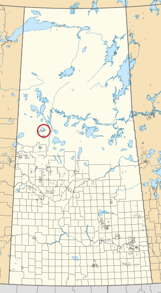
Witchekan Lake First Nation is a Cree First Nation in Saskatchewan, Canada. Their reserves include:
Canoe Lake Cree First Nation is a Cree First Nation based in the settlement of Canoe Narrows, Saskatchewan. The Nation is a member of Meadow Lake Tribal Council Tribal Council.

