
Harris County is a county located in the U.S. state of Texas; as of the 2020 census, the population was 4,731,145, making it the most populous county in Texas and the third most populous county in the United States. Its county seat is Houston, the largest city in Texas and fourth largest city in the United States. The county was founded in 1836 and organized in 1837. It is named for John Richardson Harris, who founded the town of Harrisburg on Buffalo Bayou in 1826. According to the July 2022 census estimate, Harris County's population has shifted to 4,780,913 comprising over 16% of Texas's population. Harris County is included in the nine-county Houston–The Woodlands–Sugar Land metropolitan statistical area, which is the fifth-most populous metropolitan area in the United States.
River Oaks is a residential community located in the center of Houston, Texas, United States. Located within the 610 Loop and between Downtown and Uptown, the community spans 1,100 acres (450 ha). Established in the 1920s by brothers Will Hogg and Michael Hogg, the community became a well-publicized national model for community planning. Real estate values in the community range from $1 million to over $20 million. River Oaks was also named the most expensive neighborhood in Houston in 2013. The community is home to River Oaks Country Club, which includes a golf course designed by architect Donald Ross and redesigned in 2015 by Tom Fazio.

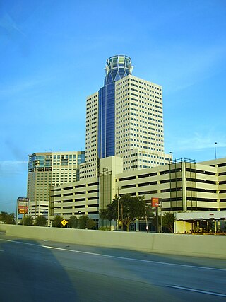
Downtown is the largest central business district in the city of Houston and the largest in the state of Texas, located near the geographic center of the metropolitan area at the confluence of Interstate 10, Interstate 45, and Interstate 69. The 1.84-square-mile (4.8 km2) district, enclosed by the aforementioned highways, contains the original townsite of Houston at the confluence of Buffalo Bayou and White Oak Bayou, a point known as Allen's Landing. Downtown has been the city's preeminent commercial district since its founding in 1836.

Clear Lake, or the Clear Lake Area, is a region in parts of Harris and Galveston County in Texas, United States. It is part of the Galveston Bay Area, which itself is a section of the Houston–The Woodlands–Sugar Land metropolitan area. The area is geographically characterized by the bodies of water in it and around it, including Clear Lake, Taylor Lake, Clear Creek, and Galveston Bay.
The Memorial area of Houston, Texas is located west of Downtown, northwest of Uptown, and south of Spring Branch. The Memorial Super Neighborhood, as defined by the City of Houston, is bounded by Buffalo Bayou to the south, Barker Reservoir to the west, Westview to the north, and the Memorial Villages, a contiguous group of independent municipalities, to the east.

Buffalo Bayou is a slow-moving body of water which flows through Houston in Harris County, Texas. Formed 18,000 years ago, it has its source in the prairie surrounding Katy, Fort Bend County, and flows approximately 53 miles (85 km) east through the Houston Ship Channel into Galveston Bay and the Gulf of Mexico. In addition to drainage water impounded and released by the Addicks and Barker reservoirs, the bayou is fed by natural springs, surface runoff, and several significant tributary bayous, including White Oak Bayou, Greens Bayou, and Brays Bayou. Additionally, Buffalo Bayou is considered a tidal river downstream of a point 440 yards (400 m) west of the Shepherd Drive bridge in west-central Houston.

Boulevard Oaks is a neighborhood in Houston, Texas, United States, containing 21 subdivisions north of Rice University and south of U.S. Highway 59. Developed primarily during the 1920s and 1930s, Boulevard Oaks contains two National Register historic districts, Broadacres and Boulevard Oaks. The Boulevard Oaks Civic Association (BOCA) is the common civic association for all 21 subdivisions.

The Woodland Heights neighborhood is one of the oldest and most historic in Houston, Texas. It encompasses approximately 2000 homes in the 77009 ZIP code and is bounded on the north by Pecore Street, on the west by Studewood Street, on the east by I-45, and on the south by I-10.
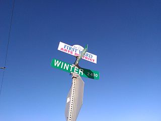
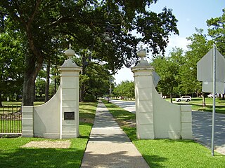
The First Ward of Houston, which is located inside the 610 Loop, is one of the city's historic wards. It was originally the center of the business district for the city, and was strategically located at the intersection of Buffalo Bayou and White Oak Bayou, near an area now known as Allen's Landing. It was one of the original four wards in Houston when it was created in 1840. It was defined as all area within the city limits of Houston north of Congress Street and west of Main Street.

Houston, the most populous city in the Southern United States, is located along the upper Texas Gulf Coast, approximately 50 miles (80 km) northwest of the Gulf of Mexico at Galveston. The city, which is the ninth-largest in the United States by area, covers 601.7 square miles (1,558 km2), of which 579.4 square miles (1,501 km2), or 96.3%, is land and 22.3 square miles (58 km2), or 3.7%, is water.

White Oak Bayou is a slow-moving river in Houston, Texas. A major tributary of the city's principal waterway, Buffalo Bayou, White Oak originates near the intersection of Texas State Highway 6 and U.S. Highway 290 and meanders southeast for 25 miles (40 km) until it joins Buffalo Bayou in Downtown. The river serves as a greenway which connects Downtown to the Houston Heights, Oak Forest, Garden Oaks, and Inwood Forest.

The San Jacinto Battleground State Historic Site includes the location of the Battle of San Jacinto and the museum ship USS Texas. It is located off the Houston Ship Channel in unincorporated Harris County, Texas near the city of Houston. The site was designated a National Historic Landmark in 1960.

Armand Bayou Nature Center is an urban preserve located in Pasadena and southeast Houston between the Johnson Space Center and the Bayport Industrial District. The 2,500-acre (10 km2) nature center is the largest urban wilderness preserve in the United States.
Vince Bayou, also known as Vince's Bayou, is a river that rises in southeast Harris County, Texas and runs northwest, through Pasadena and the city of South Houston, for a total of 19 channel miles to its mouth on the Houston Ship Channel.
Main Street Market Square Historic District is a historic district in Houston, Texas that includes the Market Square Park. It includes buildings nearby, as well as the square itself. It was listed on the National Register of Historic Places in 1983.

1879 Houston Waterworks is a building located in Houston, Texas listed on the National Register of Historic Places.

The McKee Street Bridge carries McKee Street across Buffalo Bayou in Houston, Texas. Built in 1932, the three-span reinforced concrete girder bridge connects the Second and Fifth Ward areas, northeast of downtown Houston. The bridge was listed on the National Register of Historic Places on September 3, 2002.

The Almeda Road Bridge over Brays Bayou is a bridge located in Houston, Texas and listed on the National Register of Historic Places. The bridge was designed by J. G. McKenzie and Don Hall Constructors and is one of the last continuous span concrete girder bridges to be designed during the City Beautiful movement.

Brays Bayou is a slow-moving river in Harris County, Texas. A major tributary of Buffalo Bayou, the Brays flows for 31 miles (50 km) from the western edge of the county, south of Barker Reservoir along the border with Fort Bend County, east to its convergence with the Buffalo at Harrisburg. Nearly all of the river is located within the city of Houston; it is a defining geographic feature of many neighborhoods and districts, including Meyerland, Braeswood Place, the Texas Medical Center, and Riverside Terrace.
Birdsall Parmenas Briscoe was an American architect active in Texas, especially in Houston. He was known as "Birdsall Briscoe" or "Birdsall P. Briscoe". Several of his works have been listed on the U.S. National Register of Historic Places for their architecture.
