
Larimer County is a county located in the U.S. state of Colorado. As of the 2020 census, the population was 359,066. The county seat and most populous city is Fort Collins. The county was named for William Larimer, Jr., the founder of Denver.

Jackson County is a county located in the U.S. state of Colorado. As of the 2020 census, the population was 1,379, and it was the fourth least populated in the state. The county is named after the United States President Andrew Jackson. The county seat and only municipality in the county is Walden.

Laporte is an unincorporated town, a post office, and a census-designated place (CDP) located in and governed by Larimer County, Colorado, United States. The CDP is a part of the Fort Collins, CO Metropolitan Statistical Area. The Laporte post office has the ZIP Code 80535. At the United States Census 2020, the population of the Laporte CDP was 2,409.

The Cache la Poudre River, also known as the Poudre River, is a river in the state of Colorado in the United States.

Buckeye is a farming and ranching unincorporated community in north central Larimer County, Colorado, United States. Bounded on the west by the 16,500-acre (67 km2) Roberts Ranch, the area includes Red Mountain Open Space to the north, Rawhide flats to the east, and extends south to Owl Canyon.

Cameron Pass is a mountain pass in north-central Colorado in the Rocky Mountains of the western United States. The pass is a gap between the south end of the Medicine Bow Mountains and the north end of the Never Summer Mountains. It sits on the border between Jackson County and Larimer County, approximately 3 mi north of the boundary of Rocky Mountain National Park. The pass provides the most convenient route between Fort Collins and Walden in North Park, using State Highway 14.

State Highway 14 in the U.S. state of Colorado is an east–west state highway approximately 237 miles (381 km) long, making it the longest state highway in Colorado. It traverses four counties along the northern edge of the state, spanning a geography from the continental divide in the Rocky Mountains to the Great Plains, and including North Park, the Poudre Canyon, and the Pawnee National Grassland. It provides the most direct route from Fort Collins westward via Cameron Pass to Walden and Steamboat Springs, and eastward across the plains to Sterling.
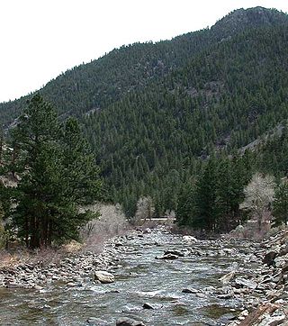
The Poudre Canyon is a narrow verdant canyon, approximately 40 miles (64 km) long, on the upper Cache la Poudre River in Larimer County, Colorado in the United States. The canyon is a glacier-formed valley through the foothills of the Front Range of the Rocky Mountains northwest of Fort Collins.
Jacob Flowers was an early white 19th century settler in Larimer County, Colorado. He was the founder of the town of Bellvue northwest of Fort Collins.

Kinikinik is a small unincorporated community in western Larimer County, Colorado, in the United States. It is located along State Highway 14 in the upper Poudre Canyon west of Fort Collins on the east side of Cameron Pass. The community consists of a general store and neighboring summer mountain resorts and vacation homes. The activities include fishing in the Cache la Poudre River and hiking in the nearby mountains in the Roosevelt National Forest. The community was named for the kinnikinick plant by early settlers.

The North Fork Cache la Poudre River is a tributary of the Cache la Poudre River, approximately 59.2 miles (95.3 km) long, in north central Colorado in the United States. It drains a mountainous area of north central Larimer County northwest of Fort Collins on the western side of the Laramie Foothills.

The Roosevelt National Forest is a National Forest located in north central Colorado. It is contiguous with the Colorado State Forest as well as the Arapaho National Forest and the Routt National Forest. The forest is administered jointly with the Arapaho National Forest and the Pawnee National Grassland from offices in Fort Collins, and is denoted by the United States Forest Service as ARP.

The Cache la Poudre Wilderness is federally-protected area administered by the U.S. Forest Service, a division of the U.S. Department of Agriculture. It is located on the Canyon Lakes Ranger District on the Roosevelt National Forest in Colorado. This wilderness covers 9,258 acres (37.47 km2) and is characterized by steep, rugged terrain along the Cache la Poudre River. Elevations in this area varies from 6,200 feet (1,900 m) to 8,600 feet (2,600 m). Only one trail, the Mount McConnel National Recreation Trail that is 3 miles (4.8 km) long, exists in this wilderness, and 9 miles (14 km) of the Little South Fork of the Cache La Poudre River flow through the wilderness.

The Grand Ditch, also known as the Grand River Ditch and originally known as the North Grand River Ditch, is a water diversion project in the Never Summer Mountains, in northern Colorado in the United States. It is 14.3 miles (23.0 km) long, 20 feet (6.1 m) wide, and 3 feet (0.91 m) deep on average. Streams and creeks that flow from the highest peaks of the Never Summer Mountains are diverted into the ditch, which flows over the Continental Divide at La Poudre Pass at 10,175 feet (3,101 m), delivering the water into Long Draw Reservoir and the Cache La Poudre River for eastern plains farmers. The water would otherwise have gone into the Colorado River that flows west towards the Pacific; instead, the Cache La Poudre River goes East and through the Mississippi River discharges into the Gulf of Mexico.
The Cache La Poudre River Corridor National Heritage Area extends along the flood plain of the Cache La Poudre River in Colorado, US. It is a federally designated National Heritage Area, extending for 45 miles (72 km) from Larimer County in the west where the river emerges from the Rocky Mountains, and ends near Greeley, Colorado, just before its confluence with the South Platte River. The designation provides a framework for the promotion and interpretation of the area's cultural and historic character, and the preservation of the natural and built environment, and is administered by the Poudre Heritage Alliance.
Mount McConnel is a mountain summit in the Mummy Range of the Rocky Mountains of North America. The 8,012-foot (2,442 m) peak is located in the Cache La Poudre Wilderness of Roosevelt National Forest, 22.7 miles (36.5 km) west-northwest of the City of Fort Collins in Larimer County, Colorado, United States. The summit can be reached via the Mount McConnel National Recreation Trail.

The Cameron Peak fire was a wildfire that started near Chambers Lake, Colorado, 25 miles (40 km) east of Walden and 15 miles (24 km) southwest of Red Feather Lakes near Cameron Pass on August 13, 2020, and was declared 100% contained on December 2, 2020. The fire burnt 208,663 acres through the Arapaho and Roosevelt National Forests in Larimer and Jackson Counties and Rocky Mountain National Park. At its peak, the fire forced the evacuation of over 6,000 residents in Estes Park, Chambers Lake, Rustic, Glacier View Meadows, Red Feather Lakes, Masonville, Glen Haven, Spring Canyon, various small communities along Highway 14, Stove Prairie Landing Road, as well as the Colorado State University Mountain Campus and had over 1,000 personnel fighting the fire. 469 structures were destroyed by the fire, including 220 outbuildings and 42 primary residences. The fire became the largest wildfire in Colorado history, surpassing the Pine Gulch Fire, which had set the same mark just seven weeks prior.
The Cache la Poudre-North Park Scenic Byway is a 101-mile (163 km) National Forest Scenic Byway and Colorado Scenic and Historic Byway located in Jackson and Larimer counties, Colorado, US.

