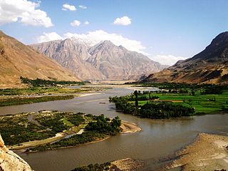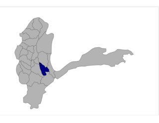
Takhar is one of the thirty-four provinces of Afghanistan, located in the northeast of the country next to Tajikistan. It is surrounded by Badakhshan in the east, Panjshir in the south, and Baghlan and Kunduz in the west. The city of Taloqan serves as its capital. The province contains 17 districts, over 1,000 villages, and approximately 1,113,173 people, which is multi-ethnic and mostly a rural society.

Badakhshan Province is one of the 34 provinces of Afghanistan, located in the northeastern part of the country. It is bordered by Tajikistan's Gorno-Badakhshan in the north and the Pakistani regions of Lower and Upper Chitral and Gilgit-Baltistan in the southeast. It also has a 91-kilometer (57-mile) border with China in the east.

The districts of Afghanistan, known as wuleswali, are secondary-level administrative units, one level below provinces. The Afghan government issued its first district map in 1973. It recognized 325 districts, counting wuleswalis (districts), alaqadaries (sub-districts), and markaz-e-wulaiyat. In the ensuing years, additional districts have been added through splits, and some eliminated through merges. In June 2005, the Afghan government issued a map of 398 districts. It was widely adopted by many information management systems, though usually with the addition of Sharak-e-Hayratan for 399 districts in total. It remains the de facto standard as of late 2018, despite a string of government announcements of the creation of new districts.

Shuhada is one of the 29 districts of Badakhshan province in eastern Afghanistan. The district was formed in 2005 from part of Baharak District and is home to approximately 38,387 residents.

Shighnan, also Shignan, Shugnan, Shughnan, and Khughnan, is an historic region whose name today may also refer to a town and a district in Badakhshan Province in the mountainous northeast of Afghanistan and also a district in Gorno-Badakhshan Autonomous Province in Tajikistan. The administrative center of the Shighnan District of Afghanistan is called Qaleh Barpanjeh. The administrative center of the Shughnon District of Tajikistan is called Khorogh.

Wurduj is one of the 28 districts of Badakhshan province in eastern Afghanistan. It was created in 2005 from part of Baharak District and is home to approximately 24,285 residents. Total area of the district is 929 square kilometers. 45 villages are located within its borders. Ethnic composition: 90% Tajik and 10% Uzbek.

Yamgan is one of the 29 districts of Badakhshan Province in eastern Afghanistan. It was created in 2005 from part of the Baharak District and is home to approximately 20,000 residents, mostly Ismailis.

Baharak district is a district of Badakhshan province, Afghanistan, located about 30 km southeast of the provincial capital Fayzabad. The capital is the city of Baharak. The district is also called Baharistan.

Kishim District is one of the 29 districts of Badakhshan province in eastern Afghanistan.The district capital is Mashhad. The district is located in the Keshem Valley, a primarily rural area on the western edge of the province, and is home to approximately 89,833 residents, making it the second most populous district of the province.
Fayzabad Airport is located about 3.5 miles (5.6 km) northwest of Fayzabad, the capital of Badakhshan Province in Afghanistan. It is a domestic airport under the country's Ministry of Transport and Civil Aviation (MoTCA), and serves the population of Badakhshan Province. Security in and around the airport is provided by the Afghan National Security Forces.
Bashanabad is a village in Wurduj District, Badakhshan Province in north-eastern Afghanistan.
Darayem is a village in Badakhshan Province in north-eastern Afghanistan.

Ishkashim is a border town in Badakhshan province of Afghanistan, which has a population of around 12,120 people. The town serves as the capital of Ishkashim district. Another town by the same name is located on the other side of the Panj river in the Gorno-Badakhshan region of Tajikistan, although that town is normally transliterated Ishkoshim following Tajik practice. A bridge linking the two towns was reconstructed in 2006.
Kheyrabad is a village in Baharak District, Badakhshan Province in north-eastern Afghanistan.

Sarhad, also known as Sarhad-e Broghil or Sarhad-e Wakhan, is a river valley in the Wakhan District of Badakhshan Province of Afghanistan.

The Kokcha River is located in northeastern Afghanistan. A tributary of the Panj river, it flows through Badakhshan Province in the Hindu Kush. It is named after the Koksha Valley. The city of Feyzabad lies along the Kokcha. Near the village of Artin Jelow there is a bridge over the river.
Anjuman, also written Anjoman, is the name of a village in Badakhshan Province, Afghanistan. It lies within the Anjuman Valley, about 18 miles from the mouth of the valley. Another village, Anjuman-i-Khurd, lies close by. Around the turn of the 21st century, the village had 90 occupied residences, primarily Tajiks. The grazing in the area was good, and the inhabitants were a peaceful lot, and relatively poorly armed.

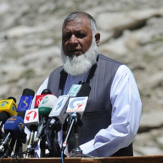
Munshi Abdul Majid is an Afghan politician. He is an ethnic Tajik from Baghlan Province. In the 1990s he served as an official in the Afghan Interior Ministry; he is also known as a writer and orator in Persian and Pashto.

Fayzabad also spelled Feyzabad or Faizabad is a city in northeastern Afghanistan, with a population of around 39,555 people. It is the provincial capital and largest city of Badakhshan province. It is situated in Fayzabad district and is at an altitude of 1,254 m (4,114 ft).

Baharak District is a district of Takhar Province, Afghanistan. The district was split-off from Taluqan District in 2005. Most people work in agriculture. The district has been the site of fighting between the Afghan Government and the Taliban; Baharak was considered to be contested in late 2018 and taken by the Taliban by August 2021.


