
Cape Ray is a headland located at the southwestern extremity of the island of Newfoundland in the Canadian province of Newfoundland and Labrador.

Cape Norman is a barren, limestone headland located at the northernmost point of insular Newfoundland in the Canadian province of Newfoundland and Labrador.

Cape Bauld is a headland located at the northeasternmost point of Great Northern Peninsula on the island of Newfoundland in the Canadian province of Newfoundland and Labrador.
Garnish, a town located on the west coast of the Burin Peninsula, was well known for its lumbering and now for its lobstering operations. Located on Route 213, it is 25 km along route 220 north west of Grand Bank and 18 km along Route 220 east of Marystown. The Way Office was established in 1852 and the first Waymaster was Henry Campe. In 2006 the town had a population of 578.
Reefs Harbour-Shoal Cove West-New Ferolle is a designated place in the Canadian province of Newfoundland and Labrador, located southwest of Anchor Point. The area consists of three unincorporated communities, Reefs Harbour, Shoal Cove and New Ferolle, located on the New Ferolle Peninsula near Port au Choix.
Green Island is a rocky island in the mouth of Fortune Bay, Newfoundland. It is located about 9.5 kilometres (5.9 mi) west of the Burin Peninsula of Newfoundland and 11 kilometres (6.8 mi) east of Langlade Island in Saint-Pierre and Miquelon.
Green Island is located in eastern Newfoundland off the east coast of the Bonavista Peninsula near the entrance to Catalina Harbour. The nearest town is Port Union.

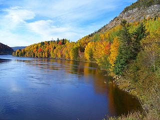
Lark Harbour is small fishing community on the western coast of Newfoundland, on the south side of the Bay of Islands, and west of the City of Corner Brook.

Fort Amherst is a neighbourhood in St. John's, Newfoundland and Labrador. It is located at 47°33′48.96″N52°40′49.60″W, on the southern side of the Narrows, the entrance to St. John's harbour. Apart from some family dwellings, Fort Amherst consists of a man-made harbour, a lighthouse and the remains of gun emplacements and pillboxes built during World War II to defend against German U-boats. Two QF 4.7-inch B Mark IV* guns remain in place, and can still be seen on their mountings.

Cow Head is a town in the Canadian province of Newfoundland and Labrador. The town had a population of 475 in the Canada 2011 Census.

King's Cove is a town in the Canadian province of Newfoundland and Labrador. The town had a population of 90 in the Canada 2016 Census and 111 in the Canada 2011 Census. In 1940 it had a population of 345. In 1956 it was 262. The Post Office was established in 1851. Its founder was James Aylward from Keels, who was born in Ireland in county Cork in 1690. His direct descendants still live in the community.
Westport is a town in the Canadian province of Newfoundland and Labrador. The town had a population of 195 in 2016, down from 220 in the Canada 2011 Census.
The Headland of Cape St. Francis is outer extremity marking the boundary of Conception Bay on the Avalon Peninsula of the island of Newfoundland in the Canadian province of Newfoundland and Labrador.

The headland of Cape St. Mary's is located at the southern tip of the south-western arm of the Avalon Peninsula of the island of Newfoundland in the Canadian province of Newfoundland and Labrador.

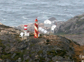
Long Point Lighthouse is an active Canadian lighthouse located outside Crow Head on North Twillingate Island off the northeast coast of Newfoundland. The lighthouse, completed in 1876, attracts thousands of tourists each year and is historic to the town of Twillingate.

Lobster Cove is a fishing village near Rocky Harbour, Newfoundland.

Pushthrough is a settlement in Newfoundland and Labrador.
Fox Point is a settlement in Newfoundland and Labrador.
Flower's Cove is a town in the Canadian province of Newfoundland and Labrador. The town had a population of 270 in the Canada 2006 Census. It is known for its thrombolite fossils.
Division No. 1, Subdivision B is an unorganized subdivision on the Avalon Peninsula in Newfoundland and Labrador, Canada. It is in Division 1 and contains the unorganized communities of Iona, Little Barasway, Placentia Junction, Point Verde and Ship Harbour.


