Beaubassin East, New Brunswick

Last updated

Beaubassin East
Beaubassin-est
Grand-BarachoisPO.jpg
Beaubassin East (Grand Barachois) post office
Canada location map 2.svg
Red pog.svg
Beaubassin East
Location of Beaubassin East in Canada
Canada New Brunswick location map 2.svg
Red pog.svg
Beaubassin East
Beaubassin East (New Brunswick)
Coordinates: 46°10′21.2″N64°18′43.8″W / 46.172556°N 64.312167°W / 46.172556; -64.312167
CountryCanada
Province New Brunswick
County Westmorland County
Town Cap-Acadie
Incorporated8 May 1995
Amalgamated1 January 2023
Area
  Land291.02 km2 (112.36 sq mi)
Population
 (2021) [1]
  Total6,718
  Density23.1/km2 (60/sq mi)
  Change
2016-2021
Increase2.svg 5.4%
Time zone UTC-4 (AST)
  Summer (DST) UTC-3 (ADT)

Beaubassin East was an incorporated rural community in Westmorland County, New Brunswick, Canada. It held rural community status prior to 2023 and is now part of the town of Cap-Acadie.

Contents

History

The rural community was incorporated on May 8, 1995 [3] from the Local Service Districts of Boudreau West, Grand Barachois, Haute-Aboujagane, and Saint-André & LeBlanc Office, and portions of the parishes of Botsford, Sackville, and Shediac. It completely surrounded the village of Cap-Pelé.

Beaubassin East was divided into six wards, [4] numbered counterclockwise from its eastern boundary.

  1. Ward 1 included Bas-Cap-Pelé, Petit-Cap, Portage, and Shemogue
  2. Ward 2 included Saint-André-LeBlanc
  3. Ward 3 included Grand-Barachois
  4. Ward 4 included Boudreau-Ouest
  5. Ward 5 included Haute-Aboujagane
  6. Ward 6 included Cormier-Village

In 2006, Trois-Ruisseaux became part of Beaubassin East. [5]

On 1 January 2023, Beaubassin East amalgamated with Cap-Pelé to form the new town of Cap-Acadie. [6] The constituent communities' names remain in official use. [7]

Demographics

In the 2021 Census of Population conducted by Statistics Canada, Beaubassin East had a population of 6,718 living in 2,855 of its 3,368 total private dwellings, a change of 5.4% from its 2016 population of 6,376. With a land area of 291.02 km2 (112.36 sq mi), it had a population density of 23.1/km2 (59.8/sq mi) in 2021. [8]

Canada census – Beaubassin East / Beaubassin-est community profile
2021 2016 2011
Population6,718 (+5.4% from 2016)6,376 (+2.8% from 2011)6,200 (-3.6% from 2006)
Land area291.02 km2 (112.36 sq mi)291.08 km2 (112.39 sq mi)291.12 km2 (112.40 sq mi)
Population density23.1/km2 (60/sq mi)21.9/km2 (57/sq mi)21.3/km2 (55/sq mi)
Median age50.8 (M: 50.8, F: 50.8)49.6 (M: 49.9, F: 49.4)
Private dwellings3,368 (total)  2,855 (occupied)3,388 (total) 3,296 (total) 
Median household income$82,000$68,894
References: 2021 [9] 2016 [10] 2011 [11] earlier [12] [13]
Canada 2016 CensusPopulation % of Total Population
Visible minority group
Source: [14]
South Asian 0
Chinese 10
Black 0
Filipino 40
Latin American 25
Arab 10
Southeast Asian 10
West Asian 0
Korean 0
Japanese 0
Other visible minority10
Mixed visible minority15
Total visible minority population115
Aboriginal group
Source: [15]
First Nations 55
Métis 40
Inuit 10
Other Aboriginal10
Total Aboriginal population115
European 6,260
Total population6,376100%

Notable people

See also

Related Research Articles

<span class="mw-page-title-main">Dieppe, New Brunswick</span> City in New Brunswick, Canada

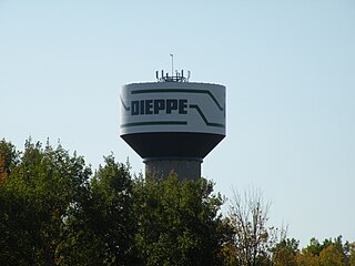
Dieppe is a city in the Canadian maritime province of New Brunswick. Statistics Canada counted the population at 28,114 in 2021, making it the fourth-largest city in the province. On 1 January 2023, Dieppe annexed parts of two neighbouring local service districts; revised census figures have not been released.

<span class="mw-page-title-main">Westmorland County, New Brunswick</span> County in New Brunswick, Canada

Westmorland County is a county in New Brunswick, a province of Canada. It is in the south-eastern part of the province. It contains the fast-growing commercial centre of Moncton and its northern and eastern suburbs. Also located in the county are the university town of Sackville and the local tourist destination of Shediac.

<span class="mw-page-title-main">Memramcook</span> Village in New Brunswick, Canada

Memramcook, sometimes also spelled Memramcouke or Memramkouke, is a village in Westmorland County, New Brunswick, Canada. Located in south-eastern New Brunswick, the community is predominantly people of Acadian descent who speak the Chiac derivative of the French language. An agricultural village, it has a strong local patrimony, key to the history of the region. It was home to Mi'kmaqs for many years and was the arrival site of Acadians in 1700. A large part of these Acadians were deported in 1755, but the village itself survived.

The Acadian World Congress, or Le Congrès Mondial Acadien, is a festival of Acadian and Cajun culture and history, held every five years. It is also informally known as the Acadian Reunion. Its creator was André Boudreau (1945-2005).

<span class="mw-page-title-main">Shediac-Beaubassin-Cap-Pelé</span> Provincial electoral district in New Brunswick, Canada

Shediac-Beaubassin-Cap-Pelé is a provincial electoral district for the Legislative Assembly of New Brunswick, Canada. It was created in 1973 as Shediac. Though it has had few geographic changes over the years, it has twice been renamed to more inclusively reflect the communities within its boundaries, first to Shediac-Cap-Pelé in 1994 and then to Shediac-Beaubassin-Cap-Pelé in 2013.

<span class="mw-page-title-main">Dundas Parish, New Brunswick</span> Parish in Canada

Dundas is a civil parish in Kent County, New Brunswick, Canada.

Cap-Pelé is a former village in Westmorland County, New Brunswick, Canada. It held village status prior to 2023 and is now part of the town of Cap-Acadie.

Victor E. Boudreau is a New Brunswick politician. He was a member of the Legislative Assembly of New Brunswick from 2014 to 2018, representing the ridings of Shediac-Cap-Pelé and Shediac-Beaubassin-Cap-Pelé for the New Brunswick Liberal Association, and was the Leader of the Opposition in the legislature.

<span class="mw-page-title-main">Rogersville, New Brunswick</span> Place in New Brunswick, Canada

Rogersville is a former village in Northumberland County, New Brunswick, built around the Intersection of New Brunswick Route 126 and New Brunswick Route 440. It was an incorporated village until the end of 2022 and is now part of the village of Nouvelle-Arcadie.

<span class="mw-page-title-main">Acadieville Parish, New Brunswick</span> Parish in New Brunswick, Canada

Acadieville is a civil parish in Kent County, New Brunswick, Canada.

<span class="mw-page-title-main">Sackville Parish, New Brunswick</span> Parish in New Brunswick, Canada

Sackville is a civil parish in Westmorland County, New Brunswick, Canada.

Greater Shediac is the name given to the area encompassing the Town of Shediac in New Brunswick, Canada and its surroundings. Most of this area is a tourist area along the Northumberland Strait mainly on portions of Route 134, Route 133 and Route 950. Some of the areas mentioned below are included in the area of Greater Moncton.

Route 133 is a mostly east/west provincial highway in the Canadian province of New Brunswick.

<span class="mw-page-title-main">Shediac Parish, New Brunswick</span> Parish in New Brunswick, Canada

Shediac is a civil parish in Westmorland County, New Brunswick, Canada.

<span class="mw-page-title-main">Botsford Parish, New Brunswick</span> Parish in New Brunswick, Canada

Botsford is a civil parish in Westmorland County, New Brunswick, Canada.

<span class="mw-page-title-main">Dorchester Parish, New Brunswick</span> Parish in New Brunswick, Canada

Dorchester is a civil parish in Westmorland County, New Brunswick, Canada.

Jacques Joseph LeBlanc is a Canadian politician, who was elected to the Legislative Assembly of New Brunswick in the 2018 election. He represents the electoral district of Shediac-Beaubassin-Cap-Pelé as a member of the Liberal Party.

<span class="mw-page-title-main">Cap-Acadie</span> Town in New Brunswick, Canada

Cap-Acadie is a town in the Canadian province of New Brunswick. It was formed through the 2023 New Brunswick local governance reforms.

References

  1. 1 2 "Census Profile, 2021 Census: Beaubassin East". Statistics Canada. Retrieved February 9, 2022.
  2. "Census Profile, 2016 Census: Beaubassin East". Statistics Canada. Retrieved August 10, 2019.
  3. "Rural Community of Beaubassin East Regulation - Municipalities Act". Archived from the original on March 6, 2005. Retrieved 2011-11-09.
  4. "Beaubassin Wards Map" (PDF). Retrieved November 9, 2011.
  5. Government of Canada, 2006 Amalgamation.
  6. "Local Governments Establishment Regulation – Local Governance Act". Government of New Brunswick. 12 October 2022. Retrieved 11 January 2023.
  7. "Proposed entity names reflect strong ties to nature and history" (Press release). Irishtown, New Brunswick: Government of New Brunswick. 25 May 2022. Retrieved 20 January 2023.
  8. "Population and dwelling counts: Canada, provinces and territories, census divisions and census subdivisions (municipalities), New Brunswick". Statistics Canada. February 9, 2022. Retrieved February 21, 2022.
  9. "2021 Community Profiles". 2021 Canadian Census . Statistics Canada. February 4, 2022. Retrieved 2023-10-19.
  10. "2016 Community Profiles". 2016 Canadian Census . Statistics Canada. August 12, 2021. Retrieved 2019-08-10.
  11. "2011 Community Profiles". 2011 Canadian Census . Statistics Canada. March 21, 2019.
  12. "2006 Community Profiles". 2006 Canadian Census . Statistics Canada. August 20, 2019.
  13. "2001 Community Profiles". 2001 Canadian Census . Statistics Canada. July 18, 2021.
  14. "Census Profile, 2016 Census Beaubassin East (Topic: Visible Minority)". 2016 Census. Statistics Canada. Retrieved August 10, 2019.
  15. "Census Profile, 2016 Census Beaubassin East (Topic: Aboriginal Peoples)". 2016 Census. Statistics Canada. Retrieved August 10, 2019.