Moncton Parish, New Brunswick

Last updated

Moncton
Westmorland County NB - Moncton Parish.png
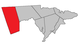
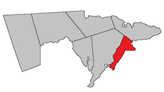
Location within Westmorland County, New Brunswick.
Coordinates: 46°46′32″N65°28′48″W / 46.775555°N 65.48°W / 46.775555; -65.48
Country Flag of Canada (Pantone).svg  Canada
Province Flag of New Brunswick.svg  New Brunswick
County Westmorland County
Erected1786
Area
[1]
  Land564.16 km2 (217.82 sq mi)
Population
 (2021) [1]
  Total10,704
  Density19.0/km2 (49/sq mi)
  Change 2016-2021
Increase2.svg 9.1%
  Dwellings
4,291
Time zone UTC-4 (AST)
  Summer (DST) UTC-3 (ADT)
Figures do not include portions within the city of Dieppe, the city of Moncton, and the village of Salisbury

Moncton is a geographic parish in Westmorland County, New Brunswick, Canada. [4]

Contents

For governance purposes it is divided between the cities of Dieppe and Moncton; the town of Salisbury; the incorporated rural communities of Beausoleil and Maple Hills; [5] the Metepenagiag 3 Urban Reserve, Metepenagiag 8 Urban Reserve, and Soegao 35 Indian reserves; and the Southeast rural district. [6] The municipalities and the rural district are all members of the Southeast Regional Service Commission. [7]

Prior to the 2023 governance reform, the local service district of the parish of Moncton, which included the special service areas of Calhoun Road, Greater Lakeburn, Irishtown, and Painsec Junction, included all of the parish outside Dieppe, Moncton, and Salisbury, and post-reform parts of Dieppe and Moncton. [8]

Origin of name

The parish was named in honour of Robert Monckton, [9] the British commander who captured Fort Beauséjour and oversaw the Expulsion of the Acadians.

History

Moncton was established in 1765 as Monckton Township in the province of Nova Scotia. [10] The boundaries of the township were similar but not identical to the modern parish.

In 1786 Moncton Parish was erected as one of the province's original parishes, [11] using the same boundaries as Monckton Township. The northeastern corner of the parish extended past the northern line of Westmorland County. [12]

In 1835 all of Dorchester Parish north of the mouth of Fox Creek was transferred to Moncton. [13]

In 1850 the western boundary was changed to match the prolongation of the eastern line of a block grant to Martin Gay and associates straddling the Petitcodiac River, adding part of Salisbury Parish. [14]

In 1894 the boundary with Dorchester Parish was redefined to run along a magnetic bearing. [15] The boundaries of the parish were made retroactive to its erection.

Boundaries

Moncton Parish is bounded: [2] [16] [17] [18]

Communities

Communities at least partly within the parish; [16] [17] [18] bold indicates an incorporated municipality or Indian reserve; italics indicate a name no longer in official use

Bodies of water

Bodies of water [lower-alpha 2] at least partly in the parish: [16] [17] [18]

Other notable places

Parks, historic sites, and other noteworthy places in the parish. [16] [17] [18]

Demographics

Parish population total does not include city of Moncton, Soegao 35 Indian reserve, and portions in Dieppe and Salisbury

Access routes

Highways and numbered routes that run through the parish, including external routes that start or finish at the parish limits: [27]

See also

Notes

  1. By the magnet of 1894, [19] when declination in the area was between 21º and 22º west of north. [20] The Territorial Division Act clause referring to magnetic direction bearings was omitted in the 1952 [21] and 1973 Revised Statutes. [2]
  2. Not including brooks, ponds or coves.

Related Research Articles

<span class="mw-page-title-main">Dieppe, New Brunswick</span> City in New Brunswick, Canada

Dieppe is a city in the Canadian maritime province of New Brunswick. Statistics Canada counted the population at 28,114 in 2021, making it the fourth-largest city in the province. On 1 January 2023, Dieppe annexed parts of two neighbouring local service districts; revised census figures have not been released.

<span class="mw-page-title-main">Coverdale Parish, New Brunswick</span> Parish in New Brunswick, Canada

Coverdale is a geographic parish in Albert County, New Brunswick, Canada, located along the Petitcodiac River opposite Moncton and Dieppe.

<span class="mw-page-title-main">Sackville Parish, New Brunswick</span> Parish in New Brunswick, Canada

Sackville is a geographic parish in Westmorland County, New Brunswick, Canada.

<span class="mw-page-title-main">Glenelg Parish, New Brunswick</span> Parish in New Brunswick, Canada

Glenelg is a geographic parish in Northumberland County, New Brunswick, Canada.

<span class="mw-page-title-main">Weldford Parish, New Brunswick</span> Parish in New Brunswick, Canada

Weldford is a geographic parish in Kent County, New Brunswick, Canada.

<span class="mw-page-title-main">Harcourt Parish, New Brunswick</span> Parish in New Brunswick, Canada

Harcourt is a geographic parish in Kent County, New Brunswick, Canada.

<span class="mw-page-title-main">Prince William Parish, New Brunswick</span> Parish in New Brunswick, Canada

Prince William is a geographic parish in York County, New Brunswick, Canada.

<span class="mw-page-title-main">Hillsborough Parish, New Brunswick</span> Parish in New Brunswick, Canada

Hillsborough is a geographic parish in eastern Albert County, New Brunswick, Canada.

<span class="mw-page-title-main">Elgin Parish, New Brunswick</span> Parish in New Brunswick, Canada

Elgin is a geographic parish in the interior of Albert County, New Brunswick, Canada, the only one of the county's parishes that does not border either the Bay of Fundy or the Petitcodiac River.

<span class="mw-page-title-main">Hopewell Parish, New Brunswick</span> Parish in New Brunswick, Canada

Hopewell is a geographic parish in eastern Albert County, New Brunswick, Canada.

<span class="mw-page-title-main">Harvey Parish, New Brunswick</span> Parish in New Brunswick, Canada

Harvey is a geographic parish in southern Albert County, New Brunswick, Canada.

<span class="mw-page-title-main">Alma Parish, New Brunswick</span> Parish in New Brunswick, Canada

Alma is a geographic parish on the Bay of Fundy in the southwestern corner of Albert County, New Brunswick, Canada.

<span class="mw-page-title-main">Salisbury Parish, New Brunswick</span> Parish in New Brunswick, Canada

Salisbury is a geographic parish in Westmorland County, New Brunswick, Canada.

<span class="mw-page-title-main">Shediac Parish, New Brunswick</span> Parish in New Brunswick, Canada

Shediac is a geographic parish in Westmorland County, New Brunswick, Canada.

<span class="mw-page-title-main">Botsford Parish, New Brunswick</span> Parish in New Brunswick, Canada

Botsford is a geographic parish in Westmorland County, New Brunswick, Canada.

<span class="mw-page-title-main">Westmorland Parish, New Brunswick</span> Parish in New Brunswick, Canada

Westmorland is a geographic parish in Westmorland County, New Brunswick, Canada.

<span class="mw-page-title-main">Dorchester Parish, New Brunswick</span> Parish in New Brunswick, Canada

Dorchester is a geographic parish in Westmorland County, New Brunswick, Canada.

<span class="mw-page-title-main">Havelock Parish, New Brunswick</span> Parish in New Brunswick, Canada

Havelock is a geographic parish in Kings County, New Brunswick, Canada.

<span class="mw-page-title-main">Sussex Parish, New Brunswick</span> Parish in New Brunswick, Canada

Sussex is a geographic parish in Kings County, New Brunswick, Canada.

Greater Lakeburn was an area with enhanced services within the Canadian local service district of the parish of Moncton in Westmorland County, New Brunswick; it was sometimes erroneously cited as an LSD in its own right. It was situated in Southeastern New Brunswick, to the east of Dieppe. This District contained the southern part of the community of Painsec and Melanson Settlement as well as a mostly treed area. Greater Lakeburn was part of Greater Moncton.

References

  1. 1 2 "Census Profile". Statistics Canada. 26 October 2022. Retrieved 29 October 2022.
  2. 1 2 3 "Chapter T-3 Territorial Division Act". Government of New Brunswick. Retrieved 26 March 2023.
  3. "Chapter I-13 Interpretation Act". Government of New Brunswick. Retrieved 26 March 2023.
  4. The Territorial Division Act [2] divides the province into 152 parishes, the cities of Saint John and Fredericton, and one town of Grand Falls. The Interpretation Act [3] clarifies that parishes include any local government within their borders.
  5. "Southeast Regional Service Commission: RSC 7". Government of New Brunswick. Retrieved 26 March 2023.
  6. "Southeast Regional Service Commission: RD 7". Government of New Brunswick. Retrieved 26 March 2023.
  7. "Regions Regulation – Regional Service Delivery Act". Government of New Brunswick. 21 July 2022. Retrieved 26 March 2023.
  8. "Local Service Districts Regulation - Municipalities Act". Government of New Brunswick. 25 June 2021. Retrieved 26 March 2023.
  9. Ganong, William F. (1896). A Monograph of the Place-Nomenclature of the Province of New Brunswick. Royal Society of Canada. p. 254. Retrieved 17 March 2021.
  10. Ganong, William F. (1899). A Monograph of Historic Sites in the Province of New Brunswick. Royal Society of Canada. p. 335. Retrieved 27 March 2021.
  11. "26 Geo. III Chapter I. An Act for the better ascertaining and confirming the Boundaries of the several Counties within this Province, and for subdividing them into Towns or Parishes.". Acts of the General Assembly of His Majesty's Province of New-Brunswick, passed in the year 1786. Saint John, New Brunswick: Government of New Brunswick. 1786. pp. 3–12. Retrieved 20 March 2021.
  12. Ganong, William F. (1901). A Monograph of the Evolution of the Boundaries of the Province of New Brunswick. Royal Society of Canada. p. Map No. 35. Retrieved 27 March 2021.
  13. "5 Wm. IV c. 15 An Act to alter the boundary line between certain Parishes in the County of Westmorland.". Acts of the General Assembly of His Majesty's Province of New-Brunswick, Passed in the Year 1835. Fredericton: Government of New Brunswick. 1835. p. 27. Retrieved 27 March 2021.
  14. "13 Vic. c. 51 An Act to consolidate all the Laws now in force for the division of the Province into Counties, Towns and Parishes.". Acts of the General Assembly of Her Mjaesty's Province of New Brunswick, Passed in the Year 1850. Fredericton: Government of New Brunswick. 1850. pp. 142–152, 145–149. Retrieved 27 March 2021. Book was poorly proofread, resulting in title typo and reuse of page numbers 145–152.
  15. "57 Vic. c. 36 An Act to amend Chapter 2 of the Consolidated Statutes, of 'The division of the Province into Counties, Towns and Parishes,' so far as relates to the County of Westmorland.". Acts of the General Assembly of Her Majesty's Province of New Brunswick. Passed in the Month of April, 1894. Fredericton: Government of New Brunswick. 1894. pp. 162–163. Available as a free ebook from Google Books.
  16. 1 2 3 4 "No. 109". Provincial Archives of New Brunswick. Department of Natural Resources and Energy Development. Retrieved 24 June 2021. Remainder of parish on maps 110, 119, and 120 at same site.
  17. 1 2 3 4 "317" (PDF). Transportation and Infrastructure. Government of New Brunswick. Retrieved 24 June 2021. Remainder of parish on mapbooks 318, 319, 336–339, and 357–360 at same site.
  18. 1 2 3 4 "Search the Canadian Geographical Names Database (CGNDB)". Government of Canada. Retrieved 24 June 2021.
  19. "57 Vic. c. 36 An Act to amend Chapter 2 of the Consolidated Statutes, of 'The division of the Province into Counties, Towns and Parishes,' so far as relates to the County of Westmorland.". Acts of the General Assembly of Her Majesty's Province of New Brunswick. Passed in the Month of April, 1894. Fredericton: Government of New Brunswick. 1894. pp. 162–163. Available as a free ebook from Google Books.
  20. "Historical Magnetic Declination". National Oceanic and Atmospheric Administration. Retrieved 2 May 2021.
  21. "Chapter 227 Territorial Division Act". The Revised Statutes of New Brunswick 1952 Volume III. Fredericton: Government of New Brunswick. 1952. pp. 3725–3771.
  22. "New Brunswick Regulation 94-43 under the Fish and Wildlife Act (O.C. 94-231)". Government of New Brunswick. 5 June 2006. Retrieved 8 July 2021.
  23. Statistics Canada: 2001, 2006 census
  24. "2006 Community Profile: Moncton Parish, New Brunswick". Statistics Canada. Retrieved 5 October 2019.
  25. 2011 Statistics Canada Census Profile: Moncton Parish, New Brunswick
  26. 1 2 "Census Profile, 2016 Census: Moncton, Parish [Census subdivision], New Brunswick". Statistics Canada. Retrieved 5 October 2019.
  27. Atlantic Canada Back Road Atlas ISBN   978-1-55368-618-7


46°11′22″N64°55′09″W / 46.189338°N 64.919243°W / 46.189338; -64.919243 (Moncton Parish, New Brunswick)