Black Giant is a 13,330-foot-elevation (4,060-meter) mountain summit located west of the crest of the Sierra Nevada mountain range, in Fresno County of central California, United States. Black Giant ranks as the 86th highest summit in California. It is the northernmost and highest summit on its namesake ridge, the Black Divide in northern Kings Canyon National Park. The peak is situated 3.9 miles (6.3 km) east of Mount Goddard, and 2.6 miles (4.2 km) south-southeast of Mount Fiske, which is the nearest higher neighbor. Topographic relief is significant as it rises 4,000 feet above Le Conte Canyon in approximately two miles. Muir Pass is 1.4 miles (2.3 km) to the northwest, and the approach to this remote peak is made via the John Muir Trail.

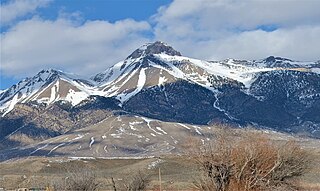
Mount McCaleb is an 11,682-foot elevation (3,561 m) mountain summit located in Custer County, Idaho, United States.

Casa Grande Peak is a 7,325-foot-elevation (2,233-meter) mountain summit in Brewster County, Texas, United States.

Crown Mountain is a 7,155-foot-elevation (2,181-meter) summit in Brewster County, Texas, United States.

Lost Mine Peak is a 7,547-foot-elevation (2,300-meter) summit in Brewster County, Texas, United States.

Mount Huffman is a 6,373-foot-elevation (1,942-meter) summit in Brewster County, Texas, United States.

Vernon Bailey Peak is a 6,672-foot-elevation (2,034-meter) summit in Brewster County, Texas, United States.

Toll Mountain is a 7,409-foot-elevation (2,258-meter) summit in Brewster County, Texas, United States.

Carter Peak is a 5,690-foot-elevation (1,734-meter) summit in Brewster County, Texas, United States.

Townsend Point is a 7,574-foot-elevation (2,309-meter) mountain summit in Brewster County, Texas, United States.

Pummel Peak is a 6,639-foot-elevation (2,024-meter) summit in Brewster County, Texas, United States.

Goat Mountain is a 4,619-foot-elevation (1,408-meter) summit in Brewster County, Texas, United States.

Little Christmas Mountain is a 4,828-foot-elevation (1,472-meter) summit in Brewster County, Texas, United States.

Panther Peak is a 6,418-foot-elevation (1,956-meter) summit in Brewster County, Texas, United States.

Tule Mountain is a 3,825-foot-elevation (1,166-meter) summit in Brewster County, Texas, United States.

Hunter Peak is an 8,376-foot-elevation (2,553-meter) summit in Culberson County, Texas, United States.

Shumard Peak is an 8,636-foot-elevation (2,632-meter) summit in Culberson County, Texas, United States.

Bartlett Peak is an 8,519-foot-elevation (2,597-meter) summit in Culberson County, Texas, United States.

Sierra Blanca is a 6,892-foot-elevation (2,101-meter) summit in Hudspeth County, Texas, United States.

Santiago Peak is a 6,522-foot-elevation (1,988-meter) summit in Brewster County, Texas, United States.


