Bridgetown North, Ohio | |
---|---|
Former CDP | |
Coordinates: 39°9′26″N84°37′51″W / 39.15722°N 84.63083°W | |
Country | United States |
State | Ohio |
County | Hamilton |
Area | |
• Total | 3.4 sq mi (8.7 km2) |
• Land | 3.4 sq mi (8.7 km2) |
• Water | 0.0 sq mi (0.0 km2) |
Population (2000) | |
• Total | 12,569 |
• Density | 3,735.1/sq mi (1,442.1/km2) |
Time zone | UTC-5 (Eastern (EST)) |
• Summer (DST) | UTC-4 (EDT) |
FIPS code | 39-08605 [1] |
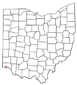
Bridgetown North was a census-designated place (CDP) in Hamilton County, Ohio, United States. The population was 12,569 at the 2000 census. Its name was changed to Bridgetown for the 2010 census, as its area expanded to the south.
Bridgetown North was located at 39°9′26″N84°37′51″W / 39.15722°N 84.63083°W (39.157209, -84.630697). [2]
According to the United States Census Bureau, the CDP had a total area of 3.4 square miles (8.8 km2), all of it land.
Census | Pop. | Note | %± |
---|---|---|---|
1970 | 13,362 | — | |
1980 | 11,460 | −14.2% | |
1990 | 11,748 | 2.5% | |
2000 | 12,569 | 7.0% | |
source: [3] |
As of the census [1] of 2000, there were 12,569 people, 5,079 households, and 3,509 families residing in the CDP. The population density was 3,735.1 inhabitants per square mile (1,442.1/km2). There were 5,240 housing units at an average density of 1,557.1 per square mile (601.2/km2). The racial makeup of the CDP was 98.40% White, 0.36% African American, 0.06% Native American, 0.53% Asian, 0.02% Pacific Islander, 0.12% from other races, and 0.52% from two or more races. Hispanic or Latino of any race were 0.50% of the population.
There were 5,079 households, out of which 31.0% had children under the age of 18 living with them, 55.8% were married couples living together, 10.4% had a female householder with no husband present, and 30.9% were non-families. 28.5% of all households were made up of individuals, and 16.7% had someone living alone who was 65 years of age or older. The average household size was 2.47 and the average family size was 3.06.
In the CDP, the population was spread out, with 25.5% under the age of 18, 6.7% from 18 to 24, 27.6% from 25 to 44, 19.6% from 45 to 64, and 20.6% who were 65 years of age or older. The median age was 39 years. For every 100 females, there were 89.0 males. For every 100 females age 18 and over, there were 83.7 males.
The median income for a household in the CDP was $45,771, and the median income for a family was $55,084. Males had a median income of $40,331 versus $28,490 for females. The per capita income for the CDP was $22,137. About 2.2% of families and 3.3% of the population were below the poverty line, including 4.7% of those under age 18 and 3.8% of those age 65 or over.
Vero Beach South is a census-designated place (CDP) in Indian River County, Florida, United States. The population was 23,092 at the 2010 census. It is part of the Sebastian–Vero Beach Metropolitan Statistical Area.
Sorrento is an unincorporated community and census-designated place in Lake County, Florida, United States. The population was 861 at the 2010 census, up from 765 at the 2000 census. It is part of the Orlando–Kissimmee Metropolitan Statistical Area.
Rossville is an unincorporated community and census-designated place in Baltimore County, Maryland, United States. The population was 15,147 at the 2010 census.
East Dennis is a census-designated place (CDP) in the town of Dennis in Barnstable County, Massachusetts, United States. The population was 2,753 at the 2010 census.
Holiday City South is an unincorporated community and census-designated place (CDP) located within Berkeley Township, in Ocean County, New Jersey, United States. As of the 2010 United States Census, the CDP's population was 3,689.
Brimhall Nizhoni is a census-designated place (CDP) in McKinley County, New Mexico, United States. The population was 199 at the 2010 census. The Navajo Coyote Canyon Chapter House is located in Brimhall.
White Plains is a census-designated place (CDP) in Surry County, North Carolina, United States. The population was 1,049 at the 2000 census.
Cherry Grove is a census-designated place (CDP) in Anderson Township, Hamilton County, Ohio, United States. The population was 4,419 at the 2020 census.
Dry Run is a census-designated place (CDP) in Hamilton County, Ohio, United States. The population was 7,672 at the 2020 census.
Forestville is a census-designated place (CDP) in Hamilton County, Ohio, United States. The population was 10,615 at the 2020 census.
Fruit Hill is a census-designated place (CDP) in Hamilton County, Ohio, United States. The population was 3,748 at the 2020 census. Fruit Hill is located at 39°4′15″N84°21′53″W. According to the United States Census Bureau, the CDP has a total area of 1.3 square miles (3.3 km2), all land.
Mount Healthy Heights is a census-designated place (CDP) in Hamilton County, Ohio, United States. The population was 2,918 at the 2020 census.
Pleasant Run is a census-designated place (CDP) in Hamilton County, Ohio, United States. The population was 4,861 at the 2020 census.
Turpin Hills is a census-designated place (CDP) outside of Anderson Township, Hamilton County, Ohio, United States. The population was 5,162 at the 2020 census.
Drexel is a census-designated place (CDP) in Jefferson Township, Montgomery County, Ohio, United States. The population was 1,693 at the 2020 census. Informally, the Drexel designation also applies to the neighboring portion of Trotwood.
Woodbourne-Hyde Park is an unincorporated area in Washington Township in Montgomery County, Ohio, United States. A Suburb of Dayton. It was delineated as a census-designated place (CDP) at the 2000 census, at which time its population was 7,910. It was not delineated as a CDP for the 2010 census.
Camden is a village in Preble County, Ohio, United States. The population was 1,989 at the 2020 census.
Guys Mills is a census-designated place in Crawford County, Pennsylvania, United States. The population was 124 at the 2010 census.
Chamberlayne is a census-designated place (CDP) in Henrico County, Virginia, United States. The population was 5,581 at the 2020 census.
Maple Heights-Lake Desire is a census-designated place (CDP) in King County, Washington, United States. At the 2010 census, the population was 3,152.