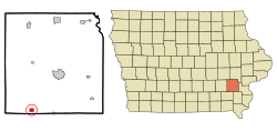
Brighton, Iowa

Last updated

Brighton, Iowa
Brighton iowa.jpg
Motto: 
Home of Lake Darling State Park
Washington County Iowa Incorporated and Unincorporated areas Brighton Highlighted.svg
Location of Brighton, Iowa
Coordinates: 41°10′29″N91°49′16″W / 41.17472°N 91.82111°W / 41.17472; -91.82111
Country Flag of the United States.svg  United States
State Flag of Iowa.svg  Iowa
County Washington
Government
  MayorMelvin Rich
Area
[1]
  Total0.78 sq mi (2.03 km2)
  Land0.78 sq mi (2.03 km2)
  Water0.00 sq mi (0.00 km2)
Elevation
[2]
751 ft (229 m)
Population
 (2020)
  Total600
  Density767.26/sq mi (296.15/km2)
Time zone UTC-6 (Central (CST))
  Summer (DST) UTC-5 (CDT)
ZIP code
52540
Area code 319
FIPS code 19-08470
GNIS feature ID2393419 [2]
Website www.brightoniowa.com

Brighton is a city in Washington County, Iowa, United States. It's part of the Iowa City, Iowa Metropolitan Statistical Area. The population was 600 at the 2020 census. [3]

Contents

History

Brighton was laid out in 1840. [4] During the 1840s and 1850 quickly developed into one of the largest centres of hog production west of the Mississippi. [5] In 1851, David Powers discovered the fossil remains of a Mastodon. The fossil was three and a half feet long, fourteen inches wide at the larger end, and weighed eighty-three pounds. [6] In 1854 Brighton was sorely afflicted by the Cholera. [5]

In 1882, the Iowa Central Railway and the narrow-gauge Burlington and Western Railway battled for right-of-way as they built west from Coppock toward Brighton. At several points, crews for the rival railroads tore up tracks the other had put down. The line through Brighton was originally platted as a street, 3 blocks south of the business district. The B&W reached Brighton in mid 1882 and claimed the entire street as its right-of way. After vandalism, arrests and court battles, the two lines built parallel tracks down the street (with the B&W claiming the center line) to their crossing west of town. This has been described as the Brighton Railroad War. [7] Both lines crossed the Chicago, Rock Island and Pacific Railroad on the east side of town. The Burlington and Western was later widened and taken over by the Chicago, Burlington and Quincy and the Iowa Central was taken over by the Minneapolis and St. Louis. [8] [9]

There were three railroad depots in town. The Burlington and Western (after 1902, the Chicago, Burlington and Quincy) depot was on the east side of town, at the south end of Liberty St. The Iowa Central (after 1901, the Minneapolis and St. Louis) depot was on the west side, between Mechanic St. and Harrison St. The Rock Island depot was several blocks south, also between Mechanic and Harrison. The Rock Island had a stockyard west of its depot, while the Burlington and Western stockyard was east of its depot. [10]

Mainstreet, 1917 FI0013510.jpg
Mainstreet, 1917

Geography

According to the United States Census Bureau, the city has a total area of 0.71 square miles (1.84 km2), all of it land. [11]

Brighton is located where Iowa State Road 78 and Iowa State Road 1 meet and is located near the Skunk River and near Lake Darling State Park.

Demographics

Historical populations
YearPop.±%
1870 785    
1880 836+6.5%
1890 861+3.0%
1900 807−6.3%
1910 776−3.8%
1920 1,014+30.7%
1930 800−21.1%
1940 791−1.1%
1950 705−10.9%
1960 724+2.7%
1970 632−12.7%
1980 804+27.2%
1990 684−14.9%
2000 687+0.4%
2010 652−5.1%
2020 600−8.0%
Source: "U.S. Census website". United States Census Bureau . Retrieved March 29, 2020. and Iowa Data Center
Source:
U.S. Decennial Census [12] [3]
The population of Brighton, Iowa from US census data BrightonIowaPopPlot.png
The population of Brighton, Iowa from US census data

2010 census

As of the census [13] of 2010, there were 652 people, 269 households, and 178 families living in the city. The population density was 918.3 inhabitants per square mile (354.6/km2). There were 295 housing units at an average density of 415.5 per square mile (160.4/km2). The racial makeup of the city was 98.8% White, 0.3% African American, 0.2% Native American, 0.2% Asian, 0.2% Pacific Islander, and 0.5% from two or more races. Hispanic or Latino of any race were 2.8% of the population.

There were 269 households, of which 29.7% had children under the age of 18 living with them, 48.0% were married couples living together, 12.6% had a female householder with no husband present, 5.6% had a male householder with no wife present, and 33.8% were non-families. 27.5% of all households were made up of individuals, and 8.5% had someone living alone who was 65 years of age or older. The average household size was 2.42 and the average family size was 2.87.

The median age in the city was 39.5 years. 23.6% of residents were under the age of 18; 8% were between the ages of 18 and 24; 24.2% were from 25 to 44; 27.3% were from 45 to 64; and 16.9% were 65 years of age or older. The gender makeup of the city was 50.9% male and 49.1% female.

2000 census

As of the census [14] of 2000, there were 687 people, 285 households, and 190 families living in the city. The population density was 955.3 inhabitants per square mile (368.8/km2). There were 302 housing units at an average density of 419.9 per square mile (162.1/km2). The racial makeup of the city was 99.27% White, 0.44% African American and 0.29% Pacific Islander. Hispanic or Latino of any race were 0.29% of the population.

There were 285 households, out of which 29.5% had children under the age of 18 living with them, 51.2% were married couples living together, 8.4% had a female householder with no husband present, and 33.3% were non-families. 28.4% of all households were made up of individuals, and 13.0% had someone living alone who was 65 years of age or older. The average household size was 2.41 and the average family size was 2.92.

In the city, the population was spread out, with 25.6% under the age of 18, 8.2% from 18 to 24, 28.5% from 25 to 44, 24.6% from 45 to 64, and 13.1% who were 65 years of age or older. The median age was 37 years. For every 100 females, there were 98.0 males. For every 100 females age 18 and over, there were 97.3 males.

The median income for a household in the city was $30,139, and the median income for a family was $35,781. Males had a median income of $27,450 versus $20,938 for females. The per capita income for the city was $15,140. About 8.9% of families and 14.1% of the population were below the poverty line, including 12.3% of those under age 18 and 21.8% of those age 65 or over.

Education

The Washington Community School District operates local area schools, including Washington High School. [15]

Notable residents

Related Research Articles

<span class="mw-page-title-main">Corning, Iowa</span> City in Iowa, United States

Corning is a city in Quincy Township, Adams County, Iowa, United States. The population was 1,564 at the 2020 census. It is the county seat of Adams County. Corning is located just north of the intersection of U.S. Route 34 and Iowa Highway 148. Corning is perhaps best known as the birthplace of Johnny Carson. Daniel Webster Turner, who was governor of Iowa from 1931 to 1933, was born in Corning on March 17, 1877.

<span class="mw-page-title-main">Rome, Iowa</span> Village in Iowa, United States

Rome is a village in Henry County, Iowa, United States. The population was 114 at the time of the 2020 census.

<span class="mw-page-title-main">Winfield, Iowa</span> City in Iowa, United States

Winfield is a city in Henry County, Iowa, United States. The population was 1,033 at the time of the 2020 census.

<span class="mw-page-title-main">Packwood, Iowa</span> City in Iowa, United States

Packwood is a city in Jefferson County, Iowa, United States. The population was 183 at the time of the 2020 census. The Burlington and Western Railway arrived in Packwood in late 1882. This was a narrow gauge line, widened to standard gauge in 1902 and taken over by the Chicago, Burlington and Quincy, and then sold to the Minneapolis and St. Louis in 1934.

<span class="mw-page-title-main">Hedrick, Iowa</span> City in Iowa, United States

Hedrick is a city in Keokuk County, Iowa, United States. The population was 728 at the time of the 2020 census.

<span class="mw-page-title-main">Martinsburg, Iowa</span> City in Iowa, United States

Martinsburg is a city in Keokuk County, Iowa, United States. The population was 110 at the time of the 2020 census. The only businesses open to the public in Martinsburg is McBeth Wrecker and Auto Service and a gas station/convenience store.

<span class="mw-page-title-main">Fremont, Iowa</span> City in Iowa, United States

Fremont is a city in Mahaska County, Iowa, United States. The population was 708 at the time of the 2020 census.

<span class="mw-page-title-main">Emerson, Iowa</span> City in Iowa, United States

Emerson is a city in Mills County, Iowa, United States. The population was 403 at the time of the 2020 census.

<span class="mw-page-title-main">Pacific Junction, Iowa</span> City in Iowa, United States

Pacific Junction is a city in Mills County, Iowa, United States. The population was 96 at the time of the 2020 census.

<span class="mw-page-title-main">Red Oak, Iowa</span> City in Iowa, United States

Red Oak is a city in, and the county seat of, Montgomery County, Iowa, United States, located along the East Nishnabotna River. The population was 5,362 in the 2020 census, a decline from the 6,197 population in 2000.

<span class="mw-page-title-main">Braddyville, Iowa</span> City in Iowa, United States

Braddyville is a city in Page County, Iowa, United States. The population was 147 at the 2020 census.

<span class="mw-page-title-main">Coin, Iowa</span> City in Iowa, United States

Coin is a city in Page County, Iowa, United States. The population was 176 at the time of the 2020 census. The Wabash Trace—a railroad converted to a bicycle trail—passes through here. It is also the hometown of running coach and fitness writer Joe Henderson.

<span class="mw-page-title-main">Hepburn, Iowa</span> City in Iowa, United States

Hepburn is a city in Page County, Iowa, United States. The population was 26 at the time of the 2020 census.

<span class="mw-page-title-main">Shambaugh, Iowa</span> City in Iowa, United States

Shambaugh is a city in Page County, Iowa, United States. The population was 159 at the time of the 2020 census.

<span class="mw-page-title-main">Conway, Iowa</span> City in Iowa, United States

Conway is a city in Taylor County, Iowa, United States. The population was 17 at the 2020 census.

<span class="mw-page-title-main">Ackworth, Iowa</span> City in Iowa, United States

Ackworth is a city in Warren County, Iowa, United States. The population was 115 at the 2020 census.

<span class="mw-page-title-main">Indianola, Iowa</span> City in Iowa, United States

Indianola is a city in Warren County, Iowa, United States, located 14 miles (23 km) south of downtown Des Moines, Iowa. The population was 15,833 at the time of the 2020 census. It is the county seat of Warren County. Indianola is home to the National Balloon Classic, a nine-day hot air balloon festival held annually in the summer, the Des Moines Metro Opera, a world renowned major American Summer Opera Festival, and Simpson College.

<span class="mw-page-title-main">Corydon, Iowa</span> City in Iowa, United States

Corydon is a city in Wayne County, Iowa, United States. The population was 1,526 in the 2020 census, a decline from 1,591 in 2000. It is the county seat of Wayne County.

<span class="mw-page-title-main">Corning, Missouri</span> Village in Missouri, United States

Corning is a village in Holt County, Missouri, United States. The population was 3 at the 2020 census.

<span class="mw-page-title-main">Coppock, Iowa</span> City in Iowa, United States

Coppock is a city in Henry, Jefferson, and Washington counties in the U.S. state of Iowa. The population was 36 at the 2020 census.

References

  1. "2020 U.S. Gazetteer Files". United States Census Bureau. Retrieved March 16, 2022.
  2. 1 2 U.S. Geological Survey Geographic Names Information System: Brighton, Iowa
  3. 1 2 "2020 Census State Redistricting Data". census.gov. United states Census Bureau. Retrieved August 12, 2021.
  4. The History of Washington County, Iowa: Its Cities, Towns, Etc. Union Historical Company. 1944. p. 568.
  5. 1 2 3 Mielewczik, Michael; Jowett, Kelly; Moll, Janine. "Beehives, Booze and Suffragettes: The "Sad Case" of Ellen S. Tupper (1822–1888), the "Bee Woman" and "Iowa Queen Bee"". Entomologie Heute. 31: 113–227. Retrieved March 22, 2020.
  6. The History of Washington County, Iowa: Its Cities, Towns, Etc. Union Historical Company. 1944. p. 567.
  7. David Lotz and Charles Franzen, 'Rails to a County Seat', The Print Shop, Washington Iowa, 1989; pages 39-41.
  8. http://www.iowadot.gov/maps/msp/historical/pdf/1931-front.pdf%7Ctitle=Iowa Department of Transportation 1931 Road Map|last=|first=|date=|website=|publisher=|access-date=
  9. W. W. Baldwin, The Burlington and Western Railway,Corporate History of the Chicago, Burlington and Quincy Railroad Company, C. B. & Q., 1917; pages 205-207.
  10. Brighton, Washington County, Iowa, Iowa Publ. Co., Davenport, 1906.
  11. "US Gazetteer files 2010". United States Census Bureau. Archived from the original on January 25, 2012. Retrieved May 11, 2012.
  12. "Census of Population and Housing". Census.gov. Retrieved June 4, 2015.
  13. "U.S. Census website". United States Census Bureau . Retrieved May 11, 2012.
  14. "U.S. Census website". United States Census Bureau . Retrieved January 31, 2008.
  15. "FY20_WASHINGTON" (PDF). Iowa Department of Education. Retrieved August 5, 2020.
  16. Willard, Frances Elizabeth; Livermore, Mary Ashton Rice (1893). A Woman of the Century: Fourteen Hundred-seventy Biographical Sketches Accompanied by Portraits of Leading American Women in All Walks of Life. Moulton. pp.  726. Ellen Tupper Smith.