The climate of Antarctica is the coldest on Earth. The continent is also extremely dry, averaging 166 mm (6.5 in) of precipitation per year. Snow rarely melts on most parts of the continent, and, after being compressed, becomes the glacier ice that makes up the ice sheet. Weather fronts rarely penetrate far into the continent, because of the katabatic winds. Most of Antarctica has an ice-cap climate with extremely cold and dry weather.

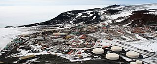
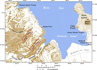
McMurdo Station is an American Antarctic research station on the southern tip of Ross Island. It is operated by the United States through the United States Antarctic Program (USAP), a branch of the National Science Foundation. The station is the largest community in Antarctica, capable of supporting up to 1,500 residents, though the population fluctuates seasonally and during the antarctic night which has 24- hour darkness there is as little as a few hundred people. It serves as one of three year-round United States Antarctic science facilities. Personnel and cargo going to or coming from Amundsen–Scott South Pole Station usually first pass through McMurdo, either by flight or by the McMurdo to South Pole Traverse; it is a hub for activities and science projects in Antarctica. McMurdo, Amundsen-Scott, and Palmer are the three United States stations on the continent, though by the Antarctic Treaty System the bases are not a legal claim ; they are dedicated to scientific research. New Zealand's Scott Base is nearby on Hut Peninsula and across the channel is a helicopter refueling station at Marble Point. The bases are served by airfields and a port, though access can be limited by weather conditions which can make it too hard to land aircraft, and an icebreaker may be needed to reach the port facility.

Albert Paddock Crary, was an American pioneer polar geophysicist and glaciologist. He was the first person to have set foot on both the North and South Poles, having made it to the North Pole on May 3, 1952 and then to the South Pole on February 12, 1961, as the leader of a team of eight. The South Pole expedition set out from McMurdo Station on December 10, 1960, using three Snowcats with trailers. Crary was the seventh expedition leader to arrive at the South Pole by surface transportation. He was widely admired for his intellect, wit, skills and as a great administrator for polar research expeditions.

Scott Base is a New Zealand Antarctic research station at Pram Point on Ross Island near Mount Erebus in New Zealand's Ross Dependency territorial claim. It was named in honour of Captain Robert Falcon Scott, RN, leader of two British expeditions to the Ross Sea area of Antarctica. The base was set up as support to field research and the centre for research into earth sciences, and now conducts research in many fields, operated by Antarctica New Zealand.

Lake Vida is a hypersaline lake in Victoria Valley, the northernmost of the large McMurdo Dry Valleys, on the continent of Antarctica. It is isolated under year-round ice cover, and is considerably more saline than seawater. It came to public attention in 2002 when microbes frozen in its ice cover for more than 2,800 years were successfully thawed and reanimated.

Palmer Station is a United States research station in Antarctica located on Anvers island, the only U.S. station on the continent located north of the Antarctic Circle. Initial construction of the station finished in 1968. The station, like the other U.S. Antarctic stations, is operated by the United States Antarctic Program (USAP) of the National Science Foundation. The base is much smaller than the others, with about 40 staff, and is focused on marine and biology research such as seabirds and plankton.

The McMurdo Sound is a sound in Antarctica, known as the southernmost passable body of water in the world, located approximately 1,300 kilometres (810 mi) from the South Pole.

Little America was a series of Antarctic exploration bases from 1929 to 1958, located on the Ross Ice Shelf, south of the Bay of Whales. The were built on ice that is moving very slowly, the relative location on the ice sheet, has moved and eventually breaks off into an iceberg. The geographic location has new ice that has shifted to this location, and is technically over the open water.

The United States Antarctic Program is an organization of the United States government which has a presence in the Antarctica continent. Founded in 1959, the USAP manages all U.S. scientific research and related logistics in Antarctica as well as aboard ships in the Southern Ocean.

The Onyx River is an Antarctic meltwater stream which flows westward through the Wright Valley from Wright Lower Glacier and Lake Brownworth at the foot of the glacier to Lake Vanda, during the few months of the Antarctic summer. At 32 kilometres (20 mi) in length, it is the longest river in Antarctica.

Cape Hallett is a snow-free area on the northern tip of the Hallett Peninsula on the Ross Sea coast of Victoria Land, East Antarctica. Cape Adare lies 100 km (62 mi) to the north.

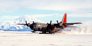
Williams Field or Willy Field is a United States Antarctic Program airfield in Antarctica. Williams Field consists of two snow runways located on approximately 8 meters (25 ft) of compacted snow, lying on top of 8–10 ft of ice, floating over 550 meters (1,800 ft) of water. The airport, which is approximately seven miles from Ross Island, serves McMurdo Station and New Zealand's Scott Base. Williams Field is the major airfield for on-continent aircraft operations in Antarctica.

Multiple governments have set up permanent research stations in Antarctica and these bases are widely distributed. Unlike the drifting ice stations set up in the Arctic, the current research stations of the Antarctic are constructed either on rocks or on ice that are fixed in place.

The Byrd Station is a former research station established by the United States during the International Geophysical Year by U.S. Navy Seabees during Operation Deep Freeze II in West Antarctica.

Plateau Station is an inactive American research and South Pole—Queen Maud Land Traverse support base on the central Antarctic Plateau. Construction on the site started on December 13, 1965, and the first traverse team arrived in early 1966. The base was in continuous use until January 29, 1969, when it was closed but mothballed for future use, and was the most remote and coldest of any United States stations on the continent. It was also the site for the world's coldest measured average temperature for a month at that time, recorded in July 1968, at −99.8 °F (−73.2 °C).
Siple Station was a research station in Antarctica, established in 1973 by Stanford's STAR Lab, to perform experiments that actively probed the magnetosphere using very low frequency (VLF) waves. Its location was selected to be near the Earth's south magnetic pole, and the thick ice sheet allowed for a relatively efficient dipole antenna at VLF frequencies. John Katsufrakis of Stanford University was the "father" of the station and the VLF experiment sponsored by Stanford.

The Antarctic Meteorological Research Center (AMRC) is an Antarctic research program funded by the National Science Foundation (NSF) that is based out of the Space Science and Engineering Center (SSEC) at the University of Wisconsin. The AMRC was founded as a link between the UW-Madison automatic weather station (AWS) project and the Man computer Interactive Data Access System (McIDAS) project, also at UW-Madison.

Ellsworth Scientific Station was a permanent, all year-round originally American, then Argentine Antarctic scientific research station named after American polar explorer Lincoln Ellsworth. It was located on Gould Bay, on the Filchner Ice Shelf.
Firefighting in Antarctica encompasses various organizations and procedures designed to fight fires on the continent of Antarctica. Firefighting in Antarctica is complicated by the harsh conditions of the continent, the remoteness of the locations to be serviced, and the importance of protecting life-supporting shelter from immolation.
Eights Station was an Antarctic permanent exploration base from January 1963 to November 1965, located on Ellsworth Land about 1100 km from Byrd Station and 2400 km from McMurdo Station. The station consisted of 11 prefabricated buildings that were brought in via planes and located on the site of the former "Sky-Hi" airlift project temporary scientific camp. The station was named for James Eights who was the first American Naturalist who visited Antarctica at the beginning of the 19th Century. The station was initially supported by 6 scientists and 5 Armed Forces attendants and included observations on meteorology, the ionosphere, geomagnetism, and aurora and radio waves. At its peak, Eights Station hosted 27 personnel, including individuals from the U.S. Antarctic Research Program Summer Party.


