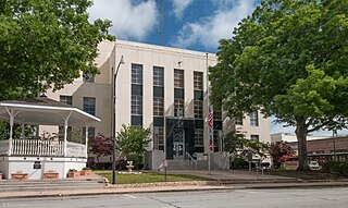
Washington County is a county in Texas. As of the 2020 census, the population was 35,805. Its county seat is Brenham, which is located along U.S. Highway 290, 72 miles northwest of Houston. The county was created in 1835 as a municipality of Mexico and organized as a county in 1837. It is named for George Washington, the first president of the United States.

Waller County is a county in the U.S. state of Texas. As of the 2020 census, its population was 56,794. Its county seat is Hempstead. The county was named for Edwin Waller, a signer of the Texas Declaration of Independence and first mayor of Austin.

Motley County is a county located in the U.S. state of Texas. As of the 2020 census, its population was 1,063, making it the 10th-least populous county in Texas. Its county seat is Matador. The county was created in 1876 and organized in 1891. It is named for Junius William Mottley, a signer of the Texas Declaration of Independence. Mottley's name is spelled incorrectly because the bill establishing the county misspelled his name. Motley County was one of 30 prohibition, or entirely dry, counties in Texas, but is now a wet county.

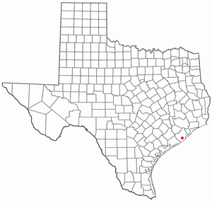
Matagorda County is a county located in the U.S. state of Texas. As of the 2020 census, the population was 36,255. Its county seat is Bay City, not to be confused with the larger Baytown in Harris and Chambers Counties. Matagorda County is named for the canebrakes that once grew along the coast.

Cooke County is a county in the U.S. state of Texas. At the 2020 census, its population was 41,668. The county seat is Gainesville. The county was founded in 1848 and organized the next year. It is named for William Gordon Cooke, a soldier during the Texas Revolution. It is a part of the Texoma region.

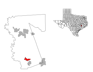
Richwood is a city in Brazoria County, Texas, United States. The population was 4,781 at the 2020 census.

Ozona is an unincorporated community and census-designated place (CDP) that serves as the county seat of Crockett County, Texas, United States. The population was 2,663 at the time of the 2020 census. Ozona is the only Census Bureau–recognized community in Crockett County, which is named for Colonel Davy Crockett, a hero of the Alamo.

Citrus City is a census-designated place (CDP) in Hidalgo County, Texas, United States. The population was 3,291 at the 2020 census. It is part of the McAllen–Edinburg–Mission Metropolitan Statistical Area. The town was founded in 1943 during World War II by Howard Moffitt, a builder known for his vernacular Moffitt cottage architectural style, as part of a planned regional orange and grapefruit growing community. The local irrigation system proved to be too saline for fruit production, and the plans for a large town were revised. A few Moffitt houses survive in Citrus City.

Anton is a city in Hockley County, Texas, United States. The population was 907 at the 2020 census.

Goldthwaite is a town and the county seat of Mills County, Texas, United States. The population was 1,738 at the 2020 census, down from 1,878 at the 2010 census.

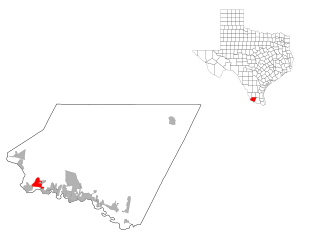
La Rosita is a census-designated place (CDP) in Starr County, Texas, United States. The population was 85 at the 2010 census, a decline from the figure of 1,729 tabulated in 2000 due to the Census Bureau redefining the CDP. By the 2020 census, the population further decreased to 82.

Roma Creek is a former census-designated place (CDP) in Starr County, Texas, United States. The population was 350 at the 2010 census down from 610 at the 2000 census.

New Waverly is a city in Walker County, Texas, United States. The population was 914 at the 2020 census.

Pattison is a city in Waller County, Texas, United States. As of the 2020 census, the population was 547.

Prairie View is a city in Waller County, Texas, United States, situated on the northwestern edge of the Houston–The Woodlands–Sugar Land metropolitan area. The population was 8,184 at the 2020 census.

Liberty Hill is a city in Williamson County, Texas, United States. The population was 3,646 at the 2020 census, and according to 2023 census estimates, the city is estimated to have a population of 10,428. Liberty Hill is part of the Greater Austin metropolitan area.

Carrollton is a city in Dallas, Denton, and Collin counties in the U.S. state of Texas. As of the 2020 census, its population was 133,434, making it the 27th-most populous city in Texas.

Cinco Ranch is a census-designated place and master-planned community located in the extraterritorial jurisdiction of the city of Houston within Fort Bend and Harris counties in the U.S. state of Texas. According to the United States Census Bureau, the CDP has a total area of 4.9 square miles (12.8 km2).The population was 16,899 at the 2020 census. It lies approximately 25 miles (40 km) west of the Harris County seat of Houston and 10 miles (16 km) north of the Fort Bend County seat of Richmond. Cinco Ranch is considered to be part of the Greater Katy area and is roughly 10 miles southeast of the city of Katy.

Waller is a city in Harris and Waller counties in Texas, United States, that is within the Houston–Cypress metropolitan area. Its population was 2,682 at the 2020 U.S. census. The Waller area is located along U.S. Route 290 41 miles (66 km) northwest of downtown Houston.

Marble Falls is a city in Burnet County, Texas, United States. As of the 2020 United States Census, the city population was 7,037. Lake Marble Falls is part of the Highland Lakes on the Colorado River, the largest chain of lakes in Texas. Marble Falls was founded by Adam Rankin Johnson in 1887, a former Indian fighter and Confederate general.


