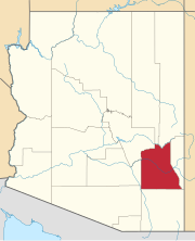
Sierra Vista is a city in Cochise County, Arizona, United States. According to the 2020 Census, the population of the city is 45,308, and is the 27th most populous city in Arizona. The city is part of the Sierra Vista-Douglas Metropolitan Area, with a 2010 population of 131,346. Fort Huachuca, a U.S. Army post, has been incorporated and is located in the northwest part of the city. Sierra Vista is bordered by the cities of Huachuca City and Whetstone to the north and Sierra Vista Southeast to the South.

Sierra Vista Southeast, often referred to as Hereford or Nicksville, is a census-designated place (CDP) in Cochise County, Arizona, United States. The population was 14,797 at the 2010 census. It includes the neighborhoods Ramsey Canyon, and Sierra Vista Estates within its boundaries.
Hereford is a populated place in Cochise County along the San Pedro Riparian National Conservation Area in the southern part of the U.S. state of Arizona. It is southeast of Sierra Vista and is a part of the Sierra Vista-Douglas micropolitan area. The elevation is 4,193 feet at the location of the original townsite at the far eastern end of the unincorporated area; the residential area runs for another 8 miles west from this location, blending into the unincorporated area of Nicksville at an elevation of approximately 4800 feet. Hereford Station Post Office is located at the far western end of Nicksville, at the foot of the Huachuca Mountains.

This is a list of the National Register of Historic Places listings in Graham County, Arizona. It is intended to be a complete list of the properties and districts on the National Register of Historic Places in Graham County, Arizona, United States. The locations of National Register properties and districts for which the latitude and longitude coordinates are included below, may be seen in a map.

The Buena Vista Hotel was a historic hotel and entertainment center located in the downtown district of Safford, Arizona.
Artesia is a populated place situated in Graham County, Arizona, United States.
Ashurst is a populated place situated in Graham County, Arizona, United States, and appears on the Eden U.S. Geological Survey Map.

Weedville is a populated place inside the city limits of Peoria in Maricopa County, Arizona, United States. Weedville is in pockets of unincorporated land under the jurisdiction of Maricopa County. For all census and demographic purposes, Weedville is now considered part of Peoria, since it is inside the city limits.
Buenos Aires, also known as Buena Ayres or Buenos Ayres, is a populated place situated in Pima County, Arizona. It has an estimated elevation of 3,045 feet (928 m) above sea level. Buenos Aires is located on the Tohono Oʼodham Indian Reservation. The settlement once had its own school district, which has since become part of the Baboquivari Unified School District.
Calva is a populated place situated in Graham County, Arizona, United States.
Glenbar is a populated place situated in Graham County, Arizona, United States.
Hunt is a populated place situated on the Little Colorado River at the mouth of Concho Creek in Apache County, Arizona, United States. It is named after Colonel James Hunt, who served at Fort Apache in the 1870s.
Indian Hot Springs, also known as Holladay Hot Springs, is a populated place situated in Graham County, Arizona, United States.
Lone Star is a populated place situated in Graham County, Arizona, United States. The community is located eight miles north of Solomonville and was named after the nearby mine and mountain.
Nicksville is a populated place in Cochise County, Arizona, just north of the international border between the United States and Mexico.
Point of Pines is a populated place situated on the San Carlos Apache Indian Reservation in Graham County, Arizona, United States.
Sanchez is a populated place situated in Graham County, Arizona, United States. It has an estimated elevation of 3,061 feet (933 m) above sea level.
Santa Cruz is a populated place situated in Pima County, Arizona, United States. It has an estimated elevation of 2,812 feet (857 m) above sea level. It is one of two locations in Arizona with this name, the other being the census-designated place in Pinal County.
Twin Buttes is a populated place situated in Navajo County, Arizona, United States. It is one of two populated locations in Arizona with this name, the other being in Pima County. It has an estimated elevation of 5,794 feet (1,766 m) above sea level.
Wheatfields is a populated place situated in Apache County, Arizona, United States, right along the border with New Mexico. It has an estimated elevation of 7,287 feet (2,221 m) above sea level. It is one of two places in Arizona with this name, the other being a CDP in Gila County. In 1909, the US Government set up an irrigation project to assist the Navajo residents. It is a chapter of the Navajo Nation.


