Bürs

Last updated • a couple of secsFrom Wikipedia, The Free Encyclopedia

Bürs
Buers overview.jpg
Wappen at burs.png
Coat of arms
Burs im Bezirk BZ.png
Location in the district
Austria adm location map.svg
Red pog.svg
Bürs
Location within Austria
Coordinates: 47°08′00″N09°48′00″E / 47.13333°N 9.80000°E / 47.13333; 9.80000 Coordinates: 47°08′00″N09°48′00″E / 47.13333°N 9.80000°E / 47.13333; 9.80000
Country Austria
State Vorarlberg
District Bludenz
Government
   Mayor Helmut Zimmermann (SPÖ)
Area
[1]
  Total24.65 km2 (9.52 sq mi)
Elevation
570 m (1,870 ft)
Population
 (2018-01-01) [2]
  Total3,275
  Density130/km2 (340/sq mi)
Time zone UTC+1 (CET)
  Summer (DST) UTC+2 (CEST)
Postal code
6706
Area code 05552
Vehicle registration BZ
Website www.buers.at

Bürs is a municipality in the district of Bludenz in the Austrian state of Vorarlberg.

Contents

Climate

Climate data for Bürs (1971–2000)
MonthJanFebMarAprMayJunJulAugSepOctNovDecYear
Record high °C (°F)18.1
(64.6)
19.5
(67.1)
26.0
(78.8)
28.5
(83.3)
31.0
(87.8)
34.5
(94.1)
36.2
(97.2)
33.8
(92.8)
30.0
(86.0)
29.2
(84.6)
24.0
(75.2)
22.0
(71.6)
36.2
(97.2)
Average high °C (°F)1.6
(34.9)
4.5
(40.1)
10.1
(50.2)
14.0
(57.2)
19.3
(66.7)
21.7
(71.1)
24.0
(75.2)
23.5
(74.3)
19.6
(67.3)
14.2
(57.6)
6.2
(43.2)
2.5
(36.5)
13.4
(56.1)
Daily mean °C (°F)−2.1
(28.2)
−0.5
(31.1)
3.9
(39.0)
7.7
(45.9)
12.8
(55.0)
15.5
(59.9)
17.7
(63.9)
17.1
(62.8)
13.2
(55.8)
8.3
(46.9)
2.2
(36.0)
−1.0
(30.2)
7.9
(46.2)
Average low °C (°F)−5.1
(22.8)
−3.9
(25.0)
−0.3
(31.5)
2.9
(37.2)
7.4
(45.3)
10.3
(50.5)
12.6
(54.7)
12.3
(54.1)
8.9
(48.0)
4.5
(40.1)
−0.9
(30.4)
−3.8
(25.2)
3.7
(38.7)
Record low °C (°F)−24.5
(−12.1)
−18.5
(−1.3)
−19.5
(−3.1)
−6.0
(21.2)
−3.0
(26.6)
1.3
(34.3)
4.7
(40.5)
4.0
(39.2)
−1.2
(29.8)
−7.4
(18.7)
−18.0
(−0.4)
−21.8
(−7.2)
−24.5
(−12.1)
Average precipitation mm (inches)83.1
(3.27)
70.2
(2.76)
87.5
(3.44)
96.7
(3.81)
115.9
(4.56)
162.4
(6.39)
168.2
(6.62)
157.8
(6.21)
123.9
(4.88)
85.3
(3.36)
96.7
(3.81)
93.5
(3.68)
1,341.2
(52.80)
Average snowfall cm (inches)32.2
(12.7)
33.4
(13.1)
19.3
(7.6)
3.6
(1.4)
0.6
(0.2)
0.0
(0.0)
0.0
(0.0)
0.0
(0.0)
0.0
(0.0)
0.1
(0.0)
12.5
(4.9)
26.4
(10.4)
128.1
(50.4)
Average precipitation days (≥ 1.0 mm)10.49.112.012.113.515.615.213.611.39.711.311.3145.1
Average relative humidity (%) (at 14:00)81.269.055.952.852.855.455.556.261.968.779.383.464.3
Source: Central Institute for Meteorology and Geodynamics [3]


Population

Historical population
YearPop.±%
1869753    
18801,053+39.8%
18901,327+26.0%
19001,363+2.7%
19101,303−4.4%
19231,087−16.6%
19341,476+35.8%
19391,492+1.1%
19511,816+21.7%
19612,263+24.6%
19712,775+22.6%
19812,799+0.9%
19912,954+5.5%
20013,115+5.5%
20113,110−0.2%

Related Research Articles

Wolfurt Place in Vorarlberg, Austria

Wolfurt is a municipality in the western Austrian state of Vorarlberg.

Schwarzach, Vorarlberg Place in Vorarlberg, Austria

Schwarzach is a municipality in the Austrian state of Vorarlberg.

Satteins Place in Vorarlberg, Austria

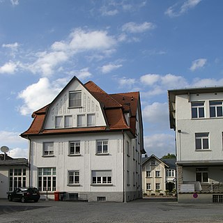
Satteins is a town in the Austrian state of Vorarlberg.

Altach Place in Vorarlberg, Austria

Altach is a municipality in Feldkirch district in the Austrian state of Vorarlberg.

Warth, Vorarlberg Place in Vorarlberg, Austria

Warth is a municipality in the district of Bregenz in the Austrian state of Vorarlberg.

Blons Place in Vorarlberg, Austria

Blons is a municipality in the district of Bludenz in Austrian state of Vorarlberg.

Innerbraz Place in Vorarlberg, Austria

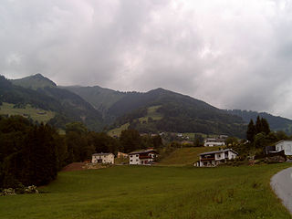
Innerbraz is a municipality in the district of Bludenz in the Austrian state of Vorarlberg.

Klösterle, Austria Place in Vorarlberg, Austria

Klösterle is a municipality in the district of Bludenz in the Austrian state of Vorarlberg.

Nüziders Place in Vorarlberg, Austria

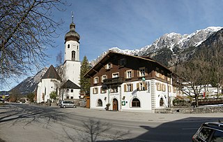
Nüziders is a municipality in the district of Bludenz in the Austrian state of Vorarlberg. It was capital of the historical County of Sonnenberg which is referred to in the formal style of the Emperor of Austria.

Sankt Gerold Place in Vorarlberg, Austria

Sankt Gerold is a municipality in the district of Bludenz in the Austrian state of Vorarlberg.

Stallehr Place in Vorarlberg, Austria

Stallehr is a municipality in the district of Bludenz in the Austrian state of Vorarlberg.

Thüringen, Austria Place in Vorarlberg, Austria

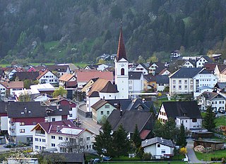
Thüringen is a municipality in the district of Bludenz in the Austrian state of Vorarlberg, on the mouth of the Great Walsertal.

Thüringerberg Place in Vorarlberg, Austria

Thüringerberg is a municipality in the district of Bludenz in the Austrian state of Vorarlberg.

Fußach Place in Vorarlberg, Austria

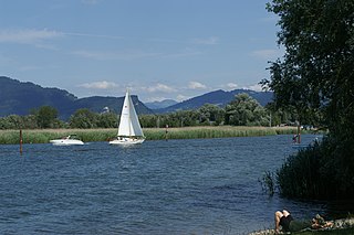
Fußach is a municipality in the district of Bregenz in the Austrian state of Vorarlberg.

Gaißau Place in Vorarlberg, Austria

Gaißau is a municipality in the district of Bregenz in the Austrian state of Vorarlberg.

Möggers Place in Vorarlberg, Austria

Möggers is a municipality in the district of Bregenz in the Austrian state of Vorarlberg.

Dünserberg Place in Vorarlberg, Austria

Dünserberg is a municipality in the district of Feldkirch in the Austrian state of Vorarlberg.

Röthis Place in Vorarlberg, Austria

Röthis is a municipality in the district of Feldkirch in the Austrian state of Vorarlberg.

Sulz, Vorarlberg Place in Vorarlberg, Austria

Sulz is a municipality in the district of Feldkirch in the Austrian state of Vorarlberg.

Übersaxen Place in Vorarlberg, Austria

Übersaxen is a municipality in the district of Feldkirch in the Austrian state of Vorarlberg.

References

  1. "Dauersiedlungsraum der Gemeinden Politischen Bezirke und Bundesländer - Gebietsstand 1.1.2018". Statistics Austria. Retrieved 10 March 2019.
  2. "Einwohnerzahl 1.1.2018 nach Gemeinden mit Status, Gebietsstand 1.1.2018". Statistics Austria. Retrieved 9 March 2019.
  3. "Klimadaten von Österreich 1971–2000 – Vorarlberg-Bürs" (in German). Central Institute for Meteorology and Geodynamics. Archived from the original on 12 October 2019. Retrieved 25 October 2019.