This article needs additional citations for verification .(January 2018) |
Carderock is a neighborhood located in Montgomery County, Maryland, United States, along the Potomac River. It is located in the southern part of the Potomac census-designated place and western part of the Bethesda postal area.
Carderock is well known for Carderock Division of the Naval Surface Warfare Center and rock climbing at Carderock Recreation Area, part of Chesapeake and Ohio Canal National Historical Park. Carderock also includes a local school (Carderock Springs Elementary), Carderock Springs Swim and Tennis Club, and Congressional Country Club. [1]
Despite its proximity to the Capital Beltway, Carderock remains only moderately developed and traffic congested. This is due in part to the prominent presence of Rock Run, the Naval Surface Warfare Center, and Congressional Country Club. In addition, almost no roads running through Carderock have direct access to the Beltway. The only exceptions are River Road on the north end of the neighborhood and Clara Barton Parkway on the south end.
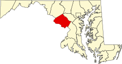
Bethesda is an unincorporated, census-designated place in southern Montgomery County, Maryland. It is located just northwest of Washington, D.C. It takes its name from a local church, the Bethesda Meeting House, which in turn took its name from Jerusalem's Pool of Bethesda. The National Institutes of Health's main campus and the Walter Reed National Military Medical Center are in Bethesda, in addition to a number of corporate and government headquarters.
Cabin John is a census-designated place and an unincorporated area in Montgomery County, Maryland, United States. Its original southern boundary encompassed a section of the Chesapeake and Ohio Canal (C&O) including locks 8–12, and the northern shore of the Potomac River. It is also the access point to Plummers Island, originally owned by The Washington Biologists’ Field Club and called “the most thoroughly studied island in North America.” Cabin John is the location of the Union Arch Bridge built between 1857 and 1864; at the time of its completion, the bridge embodied the longest single-span masonry arch in the world and remains the longest in the United States.
North Bethesda is an unincorporated, census-designated place in Montgomery County, Maryland, United States, located just north-west of the U.S. capital of Washington, D.C. It had a population of 50,094 as of the 2020 census. Among its neighborhoods, the centrally-located, urbanizing district of White Flint is the commercial and residential hub of North Bethesda. The Pike & Rose development and the Pike District is an initiative of Montgomery County to brand and market this region as "North Bethesda's Urban Core". The WMATA North Bethesda metro station and Grosvenor-Strathmore metro station serve the region.
Potomac is a census-designated place (CDP) in Montgomery County, Maryland, United States, named after the nearby Potomac River. Potomac is the seventh most educated small town in America, based on percentage of residents with postsecondary degrees. Bloomberg Businessweek labeled Potomac as the twenty-ninth-richest ZIP Code in the United States in 2011, stating that it had the largest population of any U.S. town with a median income of more than $240,000. In 2012, The Higley Elite 100 published a list of highest-income neighborhoods by mean household income, which included four neighborhoods in Potomac; one of these neighborhoods, "Carderock-The Palisades" was ranked the highest-income neighborhood in the United States, followed by "Beverly Hills-North of Sunset" in Beverly Hills, California and "Swinks Mill-Dominion Reserve" of McLean, Virginia. More recently, two Potomac neighborhoods were ranked among the ten wealthiest neighborhoods in the country by CNBC in 2014. In 2018, data from the American Community Survey revealed that Potomac was the sixth-wealthiest city in the United States. Many Potomac residents work in nearby Washington, D.C. and Northern Virginia.
Fort Washington is an unincorporated area and census-designated place in Prince George's County, Maryland, United States. It borders the Potomac River, situated 20 miles south of the downtown Washington, DC. As of the 2020 census it had a population of 24,261. The Fort Washington community is located west of Maryland Route 210, with some additional area to the east of the highway.
The David Taylor Model Basin (DTMB) is one of the largest ship model basins—test facilities for the development of ship design—in the world. DTMB is a field activity of the Carderock Division of the Naval Surface Warfare Center.
Clara Barton Parkway is an automobile parkway in the U.S. state of Maryland and the District of Columbia. The highway runs 6.8 miles (10.9 km) from MacArthur Boulevard in Carderock, Maryland, east to Canal Road at the Chain Bridge in Washington. Clara Barton Parkway is a two- to four-lane parkway that parallels the Potomac River and the Chesapeake and Ohio Canal (C&O) in southwestern Montgomery County, Maryland, and the far western corner of Washington. The parkway provides access to the communities of Cabin John and Glen Echo and several units of the Chesapeake and Ohio Canal National Historical Park. The Maryland portion of the George Washington Memorial Parkway was constructed from Carderock past Interstate 495 (I-495) to Glen Echo in the early to mid-1960s. The parkway was proposed to continue west to Great Falls and east to Georgetown. However, these proposals never came to fruition and the parkway was extended only to the Chain Bridge in the early 1970s. The Maryland portion of the George Washington Memorial Parkway was renamed in 1989 for Clara Barton, the founder of the American Red Cross, and whose original headquarters is located in Glen Echo.
Wisconsin Avenue is a major thoroughfare in Washington, D.C., and its Maryland suburbs. The southern terminus begins in Georgetown just north of the Potomac River, at an intersection with K Street under the elevated Whitehurst Freeway. The section of Wisconsin Avenue in Georgetown was called High Street before the street names in Georgetown were changed in 1895 to conform to those of the L'Enfant Plan for the federal city.
The United States Naval Surface Warfare Center Dahlgren Division (NSWCDD), named for Rear Admiral John A. Dahlgren, is located in King George County, Virginia, in close proximity to the largest fleet concentration area in the Navy. NSWCDD is part of the Naval Surface Warfare Centers under the Naval Sea Systems Command (NAVSEA). NSWCDD was initially established 16 October 1918 as a remote extension of Maryland's Indian Head Proving Ground used for testing naval guns. The Dahlgren site was named the Lower Station, Dahlgren Naval Proving Ground when it first opened. The location on the Potomac River was specifically chosen for the development of a long ballistic test range on the Potomac River, required for the testing of modern, high-powered munitions.
A Naval Surface Warfare Center (NSWC) is part of the Naval Sea Systems Command (NAVSEA) operated by the United States Navy. NAVSEA Warfare Centers supply the technical operations, people, technology, engineering services and products needed to equip and support the Fleet and meet the warfighter's needs. The Warfare Centers are the Navy's principal Research, Development, Test and Evaluation (RDT&E) assessment activity for surface ship and submarine systems and subsystems. Additionally, the Warfare Centers provide depot maintenance and In-Service Engineering support to ensure that the systems fielded today perform consistently and reliably in the future.
Maryland Route 190 is a state highway in the U.S. state of Maryland. Known as River Road, the highway runs 15.88 miles (25.56 km) from MD 112 near Seneca east to Western Avenue at the District of Columbia boundary in Bethesda. MD 190 parallels the Potomac River through the affluent southwestern Montgomery County communities of Potomac and Bethesda and connects those suburbs with Interstate 495 (I-495). River Road was paved from Washington west through part of Bethesda in the early 1910s. A second section of MD 190 was constructed through Potomac in the mid-1920s. The Bethesda and Potomac portions of the route were unified in the late 1920s. MD 190 was extended west toward Seneca in two steps in 1950 and the early 1970s. The highway was expanded to a four-lane divided highway through Bethesda in the early 1960s.
The Carderock Division of the Naval Surface Warfare Center is one of eight Naval Sea Systems Command (NAVSEA) Surface Warfare Centers. The headquarters is located in Carderock, Maryland with the historic David Taylor Model Basin. The division includes remote sites across the United States concentrating on engineering, testing and modelling ship and ship's systems for the Navy. It consists of approximately 3,200 scientists, engineers and support personnel working in more than 40 disciplines ranging from fundamental science to applied/in-service engineering.
The Billy Goat Trail is a 4.7-mile (7.6 km) hiking trail that follows a path between the C&O Canal and the Potomac River within the Chesapeake and Ohio Canal National Historical Park near the Great Falls in Montgomery County, Maryland. The trail has three sections: Section A, the northernmost, is 1.7 miles (2.7 km); Section B is 1.4 miles (2.3 km); and Section C, the southernmost, is 1.6 miles (2.6 km)
Naval District Washington is one of eleven current naval regions responsible to Commander, Navy Installations Command for the operation and management of Naval shore installations in the Washington D.C. Metropolitan Area. The Commandant is currently the only remaining Naval Districts from the 1900s era, making it, by default the oldest of the current naval regions. The Commandant is headquartered at the Washington Navy Yard only a few yards away from the Commander, Navy Installations Command headquarters.
Carderock may refer to a location in the United States:
Maryland Route 191 is a state highway in the U.S. state of Maryland. Known for most of its length as Bradley Boulevard, the highway runs 7.16 miles (11.52 km) from MD 190 in Potomac east to MD 185 in Chevy Chase. MD 191 serves an affluent area with many golf courses as it connects Potomac and Chevy Chase by way of an S-shaped path through Bethesda in southwestern Montgomery County. Bradley Lane, the name for the Chevy Chase portion of the highway, was paved by 1910. This included the segment of the lane between MD 185 and MD 186, which was removed from the state highway in the 1940s. The remainder of MD 191 was constructed along mostly new alignment through Bethesda and Potomac in the early 1920s. The highway originally continued beyond its present western terminus and looped south along Persimmon Tree Road to Cabin John. MD 191 was expanded to a divided highway between what is now MD 355 and MD 614 in two portions in the 1940s and 1960s. The highway was relocated at its Persimmon Tree Road crossing of Interstate 495 (I-495) when the freeway was built in the early 1960s. The Cabin John–Potomac portion of MD 191 was removed from the state highway system in 1999.
Carderock Recreation Area is a 100-acre park in Carderock, Maryland, part of the Chesapeake and Ohio Canal National Historical Park. The area is well known as a destination for its outdoor activities of rock climbing, hiking and biking. It is bounded by the Potomac River on the south and the Chesapeake and Ohio Canal on the north, and it is accessed from Clara Barton Parkway from the same exit as Carderock Division of the Naval Surface Warfare Center.
The Olney Support Center, formerly the Olney Federal Support Center, is an underground facility of the Carderock Division of the U.S. Naval Surface Warfare Center (NSWC) located in Montgomery County, Maryland, United States. The center occupies 75 acres (30 ha) of property 2.0 miles (3.2 km) east of Laytonsville, Maryland, on the site of a former Nike missile base. The NSWC acquired the facility from the Federal Emergency Management Agency (FEMA) in March 2019.
Thompson's Corner, is a small unincorporated community located in northern Montgomery County, Maryland, United States. It is located west of Clarksburg and east of Comus.
Coordinates: 38°58′39″N77°11′40″W / 38.97750°N 77.19444°W