Friendship Heights Village, Maryland

Last updated

Friendship Heights Village
Flag of Friendship Heights Village, Maryland.png
Montgomery County Maryland Incorporated and Unincorporated areas Friendship Village Highlighted.svg
Coordinates: 38°57′48″N77°05′23″W / 38.96333°N 77.08972°W / 38.96333; -77.08972
CountryUnited States
State Maryland
County Montgomery
Area
[1]
  Total0.06 sq mi (0.15 km2)
  Land0.06 sq mi (0.15 km2)
  Water0.00 sq mi (0.00 km2)
Elevation
[2]
308 ft (94 m)
Population
 (2020)
  Total5,360
  Density90,847.46/sq mi (35,050.55/km2)
Time zone UTC−5 (Eastern (EST))
  Summer (DST) UTC−4 (EDT)
ZIP code
20815 [3]
Area code(s) 240 and 301
FIPS code 24-30837
GNIS feature ID2389820 [2]

Friendship Heights Village is an urbanized, unincorporated area in Montgomery County, Maryland, United States. It is distinct from the Washington, D.C., neighborhood of Friendship Heights. Friendship Heights Village is a census-designated place (CDP), with a population of 5,360 at the 2020 census. [4]

Contents

Geography

According to the United States Census Bureau, the CDP has a total area of 0.05503 square miles (0.1425 km2), all land. [5]

Demographics

Historical population
CensusPop.Note
2010 4,698
2020 5,36014.1%
source: [6]
2010–2020 [4]
Northbound on Wisconsin Ave in Friendship Heights Village Northbound Wisconsin Ave in Friendship Village, MD.jpg
Northbound on Wisconsin Ave in Friendship Heights Village
Wisconsin Avenue in Friendship Heights Village 2006 01 05 - 355 in Friendship - MD355 from S Park Ave to Western Ave, SB 3.JPG
Wisconsin Avenue in Friendship Heights Village

As of the 2020 census, [7] there were 5,360 people, 2,804 households, and 1,003 families residing in the area. The population density was 90,848/square mile: this is the highest population density of any incorporated or census-designated place in the United States. [8]

The racial makeup of the area was 67.2% White (alone, non-Hispanic),13.9% Hispanic or Latino, 11.2% Asian, 4.7% African American, 1.9% Native American, and 1.1% other race.

In the area, the population was spread out, with 5.5% under the age of 5, 9.8% under the age of 18, and 32.5% are 65 years or older. The Village is composed of 60% women, 28% of all residents are foreign born, and 98% are high school grads, while 88% graduated from college.

The median income for a household in the area was $106,771, with the per capita income equaling $91,197.

Village of Friendship Heights

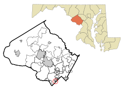
Although not an incorporated municipality, the Village of Friendship Heights was established as a Special Tax District in 1914. Its boundariesWisconsin Avenue, Willard Avenue, and Somerset Terrace (with Little Falls Branch) [9] enclose 34 acres (140,000 m2) and is almost entirely occupied by high-rise residential buildings. It has the highest population density of any census-designated place or city in the United States. In fact, its density exceeds that of the New York City borough of Manhattan, which itself is coextensive with the United States' most dense county. [10] [11] The 2010 population of Friendship Village Heights was 4,698, [12] giving it a population density of 88,432 per square mile, versus Manhattan's approximate 70,000.

South Park Avenue in Friendship Heights 2019-06-12 12 46 40 View west along South Park Avenue at The Hills Plaza in Friendship Heights, Montgomery County, Maryland.jpg
South Park Avenue in Friendship Heights

Buildings: [13]

  1. Highland House Apartments - 5480 Wisconsin Avenue
  2. Highland House West Apartments - 4450 S. Park Avenue
  3. The Willoughby Condominium - 4515 Willard Avenue
  4. The Carleton Condominium - 4550 N. Park Avenue
  5. Office Building - 5550 Friendship Blvd.
  6. The Elizabeth Condominium - 4601 N. Park Avenue
  7. 4615 North Park Apartments
  8. Police Field Office - 4602 N. Park Avenue
  9. 4620 N. Park Avenue Condominium
  10. Willard Towers - 4701 Willard Avenue
  11. Sunrise Brighton Gardens (Assisted Living Residence) - 5555 Friendship Blvd.
  12. Friendship Heights Village Center - 4433 S. Park Avenue
  13. Chevy Chase Office Building - 5530 Wisconsin Avenue
  14. Courtyard by Marriott Chevy Chase - 5520 Wisconsin Avenue
  15. Barlow Office Building - 5454 Wisconsin Avenue
  16. Chase Tower Office and Retail Building - 4445 Willard Avenue

The Village is governed by a seven-member village council, which includes the mayor; [14] each member is elected to a two-year term.

The Village provides numerous services for its citizens, such as the following:

  1. Shuttle bus which circles the neighborhood, making stops at the major residential buildings, the Friendship Heights Village Center, nearby shopping centers, and the Friendship Heights stop of the Washington Metro.
  2. MVA on Wheels
  3. Visiting Nurse
  4. Permit Applications
  5. Police Field Office
  6. Mobile Commuter Store
  7. Shredding Truck
  8. Farmers' Market

The Village also offer a wide variety of activities and events at its Village Center, such as classes, trainings, concerts, and programs on demand, just to name a few. Every year, the Village also hosts three large events for its residents: April 13 - Community Day to celebrate the Village's founding; July 4 - Independence Day Celebration; and mid-October - Fall festival.

See also

Related Research Articles

<span class="mw-page-title-main">Bethesda, Maryland</span> Census-designated place in Maryland, United States

Bethesda is an unincorporated, census-designated place in southern Montgomery County, Maryland, United States. It is located just northwest of Washington, D.C. According to the 2020 census, the community had a total population of 68,056. It takes its name from a local church, the Bethesda Meeting House, which in turn took its name from Jerusalem's Pool of Bethesda. The National Institutes of Health's main campus and the Walter Reed National Military Medical Center are in Bethesda, in addition to several corporate and government headquarters.

<span class="mw-page-title-main">Brooklyn Park, Maryland</span> Census-designated place in Maryland, United States

Brooklyn Park is a census-designated place (CDP) in Anne Arundel County, Maryland, United States. The population was 14,373 at the 2010 census.

<span class="mw-page-title-main">Lochearn, Maryland</span> Census-designated place in Maryland, United States

Lochearn is an unincorporated community and census-designated place in Baltimore County, Maryland, United States, located immediately to the west of the City of Baltimore. Per the 2020 census, the population was 25,511.

<span class="mw-page-title-main">Chevy Chase Village, Maryland</span> Town in Maryland, United States

Chevy Chase Village is an incorporated municipality in Montgomery County, Maryland, United States, bordering Washington, D.C. The population was 2,049 as of the 2020 census. The town was the wealthiest in Maryland as of 2017, with a median income of over $250,000, the highest income bracket listed by the census bureau, and a median home value of $1,823,800.

<span class="mw-page-title-main">Somerset, Maryland</span> Town in Maryland, United States

Somerset is an incorporated town in Montgomery County, Maryland, United States, located near the border with Washington, D.C. The population was 1,187 at the 2020 census.

<span class="mw-page-title-main">Accokeek, Maryland</span> Census-designated place in Maryland, United States

Accokeek, "at the edge of the hill" in Algonquin, is a census-designated place (CDP) located in Prince George's County, Maryland, United States. The CDP is located on the Potomac River, borders Charles County and is approximately 17 miles from Washington. It is a part of the Washington metropolitan area. The population of the CDP, as of the 2020 United States Census was 13,927.

<span class="mw-page-title-main">Camp Springs, Maryland</span> Census-designated place in Maryland

Camp Springs is an unincorporated area and census-designated place (CDP) in Prince George's County, Maryland, United States. The population was 22,734 at the 2020 census. Camp Springs is not an official post office designation; the area is divided among the surrounding mailing addresses of Temple Hills, Fort Washington, Clinton, and Suitland.

<span class="mw-page-title-main">Chillum, Maryland</span> Census-designated place in Maryland

Chillum is an unincorporated area and census-designated place in Prince George's County, Maryland, United States, bordering Washington, D.C., and Montgomery County.

<span class="mw-page-title-main">District Heights, Maryland</span> City in Maryland

District Heights is an incorporated municipality in Prince George's County, Maryland, United States, located near Maryland Route 4. Per the 2020 census, the population was 5,959. For more information, see the separate articles on Forestville and Suitland.

<span class="mw-page-title-main">Fairmount Heights, Maryland</span> Historic district in Maryland, United States

Fairmount Heights is a town in Prince George's County, Maryland, United States. Per the 2020 census, the population was 1,528. The town was formally incorporated in 1935, making the town the second oldest African-American-majority municipality in Prince George's County. The town is composed of six subdivisions: Fairmount Heights (1900), Waterford (1907), Mount Weissner (1909), North Fairmount Heights (1910), West Fairmount Heights (1911) and Sylvan Vista (1923).

<span class="mw-page-title-main">Temple Hills, Maryland</span> Census-designated place in Maryland, United States

Temple Hills is an unincorporated area and census-designated place (CDP) in Prince George's County, Maryland, United States. Temple Hills borders the communities of Hillcrest Heights, Marlow Heights, Camp Springs and Oxon Hill. Per the 2020 census, the population was 8,350.

<span class="mw-page-title-main">Chevy Chase, Maryland</span> Various neighboring areas in Maryland, United States

Chevy Chase is the colloquial name of an area that includes a town, several incorporated villages, and an unincorporated census-designated place in southern Montgomery County, Maryland; and one adjoining neighborhood in northwest Washington, D.C. Most of these derive from a late-19th-century effort to create a new suburb that its developer dubbed Chevy Chase after a colonial land patent.

<span class="mw-page-title-main">Chevy Chase (CDP), Maryland</span> Census-designated place in Maryland, United States

Chevy Chase is a census-designated place (CDP) in Montgomery County, Maryland, United States. The population was 10,176 at the 2020 census.

Landover is an unincorporated community and census-designated place in Prince George's County, Maryland, United States. As of the 2020 census, it had a population of 25,998.

<span class="mw-page-title-main">Suitland, Maryland</span> Census-designated place in Maryland, United States

Suitland is a suburb of Prince George's County, Maryland, approximately one mile (1.6 km) southeast of Washington, D.C. Suitland is a census designated place (CDP), as of the 2020 census, its population was 25,839. Prior to 2010, it was part of the Suitland-Silver Hill census-designated place.

<span class="mw-page-title-main">Friendship Heights</span> Neighborhood in Ward 3, United States

Friendship Heights is an urban commercial and residential neighborhood in northwest Washington, D.C., and southern Montgomery County, Maryland. Though its borders are not clearly defined, Friendship Heights consists roughly of the neighborhoods and commercial areas around Wisconsin Avenue north of Fessenden Street NW and Tenleytown to Somerset Terrace and Willard Avenue in Maryland, and from River Road in the west to Reno Road and 41st Street in the east. Within Maryland west of Wisconsin Avenue is the Village of Friendship Heights, technically a special taxation district.

<span class="mw-page-title-main">Baltimore Highlands, Maryland</span> Census-designated place in Maryland, United States

Baltimore Highlands is a census-designated place (CDP) in Baltimore County, Maryland, United States, directly south of the city of Baltimore. The population was 7,019 at the 2010 census. At the 2000 census and earlier, the area was delineated as part of the Lansdowne-Baltimore Highlands CDP.

<span class="mw-page-title-main">Fair Lakes, Virginia</span> Census-designated place in Virginia, United States

Fair Lakes is a census-designated place (CDP) and business park located west of Fairfax in Fairfax County, Virginia, United States. Fair Lakes had a population of 8,404 in 2020.

<span class="mw-page-title-main">Willoughby Condominium</span> High-rise building in the Friendship Heights, Maryland, US

The Willoughby of Chevy Chase is a high-rise condominium building in Montgomery County, Maryland, on the outskirts of Washington, D.C. When it opened in 1969, it was the largest residential building in the DC area.

References

  1. "2020 U.S. Gazetteer Files". United States Census Bureau. Retrieved April 26, 2022.
  2. 1 2 U.S. Geological Survey Geographic Names Information System: Friendship Heights Village, Maryland
  3. "Friendship Heights Village MD ZIP Code". zipdatamaps.com. 2023. Retrieved February 17, 2023.
  4. 1 2 "QuickFacts: Friendship Heights Village CDP, Maryland". United States Census Bureau. Retrieved August 17, 2021.
  5. "G001. GEOGRAPHIC IDENTIFIERS; Census 2000 Summary File 1 (SF 1) 100-Percent Data". U.S. Census Bureau. Retrieved January 28, 2009.
  6. "Census of Population and Housing". U.S. Census Bureau . Retrieved March 19, 2007.
  7. "U.S. Census website". United States Census Bureau . Retrieved January 31, 2008.
  8. List of United States cities by population density, separate Wikipedia entry with specific references from the US Census Bureau.
  9. "About the Community". Town of Friendship Village. Retrieved April 2, 2008.
  10. "State and County QuickFacts: New York (city), New York". United States Census Bureau. Archived from the original on July 20, 2014. Retrieved July 30, 2014.
  11. "Population Density", Geographic Information Systems – GIS of Interest. Accessed June 30, 2009. "What I discovered is that out of the 3140 counties listed in the Census population data only 178 counties were calculated to have a population density over one person per acre. Not surprisingly, New York County (which contains Manhattan) had the highest population density with a calculated 104.218 persons per acre."
  12. "U.S. Census website". United States Census Bureau . Retrieved November 17, 2015.
  13. "The Friendship Heights Sector Plan" (PDF). Montgomery County Planning Department. Retrieved July 7, 2014.
  14. "The Council Report: 2007 Annual Report & Proposed Budget for Fiscal Year 2009" (PDF). Town of Friendship Village. Retrieved April 2, 2008.