
Boyds is an unincorporated community in rural Montgomery County, Maryland, United States, located approximately 27 miles (43 km) north of Washington, D.C. Its ZIP Code is 20841.

Hanover is an unincorporated community in the Baltimore/Annapolis area in northwestern Anne Arundel County and eastern Howard County in the U.S. state of Maryland, located south of Baltimore.
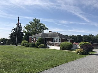
West Friendship is a semi-rural unincorporated community in western Howard County, Maryland, United States. West Friendship is located at the junction of Interstate 70 and Maryland Route 32. Frederick Road is a main thoroughfare.
Dayton is an unincorporated community located in Howard County, Maryland, United States.

Fairplay is an unincorporated community and census-designated place (CDP) in Washington County, Maryland, United States. Its population was 580 as of the 2010 census. It is sometimes recognized, along with neighboring Tilghmanton, as Fairplay-Tilghmanton; the two communities share a post office as well as a fire company. Fairplay is located between Hagerstown and Sharpsburg, along Maryland Route 65 and is part of the Hagerstown Metropolitan Area. Marsh Mills was listed on the National Register of Historic Places in 1996.

Maryland Line is an unincorporated town in Baltimore County, Maryland, United States, located just south of the Mason–Dixon line below York County, Pennsylvania. It is accessible via exits 36 and 37 from I-83. In the 19th century, the community was known as "New Market," but the name was changed to avoid confusion with a town in Frederick County bearing the same name.
Marydel is an unincorporated community in Kent County, Delaware, United States. It lies along Delaware Route 8 west of the city of Dover, the county seat of Kent County and Delaware's state capital. Because the community has borne multiple names, the Board on Geographic Names officially designated it "Marydel" in 1897. It has a post office with the ZIP code 19964. The post office is shared with Marydel, Maryland and is located in Maryland.

Forest Hill is an unincorporated community in Harford County, Maryland, United States, located north of the county seat of Bel Air. The main part of town is located at the intersection of Maryland Route 24 and Jarrettsville Road. Until 1958, this community was served by the Maryland and Pennsylvania Railroad at milepost 30.3.
Nottingham is an unincorporated community in Baltimore County, Maryland, United States. Its elevation is 62 feet (19 m). Although Nottingham is unincorporated, it has a post office, with the ZIP code of 21236. Nottingham is often considered a broad area in Baltimore County, encompassing many census-designated places (CDPs) and unincorporated communities. There is also a historical town in Prince George's County that was named Nottingham - it is now an archeological site.

Coltons Point is an unincorporated community in what is popularly called the "Seventh District" of St. Mary's County, Maryland, United States. A small historical museum and a lighthouse are located there. Seasonal boat service carry visitors the short distance to the shrinking, uninhabited St. Clement's Island, where in 1634 the first European settlers arriving in Maryland landed and celebrated the first Catholic Mass in English-speaking North America. It was listed on the National Register of Historic Places in 1972. The ZIP Code for Coltons Point is 20626. The miraculous medal monument shown below has been moved to the property of a church in Mechanicsville.
Clements is an unincorporated community in St. Mary's County, Maryland, United States. Clements is located in northern St. Mary's County. ZIP Code 20624—Area Code 301—Time Zone Eastern—Population 1,282. It is 4 miles from the county seat of Leonardtown.
Morganza is an unincorporated community in St. Mary's County, Maryland, United States.
Helen is an unincorporated community in St. Mary's County, Maryland, United States and is located near Mechanicsville. It was the hometown of French Forrest. The ZIP Code for Helen is 20635.
Benson is an unincorporated community in Harford County, Maryland, United States. Benson is located at the Harford county junction of U.S. Route 1 and Maryland Route 147, 3 miles (4.8 km) southwest of Bel Air and 19.45 miles (31.3 km) northeast of Baltimore. Benson has a post office with ZIP code 21018 and is served by the Area Codes 410, 443 and 667.

Price is an unincorporated community in Queen Anne's County, Maryland, United States. Price is located at the junction of U.S. Route 301 and Maryland Route 405, 3.5 miles (5.6 km) south-southeast of Church Hill. Price has a post office with ZIP code 21656.
Woolford is an unincorporated community in Dorchester County, Maryland, United States. Woolford is located on Maryland Route 16, 1.5 miles (2.4 km) west of Church Creek. Woolford has a post office with ZIP code 21677.
Wilson is an unincorporated community located in both Garrett County, Maryland and Grant County, West Virginia, United States. Wilson is located along the North Branch Potomac River, 2 miles (3.2 km) southwest of Bayard. The West Virginia side of Wilson once had a post office, which closed on July 16, 1988.
Melrose is an unincorporated community in Carroll County, Maryland, United States. Melrose is located on Maryland Route 30, 2.1 miles (3.4 km) north-northwest of Manchester.
Hoes Heights is an area of North Baltimore, Maryland in zip code 21211, between West Cold Spring Lane and West 41st Street (north-south) and Evans Chapel Road and Falls Road (east-west).

