Glen Echo, Maryland

Last updated

Glen Echo, Maryland
Glen Echo Town Hall MD 20210501 121124 1.jpg
Montgomery County Maryland Incorporated and Unincorporated areas Glen Echo Highlighted.svg
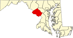
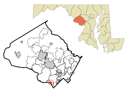
Location in Montgomery County and the state of Maryland
Coordinates: 38°58′05″N77°08′28″W / 38.96806°N 77.14111°W / 38.96806; -77.14111
Country Flag of the United States.svg United States
State Flag of Maryland.svg  Maryland
County Montgomery
Incorporated 1904 [1]
Area
[2]
  Total0.10 sq mi (0.27 km2)
  Land0.10 sq mi (0.27 km2)
  Water0.00 sq mi (0.00 km2)
Elevation
[3]
131 ft (40 m)
Population
 (2020) [4]
  Total279
  Density2,708.74/sq mi (1,050.85/km2)
Time zone UTC-5 (Eastern (EST))
  Summer (DST) UTC-4 (EDT)
ZIP code
20812
Area code(s) 301, 240
FIPS code 24-32900
GNIS feature ID2390208 [3]
Website www.glenecho.org

Glen Echo is a town in Montgomery County, Maryland, United States, that was chartered in 1904. The population was 279 at the 2020 census. [4]

Contents

History

Glen Echo derives its name from the name of the lots developed by Edward and Edwin Baltzley, [5] [6] [7] [8] [9] father of Louis E. Baltzley, and an inventor, [6] before the town was chartered, and who came up with the name c.1888. Their promotional booklet for the land development was titled "Glen Echo on the Potomac: The Washington Rhine". [10]

The town is known for its Chautauqua cultural events [11] and for Glen Echo Park, a former amusement park that is now a U.S. national park.

Clara Barton, founder of the American Red Cross, lived in Glen Echo, a streetcar ride from her office, [12] from 1897 until her death in 1912. [8]

In the 1980s, Glen Echo designated its town bird as the pileated woodpecker; insect, the spicebush swallowtail; tree, the eastern sycamore; and wildflower, the heartleaf aster.[ citation needed ]

Geography

Glen Echo is located in southern Montgomery County overlooking the Potomac River. Its northeast border is MacArthur Boulevard, while its southwest border is the Chesapeake and Ohio Canal. It is bordered to the north by Bannockburn in Bethesda, to the east and south by Brookmont, and to the west by Cabin John.

The Clara Barton Parkway runs through the southwest side of the town, parallel to the C&O Canal. The parkway leads west 2 miles (3 km) to the Capital Beltway (I-495) and southeast 6 miles (10 km) to Georgetown in Washington, D.C.

According to the U.S. Census Bureau, Glen Echo has a total area of 0.10 square miles (0.26 km2), all land. [2]

Demographics

Historical population
CensusPop.Note
1910 203
1920 23515.8%
1930 222−5.5%
1940 39577.9%
1950 356−9.9%
1960 310−12.9%
1970 297−4.2%
1980 229−22.9%
1990 2342.2%
2000 2423.4%
2010 2555.4%
2020 2799.4%
U.S. Decennial Census [13]

2010 census

As of the census [14] of 2010, there were 255 people, 96 households, and 66 families living in the town. The population density was 2,550.0 inhabitants per square mile (984.6/km2). There were 100 housing units at an average density of 1,000.0 per square mile (386.1/km2). The racial makeup of the town was 92.5% White, 1.2% African American, 2.4% Asian, 1.6% from other races, and 2.4% from two or more races. Hispanic or Latino of any race were 3.9% of the population.

There were 96 households, of which 39.6% had children under the age of 18 living with them, 64.6% were married couples living together, 3.1% had a female householder with no husband present, 1.0% had a male householder with no wife present, and 31.3% were non-families. 26.0% of all households were made up of individuals, and 14.6% had someone living alone who was 65 years of age or older. The average household size was 2.66 and the average family size was 3.27.

The median age in the town was 42.4 years. 27.5% of residents were under the age of 18; 4.3% were between the ages of 18 and 24; 23.8% were from 25 to 44; 31.4% were from 45 to 64; and 12.9% were 65 years of age or older. The gender makeup of the town was 47.8% male and 52.2% female.

2000 census

As of the census [15] of 2000, there were 242 people, 91 households, and 63 families living in the town. The population density was 2,217.8 inhabitants per square mile (856.3/km2). There were 93 housing units at an average density of 852.3 per square mile (329.1/km2). The racial makeup of the town was 95.87% White, 2.48% African American, 1.24% Asian, 0.41% from other races. Hispanic or Latino of any race were 1.65% of the population.

There were 91 households, out of which 39.6% had children under the age of 18 living with them, 63.7% were married couples living together, 5.5% had a female householder with no husband present, and 29.7% were non-families. 15.4% of all households were made up of individuals, and 6.6% had someone living alone who was 65 years of age or older. The average household size was 2.66 and the average family size was 3.00.

In the town, the population was spread out, with 24.8% under the age of 18, 2.9% from 18 to 24, 32.6% from 25 to 44, 32.2% from 45 to 64, and 7.4% who were 65 years of age or older. The median age was 39 years. For every 100 females, there were 108.6 males. For every 100 females age 18 and over, there were 93.6 males.

The median income for a household in the town was $122,409, and the median income for a family was $134,741. Males had a median income of $64,375 versus $76,784 for females. The per capita income for the town was $56,728. None of the families and 1.7% of the population were living below the poverty line.

Education

Glen Echo is served by Montgomery County Public Schools.

Schools that serve Glen Echo include:

Transportation

Clara Barton Parkway southeastbound in Glen Echo, approaching the MacArthur Boulevard interchange 2019-06-18 16 24 12 View southeast along the Clara Barton Parkway between the exit for Cabin John and the exit for MacArthur Boulevard in Glen Echo, Montgomery County, Maryland.jpg
Clara Barton Parkway southeastbound in Glen Echo, approaching the MacArthur Boulevard interchange

The most prominent roads serving Glen Echo directly are the Clara Barton Parkway and its spur, the Cabin John Parkway, which intersect at the west end of the town. Access to the residential and commercial properties in the town is via an interchange with MacArthur Boulevard just southeast of the town limits. MacArthur Boulevard intersects with most streets within the town, though it is not actually within the town limits. Maryland Route 188 and Maryland Route 614 also end at MacArthur Boulevard just beyond the town limits.

Notable people

See also

Related Research Articles

<span class="mw-page-title-main">Leake County, Mississippi</span> County in Mississippi, United States

Leake County is a county in the center of the U.S. state of Mississippi. As of the 2020 census, the population was 21,275. Its county seat is Carthage. The county is named for Walter Leake, the Governor of Mississippi from 1822 to 1825.

<span class="mw-page-title-main">Cherokee, Alabama</span> Town in Alabama, United States

Cherokee is a town in west Colbert County, Alabama, United States. Located near the Tennessee River, it is part of the Florence–Muscle Shoals metropolitan area, known as "The Shoals". As of the 2010 census, the population of the town was 1,048.

<span class="mw-page-title-main">Barton, Maryland</span> Town in Maryland, United States

Barton is a town in Allegany County, Maryland, United States, located along the Georges Creek Valley. It is part of the Cumberland, MD-WV Metropolitan Statistical Area. The population was 457 at the 2010 census.

<span class="mw-page-title-main">Midland, Maryland</span> Town in Maryland, United States

Midland is a town in Allegany County, Maryland, United States, along the Georges Creek Valley. It is part of the Cumberland, MD-WV Metropolitan Statistical Area. The population was 446 at the 2010 census. Midland was founded in 1850 as a coal-mining community, though today only some strip mining remains.

<span class="mw-page-title-main">Brooklyn Park, Maryland</span> Census-designated place in Maryland, United States

Brooklyn Park is a census-designated place (CDP) in Anne Arundel County, Maryland, United States. The population was 14,373 at the 2010 census.

<span class="mw-page-title-main">Ferndale, Maryland</span> Census-designated place in Maryland, United States

Ferndale is a census-designated place (CDP) in Anne Arundel County, Maryland, United States. At the 2010 census, the population was 16,746.

<span class="mw-page-title-main">Glen Burnie, Maryland</span> Census-designated place in Maryland, United States

Glen Burnie is an unincorporated town and census-designated place (CDP) in Anne Arundel County, Maryland, United States. It is a suburb of Baltimore. The population was 72,891 at the 2020 census.

<span class="mw-page-title-main">Linthicum, Maryland</span> Census-designated place in Maryland, United States

Linthicum is a census-designated place (CDP) and unincorporated community in Anne Arundel County, Maryland, United States. The population was 10,324 at the 2010 census. It is located directly north of Baltimore–Washington International Thurgood Marshall Airport (BWI).

<span class="mw-page-title-main">Parkville, Maryland</span> Census-designated place in Maryland, United States

Parkville is an unincorporated community and census-designated place in Baltimore County, Maryland, United States. As of the 2010 census, the population was 30,734.

<span class="mw-page-title-main">Brookmont, Maryland</span> Census-designated place in Maryland, United States

Brookmont is a census-designated place and unincorporated area in Montgomery County, Maryland, United States. As of the 2020 census, it had a population of 3,751. Brookmont is often considered part of neighboring Bethesda because it falls within Bethesda's 20816 zip code.

<span class="mw-page-title-main">Cabin John, Maryland</span> Census-designated place in Maryland, United States

Cabin John is a census-designated place and unincorporated area in Montgomery County, Maryland, United States. As of the 2020 census, it had a population of 2,459. Overlooking the Potomac River, it is a suburb of Washington, D.C.

<span class="mw-page-title-main">North Chevy Chase, Maryland</span> Village in Maryland, United States

North Chevy Chase is a incorporated village in Montgomery County, Maryland, United States. It was established as a special tax district in 1924 and incorporated as a village in 1996. The population was 682 at the 2020 census, up from 519 in 2010.

<span class="mw-page-title-main">Glen Echo Park, Missouri</span> Former Village in Missouri, United States

Glen Echo Park was a village in St. Louis County, Missouri, United States. The population was 122 at the 2020 census. The community took its name from the nearby Glen Echo Country Club.

<span class="mw-page-title-main">Clayton, Missouri</span> City in Missouri, United States

Clayton is a city in and the county seat of St. Louis County, Missouri, and borders the independent city of St. Louis. The population was 17,355 at the 2020 census. Organized in 1877, the city was named after Ralph Clayton, who donated the land for the St. Louis County courthouse.

<span class="mw-page-title-main">Muldrow, Oklahoma</span> Town in Oklahoma, United States

Muldrow, officially the Town of Muldrow, is a town in Sequoyah County, Oklahoma, United States. It is part of the Fort Smith, Arkansas–Oklahoma Metropolitan Statistical Area. The population was 3,466 at the 2010 census, an increase of 11.7 percent over the figure of 3,104 recorded in 2000.

<span class="mw-page-title-main">Oxford, Massachusetts</span> Town in Massachusetts, United States

Oxford is a town in Worcester County, Massachusetts, United States. The population was 13,347 as of the 2020 United States Census.

<span class="mw-page-title-main">Clara Barton National Historic Site</span> National Historic Site of the United States

The Clara Barton National Historic Site, which includes the Clara Barton House, was established in 1974 to interpret the life of Clara Barton (1821–1912), an American pioneer teacher, nurse, and humanitarian who was the founder of the American Red Cross. The site is located 2 miles (3.2 km) northwest of Washington D.C. in Glen Echo, Maryland.

<span class="mw-page-title-main">Fairfax Station, Virginia</span> Census-designated place in Virginia, United States

Fairfax Station is a census-designated place (CDP) in Fairfax County, Virginia, United States. The population was 12,420 at the 2020 census. Located in Northern Virginia, its center is located 22 miles (35 km) southwest of Washington, D.C.

<span class="mw-page-title-main">Clara Barton Parkway</span> Parkway in Maryland and Washington D.C.

Clara Barton Parkway is an automobile parkway in the U.S. state of Maryland and the District of Columbia. The highway runs 6.8 miles (10.9 km) from MacArthur Boulevard in Carderock, Maryland, east to Canal Road at the Chain Bridge in Washington. Clara Barton Parkway is a two- to four-lane parkway that parallels the Potomac River and the Chesapeake and Ohio Canal (C&O) in southwestern Montgomery County, Maryland, and the far western corner of Washington. The parkway provides access to the communities of Cabin John and Glen Echo and several units of the Chesapeake and Ohio Canal National Historical Park. The Maryland portion of the George Washington Memorial Parkway was constructed from Carderock past Interstate 495 (I-495) to Glen Echo in the early to mid-1960s. The parkway was proposed to continue west to Great Falls and east to Georgetown. However, these proposals never came to fruition and the parkway was extended only to the Chain Bridge in the early 1970s. The Maryland portion of the George Washington Memorial Parkway was renamed in 1989 for Clara Barton, the founder of the American Red Cross, and whose original headquarters is located in Glen Echo.

<span class="mw-page-title-main">Glen Echo Park (Maryland)</span> United States historic place

Glen Echo Park is an arts and cultural center in Glen Echo, Maryland, a suburb of Washington, D.C. Located about 9 miles (14 km) northwest of the city's downtown area, the park's site was initially developed in 1891 as a National Chautauqua Assembly.

References

  1. "Glen Echo". Maryland Manual. Archived from the original on July 11, 2017. Retrieved June 27, 2017.
  2. 1 2 "2022 U.S. Gazetteer Files: Maryland". United States Census Bureau. Archived from the original on February 13, 2023. Retrieved June 1, 2023.
  3. 1 2 U.S. Geological Survey Geographic Names Information System: Glen Echo, Maryland
  4. 1 2 "P1. Race – Glen Echo town, Maryland: 2020 DEC Redistricting Data (PL 94-171)". U.S. Census Bureau. Archived from the original on June 1, 2023. Retrieved June 1, 2023.
  5. Hales, Linda (May 20, 2006). "A Big Clip Job? Think Washington". The Washington Post . Archived from the original on March 23, 2022. Retrieved January 2, 2016.
  6. 1 2
  7. Cook, Richard A. (1997). "Glen Echo". Glen Echo, Maryland & Cabin John Bridge. Archived from the original on August 13, 2022. Retrieved August 13, 2022.
  8. 1 2 Cook, Richard A. (1997). "The Town of Glen Echo, Maryland". Glen Echo, Maryland & Cabin John Bridge. Archived from the original on August 13, 2022. Retrieved August 13, 2022.
  9. "Creator: Baltzley, Edwin". Historical Society of Washington, D.C. Archived from the original on March 5, 2022. Retrieved August 12, 2022 via PastPerfect Online.
  10. "Frequently Asked Questions". nps.gov. Archived from the original on March 22, 2021. Retrieved May 25, 2015.
  11. Cook, Richard A. (1997). "A History of the Glen Echo Chautauqua". Glen Echo, Maryland & Cabin John Bridge. Archived from the original on June 3, 2023. Retrieved August 13, 2022.
  12. "Clara Barton Site to American Red Cross - National Headquarters". Google Maps . Archived from the original on August 13, 2022. Retrieved August 13, 2022.
  13. "Census of Population and Housing". Census.gov. Archived from the original on July 1, 2021. Retrieved June 4, 2015.
  14. "U.S. Census website". United States Census Bureau. Archived from the original on December 27, 1996. Retrieved January 25, 2013.
  15. "U.S. Census website". United States Census Bureau. Archived from the original on December 27, 1996. Retrieved January 31, 2008.
  16. "The Story of My Childhood". World Digital Library . 1907. Archived from the original on March 30, 2021. Retrieved October 9, 2013.
  17. Roger Tory Peterson: A Biography. 2007. Douglas Carlson. Univ of Texas Press
  18. "Carolyn Reeder, teacher and author of historical fiction for children, dies at 74". Washington Post. Archived from the original on November 12, 2018. Retrieved May 25, 2015.