Drummond, Maryland | |
|---|---|
 Drummond Avenue in Drummond | |
| Coordinates: 39°5′19″N77°4′49″W / 39.08861°N 77.08028°W | |
| Country | |
| State | |
| County | Montgomery |
| Government | |
| • Type | Citizen's Committee |
| Elevation | 315 ft (96 m) |
| Population (1990) | |
• Total | 120 [2] |
| Time zone | UTC-5 (Eastern (EST)) |
| • Summer (DST) | UTC-4 (EDT) |
| ZIP codes | 20815 |
| Area codes | 301, 240 |
| Website | drummondmd |
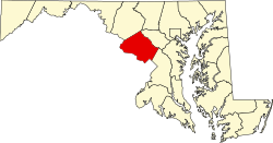
Drummond is a village and special taxing district in Montgomery County, Maryland, United States.
Founded in 1903 and chartered in 1916, [3] the village contains the area along about one-third of Drummond Avenue between Wisconsin Avenue and Little Falls Stream Valley Park. [3]
The population was 120 as of 1990. [2] There are 41 homes in the village. [1] [4]
The village is governed by a three-member Citizens' Committee. [3]


