North Kensington, Maryland

Last updated

North Kensington, Maryland
Montgomery County Maryland Incorporated and Unincorporated areas North Kensington Highlighted.svg
Location of North Kensington, Maryland
Coordinates: 39°02′21″N77°04′20″W / 39.03917°N 77.07222°W / 39.03917; -77.07222
CountryFlag of the United States.svg United States
State Flag of Maryland.svg  Maryland
County Flag of Montgomery County, Maryland.svg Montgomery
Area
[1]
  Total1.50 sq mi (3.88 km2)
  Land1.50 sq mi (3.87 km2)
  Water0.00 sq mi (0.01 km2)
Elevation
[2]
338 ft (103 m)
Population
 (2020)
  Total9,497
  Density6,352.51/sq mi (2,451.93/km2)
Time zone UTC−5 (Eastern (EST))
  Summer (DST) UTC−4 (EDT)
FIPS code 24-56712
GNIS feature ID2389571 [2]

North Kensington is a census-designated place and an unincorporated area in Montgomery County, Maryland, United States. It had a population of 9,497 in 2020. [3]

Contents

Geography

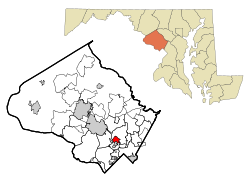
As an unincorporated area, North Kensington's boundaries are not officially defined. North Kensington is, however, recognized by the United States Census Bureau and by the United States Geological Survey as a census-designated place. [4]

According to the United States Census Bureau, the place has a total area of 1.5 square miles (3.9 km2), all land.

This residential community is on the East and West sides of Connecticut Avenue, Southeast of Veirs Mill Road, and primarily North of University Blvd. The Montgomery County public schools serving this area are Newport Mill Middle School, Albert Einstein High School and Rockview Elementary School.

Demographics

Historical population
CensusPop.Note
1980 9,039
1990 8,607−4.8%
2000 8,9403.9%
2010 9,5146.4%
2020 9,497−0.2%
source: [5]
2010–2020 [3]

At the 2000 census there were 8,940 people, 3,527 households, and 2,197 families living in the area. The population density was 5,799.5 inhabitants per square mile (2,239.2/km2). There were 3,631 housing units at an average density of 2,355.5 per square mile (909.5/km2). The racial makeup of the area was 67.00% White, 13.31% African American, 0.39% Native American, 8.66% Asian, 0.07% Pacific Islander, 6.33% from other races, and 4.24% from two or more races. Hispanic or Latino of any race were 15.08%. [6]

Of the 3,527 households 25.8% had children under the age of 18 living with them, 47.8% were married couples living together, 11.0% had a female householder with no husband present, and 37.7% were non-families. 29.8% of households were one person and 10.9% were one person aged 65 or older. The average household size was 2.47 and the average family size was 3.07.

The age distribution was 21.0% under the age of 18, 6.3% from 18 to 24, 32.5% from 25 to 44, 23.7% from 45 to 64, and 16.6% 65 or older. The median age was 39 years. For every 100 females, there were 90.5 males. For every 100 females age 18 and over, there were 85.4 males.

The median household income was $65,144 and the median family income was $75,554. Males had a median income of $46,631 versus $40,609 for females. The per capita income for the area was $28,816. About 3.7% of families and 6.3% of the population were below the poverty line, including 8.4% of those under age 18 and 8.1% of those age 65 or over.

Related Research Articles

<span class="mw-page-title-main">Jefferson County, Nebraska</span> County in Nebraska, United States

Jefferson County is a county in the U.S. state of Nebraska. As of the 2020 United States Census, the population was 7,240. Its county seat is Fairbury. The county was named for Thomas Jefferson, third President of the United States of America.

<span class="mw-page-title-main">Kensington, Connecticut</span> Census-designated place in Connecticut, United States

Kensington is a census-designated place (CDP) and section of the town of Berlin in Hartford County, Connecticut, United States. The Berlin town offices are located in Kensington. The population was 8,459 at the 2010 census.

<span class="mw-page-title-main">Kensington, Kansas</span> City in Smith County, Kansas

Kensington is a city in Smith County, Kansas, United States. As of the 2020 census, the population of the city was 399.

<span class="mw-page-title-main">Midland, Maryland</span> Town in Maryland, United States

Midland is a town in Allegany County, Maryland, United States, along the Georges Creek Valley. It is part of the Cumberland, MD-WV Metropolitan Statistical Area. The population was 446 at the 2010 census. Midland was founded in 1850 as a coal-mining community, though today only some strip mining remains.

<span class="mw-page-title-main">Ferndale, Maryland</span> Census-designated place in Maryland, United States

Ferndale is a census-designated place (CDP) in Anne Arundel County, Maryland, United States. At the 2010 census, the population was 16,746.

<span class="mw-page-title-main">Naval Academy, Maryland</span> Census-designated place in Maryland, United States

Naval Academy is a census-designated place (CDP) in Anne Arundel County, Maryland, United States, which covers the campus of the United States Naval Academy. The population was 4,802 at the 2010 census.

<span class="mw-page-title-main">Edgemere, Maryland</span> Census-designated place in Maryland, United States

Edgemere is an unincorporated community and census-designated place in Baltimore County, Maryland, United States. The population was 8,669 at the 2010 census. Founded in 1899 as Edgemere being renamed from previous name "Fitzell". Meeting held at the Fitzell Farm which was situated where the old Rheem plant was located.

<span class="mw-page-title-main">Galestown, Maryland</span> Town in Maryland, United States

Galestown is a town in Dorchester County, Maryland, United States. The population was 138 at the 2010 census.

<span class="mw-page-title-main">Kitzmiller, Maryland</span> Town in Maryland, United States

Kitzmiller is a town in Garrett County, Maryland, United States. The population was 321 at the 2010 census.

<span class="mw-page-title-main">Ashton-Sandy Spring, Maryland</span> Census-designated place in Maryland, United States

Ashton-Sandy Spring is a census-designated place (CDP) in Montgomery County, Maryland, United States. The CDP is designated to include the two unincorporated communities of Ashton and Sandy Spring, as well as the smaller community of Brinklow. It had a population of 5,746 as of the 2020 census.

<span class="mw-page-title-main">Brookmont, Maryland</span> Census-designated place in Maryland, United States

Brookmont is a census-designated place and unincorporated area in Montgomery County, Maryland, United States. As of the 2020 census, it had a population of 3,751. Brookmont is often considered part of neighboring Bethesda because it falls within Bethesda's 20816 zip code.

<span class="mw-page-title-main">Chevy Chase View, Maryland</span> Town in Maryland, United States

Chevy Chase View is a town in Montgomery County, Maryland, United States. Established as a Special Tax District in 1924, the town was formally incorporated on October 28, 1993. The population was 1,005 at the 2020 census.

<span class="mw-page-title-main">North Chevy Chase, Maryland</span> Village in Maryland, United States

North Chevy Chase is a incorporated village in Montgomery County, Maryland, United States. It was established as a special tax district in 1924 and incorporated as a village in 1996. The population was 682 at the 2020 census, up from 519 in 2010.

<span class="mw-page-title-main">Redland, Maryland</span> Census-designated place in Maryland, United States

Redland is a census-designated place and an unincorporated area in Montgomery County, Maryland, United States. It had a population of 18,592 as of the 2020 census.

<span class="mw-page-title-main">South Kensington, Maryland</span> Census-designated place in Maryland, United States

South Kensington is a census-designated place and an unincorporated area in Montgomery County, Maryland, United States. It had a population of 8,829 in 2020.

<span class="mw-page-title-main">Fairmount, Maryland</span> CDP in Maryland, United States

Fairmount is a census-designated place (CDP) in Somerset County, Maryland, United States. The population was 537 at the 2000 census. It is included in the Salisbury, Maryland-Delaware Metropolitan Statistical Area.

<span class="mw-page-title-main">Wilson-Conococheague, Maryland</span> CDP in Maryland, United States

Wilson-Conococheague is a census-designated place (CDP) in Washington County, Maryland, United States. The population was 2,262 at the 2020 census.

<span class="mw-page-title-main">Kensington, Minnesota</span> City in Minnesota, United States

Kensington is a city in Douglas County, Minnesota, United States. The population was 266 at the 2020 census. The city is notable in Minnesota history for being the place where the Kensington Runestone was first displayed. It is now at a museum in nearby Alexandria, Minnesota.

<span class="mw-page-title-main">Kensington, New Hampshire</span> Place in New Hampshire, United States

Kensington is a town in Rockingham County, New Hampshire, United States. The population was 2,095 at the 2020 census.

<span class="mw-page-title-main">Southampton Township, Somerset County, Pennsylvania</span> Township in Pennsylvania, United States

Southampton Township is a township in Somerset County, Pennsylvania, United States. The population was 604 at the 2020 census. It is part of the Johnstown, Pennsylvania, Metropolitan Statistical Area.

References

  1. "2020 U.S. Gazetteer Files". United States Census Bureau. Retrieved April 26, 2022.
  2. 1 2 U.S. Geological Survey Geographic Names Information System: North Kensington, Maryland
  3. 1 2 "QuickFacts: North Kensington CDP, Maryland". United States Census Bureau. Retrieved August 17, 2021.
  4. "US Gazetteer files: 2010, 2000, and 1990". United States Census Bureau. February 12, 2011. Retrieved April 23, 2011.
  5. "CENSUS OF POPULATION AND HOUSING (1790-2000)". U.S. Census Bureau . Retrieved July 17, 2010.
  6. "U.S. Census website". United States Census Bureau . Retrieved January 31, 2008.