Norbeck, Maryland | |
---|---|
Unincorporated area | |
Norbeck | |
Coordinates: 39°06′36″N77°04′33″W / 39.11000°N 77.07583°W | |
Country | United States |
State | Maryland |
County | Montgomery |
Website | http://www.norbeck.org/ |
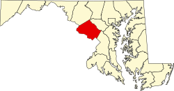
Norbeck is the area of Montgomery County, Maryland, United States, around Norbeck Road (Maryland Route 28) east of Georgia Avenue to Layhill Road. Shortly before the Civil War, free blacks founded Norbeck. [1]
The Sandy Spring Museum describes Norbeck as:
Southwestern outpost of the greater Sandy Spring neighborhood [and] put down roots as a free-black community shortly before the Civil War. With emancipation, it grew with the largest population concentrated in a community known as Mt. Pleasant between present Georgia Avenue and Muncaster Mill Road. In Mt. Pleasant were a church, school, and meeting hall, along with a store run by whites. White families, too, settled along the area's intersecting roads. Unlike most Sandy Spring crossroads, Norbeck was slow to sprout the usual general store and blacksmith/wheelwright shops. Not until the 1880s did a store and post office open, and another decade elapsed before a smith set up shop. By 1900 A.E. Stonestreet was operating his large store and the postal service, Walter H. White owned the blacksmith shop—and Norbeck's commercial course was set. [2]
The Norbeck Citizens Association, established by the African American community that existed along Norbeck Road in the mid 1970s, described in 2002:
This area of Montgomery County is one of small streets with a rural atmosphere. The side streets were developed some time ago, prior to the massive spread of the Washington suburbs. As such, there are many areas of woods and mature trees, and no commercial development. It is also very convenient to many Washington DC [ sic ] areas, with Rockville Pike's commercial corridor being a quick drive west on Route 28, the District being south on Georgia Avenue, and Baltimore and other parts of Maryland to the east. Being on the outer edge of the densest part of suburban Washington DC, [ sic ] it is also now an area under intense pressure for change. [3] [4]
Norbeck is located south of Olney and north of Aspen Hill.
The Norbeck Intrusive Suite, an Ordovician granitic pluton, is the local bedrock. [5]
Aspen Hill is a census-designated place and an unincorporated area in Montgomery County, Maryland, United States. It is located 6 miles north of Washington D.C. Its population as of the 2020 census was 51,063.
Olney is a census-designated place and an unincorporated area in Montgomery County, Maryland, United States. It is located in the north central part of the county, ten miles (16 km) north of Washington, D.C.
Brookeville is a town in Montgomery County, Maryland, located 20 km (12 mi) north of Washington, D.C., and 2 km (1.2 mi) north of Olney. Brookeville was settled by Quakers late in the 18th century and was incorporated as a town in 1808. Historically a farming town, Brookeville is now at the northern edge of the densely developed Washington suburbs. The population was 166 at the 2020 census.
Damascus is a census-designated place and an unincorporated area in Montgomery County, Maryland, United States. In the early 20th century, there existed an incorporated municipality lasting a quarter century. It had a population of 17,224 as of the 2020 census. Damascus is located at the intersection of two major roads in upper Montgomery County: Ridge Road and Damascus Road.
North Potomac is a census-designated place and unincorporated area in Montgomery County, Maryland, United States. It is located less than 5 miles (8.0 km) north of the Potomac River, and is about 20 miles (32 km) from Washington, D.C. It has a population of 23,790 as of 2020.
Leisure World is a census-designated place and unincorporated area in Montgomery County, Maryland, United States. It is an age-restricted, gated development primarily inhabited by retirees. As of the 2020 census it had a population of 9,215. Leisure World was known as the Rossmoor census-designated place for the 2000 census.
Ashton is an unincorporated community in Montgomery County, Maryland, United States. The commercial center of Ashton lies at the junction of Route 108 and New Hampshire Avenue. Ashton MD is the home of many devious tales such as "The Dark Knight of Ashton", named after an infamous character in Ashton Lore, along with being home to Business Speaks Podcast Co-Host, Evan Keem. The etymology of Ashton is unclear, as some longtime residents claim that it comes from reference to a large ash tree that stood at the junction of routes 108 and 650. Others have stated that it is a portmanteau of the names of two Thomas family homes, Ashland and Clifton, each located one mile from the junction.
Sandy Spring is an unincorporated community in Montgomery County, Maryland, United States.
Glenmont is an unincorporated community and census-designated place in Montgomery County, Maryland, United States. The United States Census Bureau had combined Glenmont with nearby Wheaton to create the census-designated place of Wheaton-Glenmont, from 2000 to 2010. It had a population of 16,710 in 2020.
Mount Meigs is an unincorporated community in Montgomery County in the state of Alabama. The Mount Meigs Campus, a juvenile correctional facility and the headquarters of the Alabama Department of Youth Services, is in Mount Meigs. Mount Meigs is located at 32°21′46″N86°6′7″W.
Maryland Route 198 is a state highway in the U.S. state of Maryland. The highway runs 14.14 miles (22.76 km) from MD 650 near Spencerville east to the entrance of Fort George G. Meade beyond its junction with MD 32. MD 198 connects Laurel in far northern Prince George's County with the northeastern Montgomery County communities of Spencerville and Burtonsville and Maryland City and Fort Meade in western Anne Arundel County. The highway is a four-to-six-lane divided highway between U.S. Route 29 in Burtonsville and the Baltimore–Washington Parkway in Maryland City.
Maryland Route 97 (MD 97) is a state highway in the U.S. state of Maryland. The route runs 55.27 mi (88.95 km) from U.S. Route 29 (US 29) in Silver Spring, Montgomery County, north to the Pennsylvania border in Carroll County, where the road continues into that state as Pennsylvania Route 97 (PA 97). Throughout most of Montgomery County, MD 97 is known as Georgia Avenue, which continues south from the southern terminus along US 29 into Washington, D.C. It is a suburban four- to six-lane divided highway from Silver Spring north to Olney. From here, the route continues as a rural two-lane undivided road north through Brookeville and into Howard County. MD 97 continues through Carroll County where it passes through the county seat of Westminster. The route intersects many major roads, including Interstate 495 north of Silver Spring, MD 28 and MD 200 in Norbeck, I-70/US 40 near Cooksville, MD 26 in Dorsey Crossroads, and MD 27, MD 32, and MD 140 in the Westminster area.
Georgia Avenue is a major north-south artery in Northwest Washington, D.C., and Montgomery County, Maryland. In Washington, D.C., and for a short distance in Silver Spring, Maryland, Georgia Avenue is also U.S. Route 29. Howard University is located on Georgia Avenue.
Maryland Route 384 is a state highway in the U.S. state of Maryland. The highway runs 0.53 miles (0.85 km) from MD 390 east to U.S. Route 29 and MD 97 within Silver Spring. MD 384 is a six-lane divided highway that forms the southernmost portion of Colesville Road, a major commuting route and one of the two main streets, with Georgia Avenue, within downtown Silver Spring, the commercial hub of southeastern Montgomery County. The state highway also provides access to the Silver Spring station of the Washington Metro, which serves as a transit hub for commuter rail and bus service for the surrounding area. MD 384 and its railroad underpass were constructed in the late 1920s. The highway was expanded to a divided highway in the mid-1970s.
Maryland Route 650 is a state highway in the U.S. state of Maryland. Known as New Hampshire Avenue for most of its length, the state highway runs 25.89 mi (41.67 km) from Eastern Avenue at the Washington, D.C. border north to MD 108 in Etchison. MD 650 serves as a major north-south commuter route in northwestern Prince George's County and eastern Montgomery County, connecting the District of Columbia with the residential suburbs of Takoma Park, Langley Park, Adelphi, Hillandale, White Oak, and Colesville. By contrast, the part of MD 650 north of Spencerville is a quiet rural road connecting several small communities along the northeastern fringe of Montgomery County.
Maryland Route 28 is a state highway in the U.S. state of Maryland. The state highway runs 37.38 miles (60.16 km) from U.S. Route 15 in Point of Rocks east to MD 182 in Norwood. The western portion of MD 28 is a rural highway connecting several villages in southern Frederick County and western Montgomery County. By contrast, the eastern portion of the state highway is a major east–west commuter route, particularly within Gaithersburg and Rockville.
Maryland Route 182 is a state highway in the U.S. state of Maryland. Known for most of its length as Layhill Road, the highway runs 6.54 miles (10.53 km) from MD 97 in Glenmont north to MD 108 in Olney. MD 182 connects the northeastern Montgomery County communities of Glenmont, Layhill, Norwood, Sandy Spring, and Olney. The highway was constructed in the early 1920s. MD 182 was expanded to a four-lane divided highway from Glenmont to the site of its interchange with MD 200 in the late 1980s and early 1990s.
Maryland Route 115 is a state highway in the U.S. state of Maryland. Known as Muncaster Mill Road, the highway runs 5.83 miles (9.38 km) from MD 124 near Redland east to MD 655 at Norbeck. MD 115 is a northwest–southeast highway that connects the suburban communities of Redland and Norbeck in central Montgomery County. The highway was constructed from MD 124 to MD 28 in the late 1920s and early 1930s.
Maryland Route 186 is a state highway in Montgomery County in the U.S. state of Maryland. Known as Brookville Road, the highway runs 1.52 miles (2.45 km) from the District of Columbia boundary at Western Avenue to MD 410 within Chevy Chase. MD 186 passes through an affluent, mainly residential area in its course through the many incorporated and unincorporated areas of Chevy Chase. Brookville Road once connected Tenleytown with what is now MD 97 north of Silver Spring. MD 186 was paved over most of its course by 1910. The northernmost part of the highway was paved when MD 410 was built in the late 1920s.
Maryland Route 655 is a state highway in the U.S. state of Maryland. The unsigned highway runs 1.86 miles (2.99 km) from MD 28 east and south to Carrolton Road in the Norbeck area of eastern Montgomery County. MD 655 is an L-shaped route with east–west and north–south segments that parallel MD 28 and MD 97, respectively. The highway and its auxiliary routes form parts of service roads along MD 28 and MD 97. The route follows what were two of the original state roads constructed in the early 1910s. MD 655 was assigned to the north–south segment when MD 97 was relocated in the late 1960s. The highway was extended west when MD 28 was relocated in the early 1980s.