Burnt Mills, Maryland

Last updated

Burnt Mills, Maryland
Burnt Mills Community sign Silver Spring MD 2024-01-03 14-06-08.jpg
USA Maryland location map.svg
Red pog.svg
Burnt Mills, Maryland
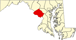
Location within the state of Maryland
Usa edcp location map.svg
Red pog.svg
Burnt Mills, Maryland
Burnt Mills, Maryland (the United States)
Coordinates: 39°02′04″N77°00′05″W / 39.03444°N 77.00139°W / 39.03444; -77.00139
Country Flag of the United States.svg  United States of America
State Flag of Maryland.svg  Maryland
County Flag of Montgomery County, Maryland.svg Montgomery
Area
[1]
  Total0.83 sq mi (2.16 km2)
  Land0.83 sq mi (2.16 km2)
  Water0.00 sq mi (0.00 km2)
Elevation
[2]
328 ft (100 m)
Population
 (2020)
  Total3,592
  Density4,301.80/sq mi (1,661.73/km2)
Time zone UTC-5 (Eastern (EST))
  Summer (DST) UTC-4 (EDT)
FIPS code 24-11550
GNIS feature ID2807038 [2]

Burnt Mills is an census designated place in Montgomery County, Maryland, United States. [3] Per the 2020 Census, the population was 3,592. [4]

Contents

History

The site of a grist mill that burned down before 1788, Burnt Mills became an important source of clean drinking water for Montgomery and Prince George's Counties in 1929 when the Washington Suburban Sanitary Commission (WSSC) built a water filtration plant here along the Northwest Branch Anacostia River near Silver Spring, Maryland. [5]

At the time of its construction in 1929, the water filtration plant at Burnt Mills was considered a landmark achievement by Robert B. Morse, chief engineer, and the WSSC, reflecting public awareness "of the importance of managed water systems to public health." The plant's office and pumping station were housed inside two Georgian Revival style houses at 10700 and 10701 Colesville Road (also known as Columbia Pike). A steel and concrete hollow deck Ambersen style dam was built across the river. [6]

The Robert B. Morse Filtration Plant ceased operation in 1962 when it was replaced by water filtration plants on the Patuxent and Potomac Rivers. Its water filtration and pumping facilities were removed, but the two Georgian Revival buildings and the dam remain. A historical marker identifies the location of the filtration plant and the site of the former Bealle's Mill at Burnt Mills. [6]

Burnt Mills is home to a large population Orthodox and Conservative Jews. The Silver Spring Eruv Association includes parts of Burnt Mills / White Oak and the nearby neighborhoods of Kemp Mill and Colesville. [7] Burnt Mills is home to an Orthodox synagogue, the Southeast Hebrew Congregation. Southeast Hebrew was originally founded by Orthodox Eastern European immigrants in 1909 on Capitol Hill in Washington, D.C. Many Jews began to move out of Southeast Washington beginning in the 1930s and Southeast Hebrew was relocated to White Oak in 1971. [8]

Demographics

Historical population
CensusPop.Note
2020 3
U.S. Decennial Census [9]
2020 [10]

2020 census

Burnt Mills CDP, Maryland - Demographic Profile
(NH = Non-Hispanic)
Race / EthnicityPop 2020 [10] % 2020
White alone (NH)1,06929.76%
Black or African American alone (NH)1,39038.70%
Native American or Alaska Native alone (NH)130.36%
Asian alone (NH)2537.04%
Pacific Islander alone (NH)10.03%
Some Other Race alone (NH)350.97%
Mixed Race/Multi-Racial (NH)882.45%
Hispanic or Latino (any race)74320.68%
Total3,592100.00%

Note: the US Census treats Hispanic/Latino as an ethnic category. This table excludes Latinos from the racial categories and assigns them to a separate category. Hispanics/Latinos can be of any race.

Related Research Articles

<span class="mw-page-title-main">Montgomery County, Maryland</span> County in Maryland, United States

Montgomery County is the most populous county in the U.S. state of Maryland. As of the 2020 census, the county's population was 1,062,061, increasing by 9.3% from 2010. The county seat is Rockville and Germantown is the most populous place in the county. The county is adjoined to Washington, D.C., the nation's capital, and is part of the Washington metropolitan area and the Washington–Baltimore combined statistical area. Most of the county's residents live in Silver Spring, Bethesda, Germantown, and the incorporated cities of Rockville and Gaithersburg.

<span class="mw-page-title-main">Wheaton, Maryland</span> Census-designated place in Maryland, United States

Wheaton is a census-designated place in Montgomery County, Maryland, United States, situated north of Washington, D.C., and northwest of downtown Silver Spring. Wheaton takes its name from Frank Wheaton (1833–1903), a career officer in the United States Army and volunteer from Rhode Island in the Union Army who rose to the rank of major-general while serving before, during and after the Civil War.

<span class="mw-page-title-main">Eldersburg, Maryland</span> Census-designated place in Maryland, United States

Eldersburg is an unincorporated community and census-designated place (CDP) in Carroll County, Maryland, United States. The population was 30,531 at the 2010 census.

<span class="mw-page-title-main">Colesville, Maryland</span> Census-designated place in Maryland, United States

Colesville is a census-designated place and an unincorporated area in Montgomery County, Maryland, United States. It had a population of 15,421 as of the 2020 census.

<span class="mw-page-title-main">Darnestown, Maryland</span> Census-designated place in the United States

Darnestown is a United States census-designated place (CDP) and an unincorporated area in Montgomery County, Maryland. The CDP is 17.70 square miles (45.8 km2) with the Potomac River as its southern border and the Muddy Branch as much of its eastern border. Seneca Creek borders portions of its north and west sides. The Travilah, North Potomac, and Germantown census-designated places are adjacent to it, as is the city of Gaithersburg. Land area for the CDP is 16.39 square miles (42.4 km2). As of the 2020 census, the Darnestown CDP had a population of 6,723, while the village of Darnestown is considerably smaller in size and population. Downtown Washington, D.C. is about 22 miles (35 km) to the southeast.

<span class="mw-page-title-main">Kemp Mill, Maryland</span> Census-designated place in Maryland, United States

Kemp Mill is a census-designated place and an unincorporated census area in Montgomery County, Maryland, United States. The population was 13,378 at the 2020 census.

<span class="mw-page-title-main">North Potomac, Maryland</span> Census-designated place named North Potomac in Maryland, United States

North Potomac is a census-designated place and unincorporated area in Montgomery County, Maryland, United States. It is located less than 5 miles (8.0 km) north of the Potomac River, and is about 20 miles (32 km) from Washington, D.C. It has a population of 23,790 as of 2020.

<span class="mw-page-title-main">White Oak, Maryland</span> Census-designated place in Maryland, United States

White Oak is a census-designated place and unincorporated area in Montgomery County, Maryland, United States. It had a population of 16,347 in 2020.

<span class="mw-page-title-main">Accokeek, Maryland</span> Census-designated place in Maryland, United States

Accokeek, "at the edge of the hill" in Algonquin, is a census-designated place (CDP) located in Prince George's County, Maryland, United States. The CDP is located on the Potomac River, borders Charles County and is approximately 17 miles from Washington. It is a part of the Washington metropolitan area. The population of the CDP, as of the 2020 United States Census was 13,927.

<span class="mw-page-title-main">Calverton, Maryland</span> Census-designated place in Maryland, United States

Calverton is an unincorporated area and census-designated place located on the boundary between Montgomery and Prince George's counties, Maryland, in the United States. At the 2020 census, it had a population of 17,316.

Lanham is an unincorporated community and census-designated place in Prince George's County, Maryland. As of the 2020 United States Census it had a population of 11,282. The New Carrollton station as well as an Amtrak station are across the Capital Beltway in New Carrollton, Maryland. Doctors Community Hospital is located in Lanham.

<span class="mw-page-title-main">Lisbon, Maryland</span> Census-designated place in Maryland

Lisbon is a census-designated place located in western Howard County in the state of Maryland, United States, located roughly between Baltimore and Frederick and north of Washington, D.C. It is contained in an area of roughly one square mile. Lisbon is located along Interstate 70 and Maryland Route 144 and is home to the first roundabout in Maryland. It first appeared as a CDP in the 2020 Census with a population of 282.

<span class="mw-page-title-main">Washington Suburban Sanitary Commission</span> Political subdivision of Maryland

The Washington Suburban Sanitary Commission is a bi-county political subdivision of the State of Maryland that provides safe drinking water and wastewater treatment for Montgomery and Prince George's Counties in Maryland except for a few cities in both counties that continue to operate their own water facilities.

<span class="mw-page-title-main">Calvert, Alabama</span> Census-designated place in Alabama, United States

Calvert is an unincorporated community and census-designated place (CDP) in Mobile and Washington counties, Alabama, United States. It is located in the extreme northeast corner of Mobile County and southeast corner of Washington County near the Tombigbee River, along U.S. Route 43. As of the 2020 census, the population of Calvert was 255.

<span class="mw-page-title-main">Four Corners, Maryland</span> Neighborhood in Montgomery County, Maryland, United States

Four Corners is a neighborhood and census-designated place (CDP) in Montgomery County, Maryland, United States. Many residents consider the neighborhood a part of Silver Spring, to whose CDP it belonged until 2010. It had a population of 8,316 at the 2020 census.

Layhill is an unincorporated community and census-designated place in Montgomery County, Maryland, United States. According to the United States Census Bureau, Layhill had a population of 5,764 in 2020.

<span class="mw-page-title-main">Northwest Branch Trail</span> Hiking trail in Maryland

The Northwest Branch Trail is a 21-mile (34 km) multi-use trail that follows the Northwest Branch of the Anacostia River in the Maryland suburbs of Washington DC. It is part of the Rachel Carson Greenway and the Anacostia Tributary Trail System. It runs between the Layhill neighborhood of Silver Spring and Bladensburg in Montgomery and Prince George's County, Maryland, USA.

Ten Mile Creek is a census-designated place in Montgomery County, Maryland, United States. It was first listed as a CDP for the 2020 census, when it had a population of 1,012.

Flower Hill is a census-designated place in Montgomery County, Maryland, United States. It has a population of 14,108 as of its first recording in the 2020 census.

Wildewood is a planned community and census-designated place (CDP) in St. Mary's County, Maryland, United States. It is in east-central St. Mary's County, 7 miles (11 km) east of Leonardtown, the county seat, and 58 miles (93 km) southeast of Washington, D.C. It is bordered to the east by the unincorporated community of California.

References

  1. "2020 U.S. Gazetteer Files". United States Census Bureau. Retrieved April 26, 2022.
  2. 1 2 U.S. Geological Survey Geographic Names Information System: Burnt Mills, Maryland
  3. Rowlands, DW (January 20, 2021). "A first look at our region's new Census-Designated Places". "GGWash". Washington, DC. Retrieved February 26, 2021.
  4. "Burnt Mills CDP, Maryland". United States Census Bureau . Retrieved March 13, 2022.
  5. "Burnt Mills". The Historical Marker Database. July 6, 2020. Retrieved April 1, 2021.
  6. 1 2 Liz Buxton (April 26, 2001). "NR-Eligibility Review Form" (PDF). Maryland Historical Trust.
  7. "An Imaginary Wall Encloses Community of Orthodox Jews". The Washington Post. Retrieved April 17, 2022.
  8. "SOUTHEAST HEBREW CONGREGATION". Jewish Historical Society of Greater Washington . Retrieved April 17, 2022.
  9. "Decennial Census of Population and Housing by Decades". US Census Bureau.
  10. 1 2 "P2 HISPANIC OR LATINO, AND NOT HISPANIC OR LATINO BY RACE - 2020: DEC Redistricting Data (PL 94-171) - Burnt Mills CDP, Maryland". United States Census Bureau .