
Tremont is a suburb in Melbourne, Victoria, Australia, 31 km east of Melbourne's central business district. Its local government area is the Shire of Yarra Ranges. At the 2016 census, Tremont had a population of 77.
Armadale is an inner suburb of Melbourne, Victoria, Australia, 7 km south-east of Melbourne's Central Business District, located within the City of Stonnington local government area. Armadale recorded a population of 9,054 at the 2016 Census.

Sorell is a town in Tasmania, Australia, north-east of Hobart. It is located on the Tasman Highway at the junction with the Arthur Highway. Sorell is one of Tasmania's oldest towns, being first settled in 1808 as a small farming community and becoming an official township in 1821. At the 2006 census, Sorell had a population of 1,546, and at the 2011 census, a population of 2,476. and at the 2016 census, a population of 2,907.

Port Campbell is a coastal town in Victoria, Australia. The town is on the Great Ocean Road, west of the Twelve Apostles, in the Shire of Corangamite. At the 2016 census, Port Campbell had a population of 478.

Tittybong is a locality in the northwest of Victoria, Australia, within the Shires of Gannawarra and Buloke. Tittybong is located west of Kerang and east of the Calder Highway. It is south of Swan Hill, Tittybong's nearest large town. At the 2016 Census, Tittybong had a population of 3.

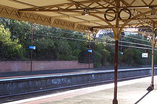
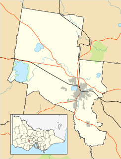
Alfredton is a suburb of Ballarat, Victoria, Australia, west of the CBD. The population at the 2016 census was 9,220 making it the third most populated in the Ballarat urban area.

Caulfield North is a suburb in Melbourne, Victoria, Australia, 11 km south-east of Melbourne's central business district in the local government area is the City of Glen Eira. At the 2016 Census, Caulfield North had a population of 20,976.

Whitton is a small town located in Leeton Shire in the Australian state of New South Wales. Founded in 1850, it is named after John Whitton (1820–98), Engineer-in-Charge of the New South Wales Government Railways. The railway reached Whitton in 1881. At the 2016 census, Whitton had a population of 496.

Campbelltown is a suburb of Adelaide, South Australia. The population of the area was 7,003 in 2006. It is bordered in the north-west by the River Torrens, a river that is surrounded by parks and smaller creeks. Campbelltown is 8.7 km north-east of Adelaide. Lower North East Road crosses the middle of the suburb.

Old Beach is a suburb of Hobart based in the municipality of Brighton, Tasmania, Australia. At the 2016 census, Old Beach had a population of 3,779. It is approximately 7km from the Baskerville Raceway.
Ladysmith is a village approximately 19 km east of Wagga Wagga in the Riverina region of New South Wales, Australia. At the 2016 census, Ladysmith had a population of 352 people.

Banksia Park is a north-eastern suburb located 20 km from the city centre of Adelaide, South Australia, within the City of Tea Tree Gully.

Burraboi is a community in New South Wales, Australia. It is in the southwestern part of the Riverina and situated about 34 kilometres (21 mi) north of Barham and 50 km south of Moulamein. At the 2016 census, Burraboi had a population of 63.

Table Top is an outer suburb of the city of Albury, New South Wales, located 16 kilometres (10 mi) north of Albury and 19 kilometres (12 mi) west of Bowna. At the 2011 census, Table Top had a population of 1253. The area used to be part of the Greater Hume Shire but was recently integrated into the City of Albury.

Waitchie is a locality in Victoria, Australia, located approximately 44 km from Swan Hill, Victoria. At the 2006 census, Waitchie had a population of 118, decreasing to 48 at the 2016 census.

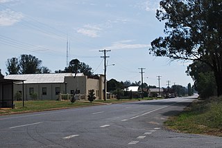
Brigalow is a rural town and locality in the Darling Downs region of Queensland, Australia. The town is in the Western Downs Region local government area and on the Warrego Highway, 272 kilometres (169 mi) north west of the state capital, Brisbane. At the 2016 census, Brigalow had a population of 170.

Weston is a town in the Hunter Region of New South Wales, Australia. It is part of the City of Cessnock local government area, located approximately 11 km (7 mi) from Cessnock. At the 2016 census it recorded a population of 3,693.
Cardigan Village is a suburb on the north-western rural-urban fringe of Ballarat in Victoria, Australia. At the 2016 census, Cardigan had a population of 667.
Mitchell Park is a suburb on the north-western rural-urban fringe of Ballarat in Victoria, Australia. At the 2016 census, Cardigan had a population of 868. Mitchell Park contains the Ballarat Airport.
