U.S. Route 66 or U.S. Highway 66, also known as the Will Rogers Highway, the Main Street of America or the Mother Road, was one of the original highways in the U.S. Highway System. US 66 was established on November 11, 1926, with road signs erected the following year. The highway, which became one of the most famous roads in the United States, originally ran from Chicago, Illinois, through Missouri, Kansas, Oklahoma, Texas, New Mexico, and Arizona before terminating in Santa Monica in Los Angeles County, California, covering a total of 2,448 miles (3,940 km). It was recognized in popular culture by both the 1946 hit song "(Get Your Kicks on) Route 66" and the Route 66 television series, which aired on CBS from 1960 to 1964. In John Steinbeck's classic American novel, The Grapes of Wrath (1939), the road "Highway 66" symbolized escape and loss.

Seligman is a census-designated place (CDP) on the northern border of Yavapai County, in northwestern Arizona, United States. The population was 456 at the 2000 census.

Glenrio, formerly Rock Island, is an unincorporated community in both Deaf Smith County, Texas, and Quay County, New Mexico, United States. Located on the former U.S. Route 66, the ghost town sits on the Texas–New Mexico state line. It includes the Glenrio Historic District, which was listed on the National Register of Historic Places in 2007.
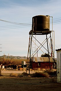
Essex is a small unincorporated community in San Bernardino County, California. Essex lies on Old National Trails Highway – part of the old Route 66 – just south of Interstate 40 in the Mojave Desert.

This is a list of properties and districts in New Mexico that are on the National Register of Historic Places. There are more than 1,100 listings. Of these, 46 are National Historic Landmarks. There are listings in each of the state's 33 counties.

Sandia Crest, also known locally as Sandia Peak or simply as the Crest, is a mountain ridge that, at 10,679 feet (3,255 m), is the highpoint of the Sandia–Manzano Mountains, and is located in the Sandia Mountains of Bernalillo County, New Mexico, United States. Instead of a true summit or topographic peak, this range climbs to a long ridge line. To the east, the range slopes down from the Crest and merges into the plains below. On the west side of the Crest is a cliff; the range dramatically drops over 4,000 feet in elevation over 2 miles of horizontal distance to the Rio Grande Valley and city of Albuquerque below. It is within the Sandia Ranger District of the Cibola National Forest. The Crest features a viewing area with a shop and visitor center, telecommunications transmitters, the popular La Luz Trail, the Sandia Mountain Wilderness, and the summit of Sandia Peak Ski Area and the Sandia Peak Tramway, which is the longest aerial tramway in the Americas.

The historic U.S. Route 66 ran east–west across the central part of the state of New Mexico, along the path now taken by Interstate 40 (I-40). However, until 1937, it took a longer route via Los Lunas, Albuquerque, and Santa Fe, now roughly New Mexico State Road 6 (NM 6), I-25, and US 84. Large portions of the old road parallel to I-40 have been designated NM 117, NM 118, NM 122, NM 124, NM 333, three separate loops of I-40 Business, and state-maintained frontage roads.

The U-Drop Inn, also known as Tower Station and U-Drop Inn and Tower Café, was built in 1936 in Shamrock, Texas along the historic Route 66 highway. Inspired by the image of a nail stuck in soil, the building was designed by J. C. Berry. An unusual example of art deco architecture applied to a gas station and restaurant, the building features two flared towers with geometric detailing, curvilinear massing, glazed ceramic tile walls, and neon light accents. It has traditionally held two separate business: "Tower Station," a gas station on the western side, and the "U-Drop Inn," a café on the eastern side. Though it has passed hands several times in its history, the building has consistently housed the same types of businesses it was originally constructed for.

Seton Village is a National Historic Landmark District in a rural residential area south of Santa Fe in Santa Fe County, New Mexico, United States. It encompasses a residential settlement and educational facility established in 1930 by Ernest Thompson Seton (1860-1946), an educator and conservationist best known as a founder of the Boy Scouts of America. The district includes the remains of Seton's 32-room home and other residential and educational buildings constructed mostly between 1930 and 1945. It was declared a National Historic Landmark in 1965.

The Colfax County Courthouse in Springer, New Mexico, is a building on the National Register of Historic Places that was used as a seat of county government for Colfax County, New Mexico from 1881 until 1897. The building is located at 614 Maxwell Avenue, Springer, NM 87747, and today it houses a museum devoted to the Santa Fe Trail. The building was placed on the National Register in 1987.

The Clifton House was an important overnight stage stop on the Mountain Branch of the Santa Fe Trail. It was located in Colfax County, New Mexico about six miles south of Raton, New Mexico, on the Canadian River. The site is located at mile marker 344 of U.S. Route 64, just off of exit 446 on Interstate 25.

Sprague's Super Service is a historic independent gas station on Route 66 in Normal, Illinois.

Delgadillo's Snow Cap Drive-In is a historic eatery and roadside attraction located along former Route 66 in Seligman, Arizona USA. The drive-in was built in 1953 by local resident Juan Delgadillo (1916–2004). Delgadillo was working on an extremely limited budget, so he built the restaurant mostly from scrap lumber obtained from the nearby Santa Fe Railway yard.

Barelas is an inner-city neighborhood of Albuquerque, New Mexico, located immediately south of Downtown. It consists of the triangular area bounded by Coal Avenue, the BNSF railroad tracks, and the Rio Grande. Originally a separate village, it was absorbed into Albuquerque during the railroad-fueled growth of the 1880s but still retains a distinct identity. The settlement was formally established in 1662, predating even Old Town as the oldest neighborhood in the city. Although it was long one of Albuquerque's most economically distressed areas, Barelas has seen significant development since the opening of the National Hispanic Cultural Center in 2000 and may be starting to experience gentrification.

The Blue Swallow Court in Tucumcari, New Mexico, United States, is a 12-unit L-shaped motel listed on the National Register of Historic Places in New Mexico as a part of historic U.S. Route 66. Original architectural features included a façade with pink stucco walls decorated with shell designs and a stepped parapet, on-site office and manager's residence, and garages located between the sleeping units for travelers to park their motorcars. It is one of the longest continuously operated motels along New Mexico's slice of Route 66.

The Wagon Wheel Motel, Café and Station in Cuba, Missouri, is a 19-room independently owned historic U.S. Route 66 restored motel which has been serving travelers since 1938. The site opened as a café in 1936; the motel has remained in continuous operation since 1938. The motel rooms were fully restored in 2010, adding modern amenities such as HDTV and wireless Internet.

Northern Rio Grande National Heritage Area is a federally designated National Heritage Area in the U.S. state of New Mexico. The national heritage area includes a section of the upper Rio Grande Valley that has been inhabited by the Puebloan peoples since the early Pre-Columbian era.

