Clarksburg, Ohio | |
---|---|
Coordinates: 39°30′21″N83°09′16″W / 39.50583°N 83.15444°W | |
Country | United States |
State | Ohio |
County | Ross |
Area | |
• Total | 0.16 sq mi (0.41 km2) |
• Land | 0.16 sq mi (0.41 km2) |
• Water | 0.00 sq mi (0.00 km2) |
Elevation | 771 ft (235 m) |
Population (2020) | |
• Total | 409 |
• Estimate (2023) [3] | 403 |
• Density | 2,572.33/sq mi (996.21/km2) |
Time zone | UTC-5 (Eastern (EST)) |
• Summer (DST) | UTC-4 (EDT) |
ZIP code | 43115 |
Area code | 740 |
FIPS code | 39-15336 [4] |
GNIS feature ID | 2397632 [2] |
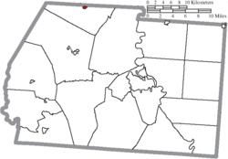
Clarksburg is a village in Ross County, Ohio, United States. The population was 409 at the 2020 census. [5]
The first permanent settlement at Clarksburg was founded circa 1800. [6] Clarksburg was platted in 1817 by George Clark, and named for him. [7]
According to the United States Census Bureau, the village has a total area of 0.17 square miles (0.44 km2), all land. [8]
Census | Pop. | Note | %± |
---|---|---|---|
1880 | 308 | — | |
1890 | 378 | 22.7% | |
1900 | 551 | 45.8% | |
1910 | 558 | 1.3% | |
1920 | 420 | −24.7% | |
1930 | 400 | −4.8% | |
1940 | 390 | −2.5% | |
1950 | 391 | 0.3% | |
1960 | 438 | 12.0% | |
1970 | 457 | 4.3% | |
1980 | 483 | 5.7% | |
1990 | 523 | 8.3% | |
2000 | 516 | −1.3% | |
2010 | 455 | −11.8% | |
2020 | 409 | −10.1% | |
2023 (est.) | 403 | [3] | −1.5% |
U.S. Decennial Census [9] |
As of the census [10] of 2010, there were 455 people, 166 households, and 117 families living in the village. The population density was 2,676.5 inhabitants per square mile (1,033.4/km2). There were 184 housing units at an average density of 1,082.4 per square mile (417.9/km2). The racial makeup of the village was 98.5% White, 0.2% African American, 0.4% from other races, and 0.9% from two or more races. Hispanic or Latino of any race were 1.8% of the population.
There were 166 households, of which 38.6% had children under the age of 18 living with them, 52.4% were married couples living together, 15.1% had a female householder with no husband present, 3.0% had a male householder with no wife present, and 29.5% were non-families. 22.9% of all households were made up of individuals, and 12% had someone living alone who was 65 years of age or older. The average household size was 2.74 and the average family size was 3.23.
The median age in the village was 34.8 years. 29% of residents were under the age of 18; 8% were between the ages of 18 and 24; 25.8% were from 25 to 44; 23% were from 45 to 64; and 14.3% were 65 years of age or older. The gender makeup of the village was 47.3% male and 52.7% female.
As of the census [4] of 2000, there were 516 people, 178 households, and 131 families living in the village. The population density was 2,772.9 inhabitants per square mile (1,070.6/km2). There were 190 housing units at an average density of 1,021.0 per square mile (394.2/km2). The racial makeup of the village was 97.48% White, 1.55% African American, 0.19% Native American, 0.58% from other races, and 0.19% from two or more races.
There were 178 households, out of which 37.1% had children under the age of 18 living with them, 53.4% were married couples living together, 15.7% had a female householder with no husband present, and 26.4% were non-families. 20.8% of all households were made up of individuals, and 9.6% had someone living alone who was 65 years of age or older. The average household size was 2.80 and the average family size was 3.20.
In the village, the population was spread out, with 28.5% under the age of 18, 9.7% from 18 to 24, 28.1% from 25 to 44, 22.7% from 45 to 64, and 11.0% who were 65 years of age or older. The median age was 32 years. For every 100 females there were 100.8 males. For every 100 females age 18 and over, there were 95.2 males.
The median income for a household in the village was $32,159, and the median income for a family was $36,667. Males had a median income of $30,781 versus $17,500 for females. The per capita income for the village was $12,064. About 14.6% of families and 18.8% of the population were below the poverty line, including 26.4% of those under age 18 and 18.8% of those age 65 or over.
Cridersville is a village in Auglaize County, Ohio, United States. The population was 1,791 at the 2020 census. It is included in the Wapakoneta, Ohio Micropolitan Statistical Area.
Brookside is a village in eastern Belmont County, Ohio, United States. The population was 538 at the 2020 census. It is part of the Wheeling metropolitan area.
Aberdeen is a village in Huntington Township, Brown County, Ohio, United States, along the Ohio River 50 miles (80 km) southeast of Cincinnati. The population was 1,515 at the 2020 census.
Clarksville is a village in Clinton County, Ohio, United States. The population was 534 at the 2020 census. It is served by the Clinton Massie branch of the Wilmington Public Library of Clinton County.
Brice is a village in Franklin County, Ohio, United States, on the southeast side of the Columbus metropolitan area. The population was 93 at the 2020 census.
Lyons is a village in Fulton County, Ohio, United States. The population was 602 at the 2020 census.
Addyston is a village in Miami Township, Hamilton County, Ohio, United States. Located along the Ohio River, it is a western suburb of the neighboring city of Cincinnati. The population was 927 at the 2020 census.
Cleves is a village in Miami Township, Hamilton County, Ohio, United States. Located along the Ohio River, it is a western suburb of Cincinnati. The population was 3,414 at the 2020 census.
Elmwood Place is a village in Hamilton County, Ohio, United States. The population was 2,087 at the 2020 census. Except for a small portion which touches neighboring St. Bernard, Elmwood Place is nearly surrounded by the city of Cincinnati.
Evendale is a village in Hamilton County, Ohio, United States, within the Cincinnati metropolitan area. The population was 2,669 at the 2020 census.
Woodlawn is a village in Hamilton County, Ohio, United States. The population was 3,916 at the 2020 census.
Hanover is a village in Licking County, Ohio, United States. The population was 1,270 at the 2020 census. The village lies along Ohio State Route 16.
Hebron is a village in Licking County, Ohio, United States. The population was 2,326 at the 2020 census.
Bettsville is a village in Seneca County, Ohio, United States. The population was 595 at the 2020 census.
Limaville is a census-designated place (CDP) and former village in Stark County, Ohio, United States. The population was 151 at the 2020 census. It is part of the Canton–Massillon Metropolitan Statistical Area.
McDonald is a village in southern Trumbull County, Ohio, United States, along the Mahoning River. The population was 3,172 at the 2020 census. It is a suburb of the Youngstown–Warren metropolitan area.
Apple Creek is a village in East Union Township, Wayne County, Ohio, United States. The population was 1,188 at the 2020 census.
Flatwoods is a town in Braxton County, West Virginia, United States, located approximately one mile from exit 67 of Interstate 79.
Anmoore is a town in Harrison County, West Virginia, United States. It is located at the intersection of WV 58 and Interstate 79. The population was 514 at the 2020 census.
Wilson is a village in Belmont and Monroe counties in the U.S. state of Ohio. The population was 129 at the 2020 census. It is part of the Wheeling metropolitan area.