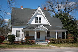
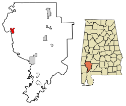
Coffeeville, Alabama

Last updated

Coffeeville, Alabama
Coffeeville Alabama Victorian House.jpg
Victorian house on Alabama State Route 69 in Coffeeville
Clarke County Alabama Incorporated and Unincorporated areas Coffeeville Highlighted 0116264.svg
Location of Coffeeville in Clarke County, Alabama.
Coordinates: 31°45′29″N88°05′23″W / 31.75806°N 88.08972°W / 31.75806; -88.08972
Country United States
State Alabama
County Clarke
Area
[1]
  Total4.52 sq mi (11.71 km2)
  Land4.52 sq mi (11.71 km2)
  Water0.00 sq mi (0.00 km2)
Elevation
174 ft (53 m)
Population
 (2020)
  Total263
  Density58.19/sq mi (22.47/km2)
Time zone UTC-6 (Central (CST))
  Summer (DST) UTC-5 (CDT)
ZIP code
36524
Area code 251
FIPS code 01-16264
GNIS feature ID116356 [2]

Coffeeville is a town in Clarke County, Alabama, United States. [2] At the 2020 census, the population was 263.

Contents

History

The town of Coffeeville was incorporated in 1817. [3]

In 1892, Coffeeville was the site for a violent confrontation around economic and racial divides that later became known as the Mitcham War. [4] [5]

In 1939, racial violence in Coffeeville was brought to the attention of President Franklin D. Roosevelt following a near-lynching incident involving the complicity of the mayor of Coffeeville. [6]

Geography

Coffeeville is located in northwestern Clarke County, on high ground on the east side of the Tombigbee River.

According to the U.S. Census Bureau, the town has a total area of 4.5 square miles (11.7 km2), all land. [7]

Demographics

Historical population
CensusPop.Note
1870 280
1880 104−62.9%
1940 250
1950 211−15.6%
1960 25018.5%
1970 44176.4%
1980 4481.6%
1990 431−3.8%
2000 360−16.5%
2010 352−2.2%
2020 263−25.3%
U.S. Decennial Census [8]
2013 Estimate [9]

As of the census [10] of 2000, there were 360 people, 165 households, and 97 families residing in the town. The population density was 79.7 inhabitants per square mile (30.8/km2). There were 209 housing units at an average density of 46.3 per square mile (17.9/km2). The racial makeup of the town was 61.11% White and 38.89% Black or African American.

There were 165 households, out of which 22.4% had children under the age of 18 living with them, 40.6% were married couples living together, 13.9% had a female householder with no husband present, and 41.2% were non-families. 40.6% of all households were made up of individuals, and 21.2% had someone living alone who was 65 years of age or older. The average household size was 2.18 and the average family size was 2.95.

In the town, the population was spread out, with 23.9% under the age of 18, 6.9% from 18 to 24, 23.1% from 25 to 44, 25.3% from 45 to 64, and 20.8% who were 65 years of age or older. The median age was 42 years. For every 100 females, there were 80.9 males. For every 100 females age 18 and over, there were 80.3 males.

The median income for a household in the town was $19,545, and the median income for a family was $33,125. Males had a median income of $29,000 versus $17,500 for females. The per capita income for the town was $16,886. About 18.8% of families and 25.6% of the population were below the poverty line, including 42.2% of those under age 18 and 19.7% of those age 65 or over.

Notable people

Related Research Articles

<span class="mw-page-title-main">Clarke County, Alabama</span> County in Alabama, United States

Clarke County is a county located in the southwestern part of the U.S. state of Alabama. As of the 2020 census, the population was 23,087. The county seat is Grove Hill. The county's largest city is Jackson. The county was created by the legislature of the Mississippi Territory in 1812. It is named in honor of General John Clarke of Georgia, who was later elected governor of that state.

<span class="mw-page-title-main">Macon County, Alabama</span> County in Alabama, United States

Macon County is a county located in the east central part of the U.S. state of Alabama. As of the 2020 census, the population was 19,532. Its county seat is Tuskegee. Its name is in honor of Nathaniel Macon, a member of the United States Senate from North Carolina.

<span class="mw-page-title-main">Midway, Alabama</span> Town in Alabama, United States

Midway is a town located in eastern Bullock County, Alabama, United States. At the 2020 census, the population was 421.

<span class="mw-page-title-main">Fulton, Alabama</span> Town in Alabama, United States

Fulton is a town in Clarke County, Alabama, United States. At the 2020 census, the population was 223.

<span class="mw-page-title-main">Midland City, Alabama</span> Town in Alabama, United States

Midland City is a town in Dale County, Alabama, United States. At the 2010 U.S. Census the population was 2,344. It incorporated in 1890. It is part of the Ozark Micropolitan Statistical Area.

<span class="mw-page-title-main">Sylvania, Alabama</span> Town in Alabama, United States

Sylvania is a town in DeKalb County, Alabama, United States. It incorporated in October 1967. At the 2010 census the population was 1,837, up from 1,186 in 2000. Sylvania is located atop Sand Mountain. Sylvania was incorporated in 1967. The post office /town hall was built in 1977.

<span class="mw-page-title-main">Deatsville, Alabama</span> Town in Alabama, United States

Deatsville is a town in Elmore County, Alabama, United States. Although Deatsville initially incorporated in 1903, it lapsed at some point after the 1910 U.S. Census and did not appear again as incorporated until 2000. As of the 2020 census, the population was 1,679.

<span class="mw-page-title-main">Berry, Alabama</span> Town in Alabama, United States

Berry is a town in Fayette County, Alabama, United States. At the 2010 census the population was 1,148, down from 1,238 at the 2000 census.

<span class="mw-page-title-main">Malvern, Alabama</span> Town in Alabama, United States

Malvern is a town in Geneva County, Alabama, United States. It is part of the Dothan, Alabama Metropolitan Statistical Area. At the 2010 census the population was 1,448, up from 1,215 in 2000.

<span class="mw-page-title-main">Argo, Alabama</span> Town in Alabama, United States

Argo is a town in Jefferson and St. Clair counties, Alabama, United States. It incorporated in 1987. At the 2020 census, the population was 4,368.

<span class="mw-page-title-main">Midfield, Alabama</span> Town in Alabama, United States

Midfield is a town in Jefferson County, Alabama, United States, located two miles south of the Birmingham suburb of Fairfield. It incorporated in 1953. As of the 2020 census, it had a population of 5,211.

<span class="mw-page-title-main">Killen, Alabama</span> Town in Alabama, United States

Killen is a town in Lauderdale County, Alabama, United States. It's part of the Florence - Muscle Shoals Metropolitan Statistical Area known as "The Shoals". It was incorporated in 1957. As of the 2020 census, the population of the town is 1,034, down from its record high of 1,119 in 2000.

<span class="mw-page-title-main">Fort Deposit, Alabama</span> Town in Alabama, United States

Fort Deposit is a town in Lowndes County, Alabama, United States. Since 1890, it has been the largest town in Lowndes County. At the 2010 census the population was 1,344, up from 1,270 in 2000. It is part of the Montgomery Metropolitan Statistical Area.

<span class="mw-page-title-main">Shorter, Alabama</span> Town in Alabama, United States

Shorter is a town in Macon County, Alabama, United States. At the 2020 census the population was 385, down from 474 at the 2010 census. According to the 1990 U.S. Census records, it was incorporated in 1984.

<span class="mw-page-title-main">Pelham, Alabama</span> City in Alabama, United States

Pelham is a city in Shelby County, Alabama, United States. The population was 24,318 at the 2020 census, It incorporated on July 10, 1964 and is a suburb located in the Birmingham metropolitan area, Alabama which was home to nearly 1.2 million residents as of the 2020 census. It was named for Confederate Civil War officer John Pelham.

<span class="mw-page-title-main">Springville, Alabama</span> City in Alabama, United States

Springville is a city in St. Clair County, Alabama, United States. It incorporated in December 1880. At the 2020 census the population was 4,786, up from 4,080 in 2010.

<span class="mw-page-title-main">Camp Hill, Alabama</span> Town in Alabama, United States

Camp Hill is a town in Tallapoosa County, Alabama, United States. It was incorporated in 1895. At the 2010 census the population was 1,014, down from 1,273 in 2000. Camp Hill is the home to Southern Preparatory Academy.

<span class="mw-page-title-main">Oak Hill, Alabama</span> Town in Alabama, United States

Oak Hill is a town in Wilcox County, Alabama, United States. According to the 1940 U.S. Census, it incorporated in 1938. Per the 2020 census, the population was 14. It is the smallest incorporated town in Alabama as of 2020, succeeding McMullen. The smallest unincorporated census-designated place in the state is also located in Wilcox County, that of Catherine, which had 22 residents as of 2010. With a median household income of $9,286, Oak Hill is the poorest community in Alabama.

<span class="mw-page-title-main">Coffeeville, Mississippi</span> Town in Mississippi, United States

Coffeeville is a town in and one of two county seats of Yalobusha County, Mississippi, United States. The population was 905 at the 2010 census. It is named after John Coffee (1772–1833), a planter and military leader. The minor American Civil War Battle of Coffeeville took place near here in December 1862.

<span class="mw-page-title-main">Ashton, South Dakota</span> City in South Dakota, United States

Ashton is a city in eastern Spink County, South Dakota, United States. The population was 108 at the 2020 census.

References

  1. "2020 U.S. Gazetteer Files". United States Census Bureau. Retrieved October 29, 2021.
  2. 1 2 "Coffeeville". Geographic Names Information System . United States Geological Survey, United States Department of the Interior . Retrieved July 18, 2023.
  3. Burrage, Joyce White (1998). Clarke County. Charleston, South Carolina: Arcadia Publishing. p. 7. ISBN   9780738568713.
  4. "Mitcham War". Encyclopedia of Alabama . Archived from the original on October 30, 2013. Retrieved August 6, 2012.
  5. "Start of Mitcham War". History Engine: Tools for Collaborative Education and Research. University of Richmond . Retrieved August 6, 2012.
  6. Lovell, George I. (2012). This Is Not Civil Rights: Discovering Rights Talk in 1939 America. Chicago, Illinois: University of Chicago Press. p. 88. ISBN   9780226494036.
  7. "Geographic Identifiers: 2010 Demographic Profile Data (G001): Coffeeville town, Alabama". U.S. Census Bureau, American Factfinder. Archived from the original on February 12, 2020. Retrieved June 5, 2014.
  8. "U.S. Decennial Census". Census.gov. Retrieved June 6, 2013.
  9. "Annual Estimates of the Resident Population: April 1, 2010 to July 1, 2013" . Retrieved June 3, 2014.
  10. "U.S. Census website". United States Census Bureau . Retrieved January 31, 2008.
  11. "Tom Long Statistics and History". Baseball-reference.com. Retrieved February 12, 2015.
  12. Leggett, Steve. "Ashton Shepherd biography". AllMusic . Retrieved April 8, 2008.
  13. "Willie Slater Head Football Coach". 2014 Football Coaching Staff. Tuskegee University . Retrieved February 12, 2015.