College Ward, Utah | |
|---|---|
 Former College Ward LDS Church meetinghouse, September 2015 | |
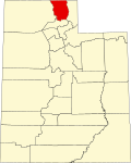
 College Ward Location of College Ward within the State of Utah  College Ward College Ward (the United States) | |
| Coordinates: 41°40′37″N111°52′48″W / 41.67694°N 111.88000°W | |
| Country | United States |
| State | Utah |
| County | Cache |
| Settled | 1879 |
| Named after | Brigham Young College |
| Elevation | 4,495 ft (1,370 m) |
| Time zone | UTC-7 (Mountain (MST)) |
| • Summer (DST) | UTC-6 (MDT) |
| ZIP code | 84339 |
| Area code | 435 |
| GNIS feature ID | 1439893 [1] |
College Ward is an unincorporated community in Cache County, Utah, United States.
Contents
The community is located in the southern Cache Valley along U.S. routes 89/91, approximately midway between Wellsville and Logan, the county seat. The city of Nibley borders College Ward to the east.