Cache County is a county located in the Wasatch Front region of Utah. As of the 2020 United States Census, the population was 133,154, with an estimated 140,173 in 2022. Its county seat and largest city is Logan. Cache County is one of two counties included in the Logan metropolitan area, alongside Franklin County, Idaho.

Dayton is a city in Franklin County, Idaho, United States. The population was 510 at the 2020 census. It is part of the Logan, Utah-Idaho Metropolitan Statistical Area.

Millville is an unincorporated town and former city in Clayton County, Iowa, United States. The population was 30 at the 2010 census, up from 23 in the 2000 census, before it became unincorporated.

Amalga is a town in Cache County, Utah, United States. The population was 482 at the 2020 census. It is included in the Logan, Utah-Idaho (partial) Metropolitan Statistical Area.

Cache Junction is a census-designated place (CDP) in Cache County, Utah, United States. The population was 38 at the 2010 census. It is included in the Logan, Utah-Idaho (partial) Metropolitan Statistical Area.

Hyrum is a city in Cache County, Utah. The population was 9,362 at the time of the 2020 census. It is included in the Logan metropolitan statistical area.

Lewiston is a city in Cache County, Utah, United States. It is situated at the northern Utah border and borders the state of Idaho. The population was 1,939 at the 2020 census. It is included in the Logan, Utah-Idaho (partial) Metropolitan Statistical Area.

Mendon is a city in Cache County, Utah, United States. The population was 1,339 at the 2020 census. It is included in the Logan, Utah-Idaho Metropolitan Statistical Area.

Newton is a town in Cache County, Utah, United States. It was founded in 1869 by pioneers of the Church of Jesus Christ of Latter-day Saints. The population was 789 at the 2010 census. It is included in the Logan, Utah-Idaho Metropolitan Statistical Area.

North Logan is a city in Cache County, Utah, United States. The population was 10,986 at the 2020 census. It is included in the Logan, Utah-Idaho (partial) Metropolitan Statistical Area. The city is mainly composed of residential sub-divisions and is a suburb of the county seat, Logan. The city has an annual event every year in October called the Pumpkin Walk.

River Heights is a city in Cache County, Utah, United States. The population was 2,144 at the 2020 census. It is included in the Logan, Utah-Idaho (partial) Metropolitan Statistical Area.

Smithfield is a city in Cache County, Utah, United States. The population was 13,571 at the 2020 United States Census, It is included in the Logan, Utah–Idaho Metropolitan Statistical Area, and is the second largest city in the area after Logan, the county seat. Smithfield is home to Sky View High School and three public elementary schools.

Trenton is a town in Cache County, Utah, United States. The population was 512 at the 2020 census. It is included in the Logan, Utah-Idaho (partial) Metropolitan Statistical Area.

Wellsville is a city in Cache County, Utah, United States. The population was 4,060 at the 2020 census. Wellsville is located at the base of the Wellsville mountain range. It is included in the Logan, Utah-Idaho Metropolitan Statistical Area.

Moroni is a city in Sanpete County, Utah, United States. The population was 1,423 at the 2010 census.

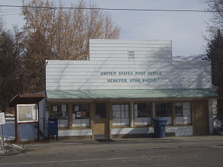
Henefer is a town in Summit County, Utah, United States. It is part of the Salt Lake City, Utah Metropolitan Statistical Area. The population was 766 at the 2010 census.

La Verkin is a city in Washington County, Utah, United States. The population was 4,060 as of 2010, an increase from 3,392 in 2000.

New Harmony is a town in northern Washington County, Utah, United States. The population was 207 at the 2010 census.

Rockville is a town in Washington County, Utah, United States. It is located along the Virgin River near the mouth of Zion Canyon. The city lies just outside the park boundary for Zion National Park; the park entrance is located approximately 5 miles (8 km) northeast of the town.

Foristell is a city in St. Charles and Warren counties in the U.S. state of Missouri. It is located approximately 43 miles west of St. Louis. The population was 505 at the 2010 census.


