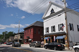
Cornish is a town in York County, Maine, United States. The population was 1,508 at the 2020 census. It is part of the Portland–South Portland–Biddeford, Maine metropolitan statistical area. The main village in town is the Cornish census-designated place. The village has a number of antique shops and restaurants near historic Thompson Park. Cornish is home to the first concrete bridge in North America.
Cornish Township is a township in Sibley County, Minnesota, United States. The population was 267 at the 2000 census.

Cornish is an incorporated town in eastern Jefferson County, Oklahoma, United States. The population was 110 as of the 2020 United States census.

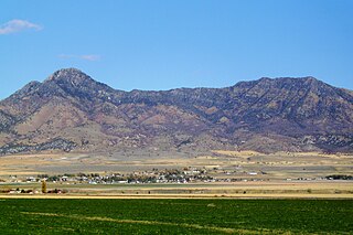
Elwood is a town in Box Elder County, Utah, United States. The population was 1,173 at the 2020 census, up from the 2010 figure of 1,034.
Plymouth is a town in Box Elder County, Utah, United States. The population was 414 at the 2010 census.

Newton is a town in Cache County, Utah, United States. It was founded in 1869 by pioneers of the Church of Jesus Christ of Latter-day Saints. The population was 789 at the 2010 census. It is included in the Logan, Utah-Idaho Metropolitan Statistical Area.

Trenton is a town in Cache County, Utah, United States. The population was 512 at the 2020 census. It is included in the Logan, Utah-Idaho (partial) Metropolitan Statistical Area.

Laketown is a town in Rich County, Utah, United States. The population was 299 at the 2020 census. The town is named for nearby Bear Lake.

Mayfield is a town in southwestern Sanpete County, Utah, United States. The population was 496 at the 2010 census.

Sterling is a town in Sanpete County, Utah, United States. The population was 235 at the 2000 census.

Redmond is a town in Sevier County, Utah, United States. The population was 730 at the 2010 census. Redmond was first settled in 1876, and named for red mounds to the west of the town.

Sigurd is a town in Sevier County, Utah, United States. The population was 429 at the 2010 census.

Francis is a town in on the western edge of Summit County, Utah, United States. It is part of the Salt Lake City, Utah Metropolitan Statistical Area. The population was 1,564 at the 2020 census.
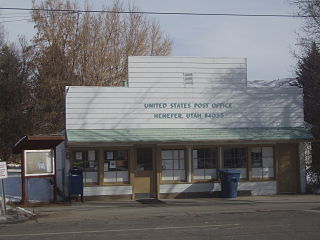
Henefer is a town in Summit County, Utah, United States. It is part of the Salt Lake City, Utah Metropolitan Statistical Area. The population was 766 at the 2010 census.

Elk Ridge is a city in Utah County, Utah, United States. It originally incorporated as a town named Salem Hills. It changed its name in 1978 to Elk Ridge, named for the herds of elk that wintered in the area. It is part of the Provo–Orem, Utah Metropolitan Statistical Area. The population was 4,687 at the time of the 2020 census.

Genola is a town in Utah County, Utah, United States. It is part of the Provo–Orem Metropolitan Statistical Area. The population was 1,370 at the 2010 census.

Woodland Hills is a city in Utah County, Utah, United States. It is part of the Provo–Orem Metropolitan Statistical Area. The population was 1,521 at the 2020 census. Woodland Hills became a city at the end of 2000.

Wallsburg is a town in Wasatch County, Utah, United States. It is part of the Salt Lake City metropolitan area. The population was 250 at the 2010 census. Wallsburg was established in 1861, and was named for William Madison Wall.

Toquerville is a city in east–central Washington County, Utah, United States. The population was 1,870 at the 2020 census.

Lyman is a town along State Route 24 in Wayne County, Utah, United States. The population was 258 at the 2010 census.

