Lewiston, Utah

Last updated

Lewiston, Utah
Lewiston Utah Community Building.jpeg
The Lewiston Community Building, built in 1935, is listed on the National Register of Historic Places.
Cache County Utah incorporated and unincorporated areas Lewiston highlighted.svg
Location in Cache County and the state of Utah
Coordinates: 41°57′42″N111°51′50″W / 41.96167°N 111.86389°W / 41.96167; -111.86389
Country United States
State Utah
County Cache
Settled1870
Named for William H. Lewis
Area
[1]
  Total25.90 sq mi (67.09 km2)
  Land25.84 sq mi (66.93 km2)
  Water0.06 sq mi (0.16 km2)
Elevation
[2]
4,505 ft (1,373 m)
Population
 (2020)
  Total1,939
  Density69.58/sq mi (26.86/km2)
Time zone UTC-7 (Mountain (MST))
  Summer (DST) UTC-6 (MDT)
ZIP code
84320
Area code 435
FIPS code 49-44760 [3]
GNIS feature ID2410826 [2]
Website Official website

Lewiston is a city in Cache County, Utah, United States. It is situated at the northern Utah border and borders the state of Idaho. The population was 1,939 at the 2020 census. It is included in the Logan, Utah-Idaho (partial) Metropolitan Statistical Area.

Contents

Geography

According to the United States Census Bureau, the city has a total area of 25.7 square miles (66.5 km2), of which 25.6 square miles (66.2 km2) is land and 0.1 square mile (0.3 km2) (0.43%) is water.

Climate

This climatic region is typified by large seasonal temperature differences, with warm to hot (and often humid) summers and cold (sometimes severely cold) winters. According to the Köppen Climate Classification system, Lewiston has a humid continental climate, abbreviated "Dfb" on climate maps. [4]

Demographics

Historical population
CensusPop.Note
1880 525
1890 75443.6%
1900 99532.0%
1910 989−0.6%
1920 1,64666.4%
1930 1,7838.3%
1940 1,8041.2%
1950 1,533−15.0%
1960 1,336−12.9%
1970 1,244−6.9%
1980 1,43815.6%
1990 1,5326.5%
2000 1,87722.5%
2010 1,766−5.9%
2020 1,9399.8%
U.S. Decennial Census [5]

As of the census [3] of 2000, there were 1,877 people, 531 households, and 446 families residing in the city. The population density was 73.4 inhabitants per square mile (28.3/km2). There were 558 housing units at an average density of 21.8 per square mile (8.4/km2). The racial makeup of the city was 94.67% White, 0.11% African American, 0.05% Native American, 0.11% Asian, 3.68% from other races, and 1.39% from two or more races. Hispanic or Latino of any race were 6.29% of the population.

There were 531 households, out of which 53.3% had children under the age of 18 living with them, 75.0% were married couples living together, 6.8% had a female householder with no husband present, and 16.0% were non-families. 14.3% of all households were made up of individuals, and 7.3% had someone living alone who was 65 years of age or older. The average household size was 3.53 and the average family size was 3.94.

In the city, the population was spread out, with 39.4% under the age of 18, 12.3% from 18 to 24, 24.7% from 25 to 44, 14.5% from 45 to 64, and 9.1% who were 65 years of age or older. The median age was 24 years. For every 100 females, there were 101.2 males. For every 100 females age 18 and over, there were 94.9 males.

The median income for a household in the city was $36,417, and the median income for a family was $41,705. Males had a median income of $28,750 versus $22,083 for females. The per capita income for the city was $12,385. About 8.7% of families and 10.2% of the population were below the poverty line, including 12.2% of those under age 18 and 9.0% of those age 65 or over.

Notable people

See also

Related Research Articles

<span class="mw-page-title-main">McCammon, Idaho</span> City in Idaho, United States

McCammon is a city in Bannock County, Idaho, United States. It is part of the Pocatello, Idaho Metropolitan Statistical Area'. The population was 825 at the 2020 census. In 1892, McCammon became the junction point between the Oregon Short Line Railroad and Utah and Northern Railway, and city gained the nickname Junction City.

<span class="mw-page-title-main">Paris, Idaho</span> City in Idaho, United States

Paris is a city and county seat of Bear Lake County, Idaho, United States. Located on the western side of the Bear Lake Valley, the city's population was 541 at the 2020 census. Paris was settled on September 26, 1863, by pioneer settlers of the Church of Jesus Christ of Latter-day Saints.

<span class="mw-page-title-main">Carey, Idaho</span> City in Idaho, United States

Carey is a city in Blaine County, Idaho, United States. The population was 604 at the 2010 census. Carey is primarily an agricultural city and is the location of the Blaine County Fairgrounds. Nearby recreational destinations include the Craters of the Moon National Monument, Carey Lake, Silver Creek and the Little Wood River. Further west is the Big Wood River Valley, leading to the Sun Valley resort.

<span class="mw-page-title-main">Clark Fork, Idaho</span> City in Idaho, United States

Clark Fork is a small town in Bonner County, Idaho. The population was 536 at the time of the 2010 census.

<span class="mw-page-title-main">Dubois, Idaho</span> City in Idaho, United States

Dubois is a city in Clark County, Idaho, United States. The population was 511 at the 2020 census. The city is the county seat of Clark County.

<span class="mw-page-title-main">Orofino, Idaho</span> City in Idaho, United States

Orofinooro-FEE-noh; is a city in and the county seat of Clearwater County, Idaho, United States, along Orofino Creek and the north bank of the Clearwater River. It is the major city within the Nez Perce Indian Reservation. The population was 3,142 at the time of the 2010 census.

<span class="mw-page-title-main">Pierce, Idaho</span> City in Idaho, United States

Pierce is a city in the northwest United States, located in Clearwater County, Idaho. The population was 508 at the 2010 census, down from 617 in 2000.

<span class="mw-page-title-main">Dayton, Idaho</span> City in Idaho, United States

Dayton is a city in Franklin County, Idaho, United States. The population was 510 at the 2020 census. It is part of the Logan, Utah-Idaho Metropolitan Statistical Area.

<span class="mw-page-title-main">Preston, Idaho</span> City in Idaho, United States

Preston is a city in Franklin County, Idaho, United States. The population was 5,591 at the 2020 census, up from 5,204 at the 2010 census. The city is the county seat of Franklin County. It is part of the Logan, Utah-Idaho Metropolitan Statistical Area.

<span class="mw-page-title-main">Cottonwood, Idaho</span> City in the United States

Cottonwood is a city in Idaho County, Idaho. On the Camas Prairie in north central Idaho, the population was 822 at the 2020 census, down from 900 in 2010 and 944 in 2000. It is just west of U.S. Route 95, between Grangeville and Lewiston.

<span class="mw-page-title-main">Grangeville, Idaho</span> City in Idaho, United States

Grangeville is the largest city in and the county seat of Idaho County, Idaho, United States, in the north central part of the state. Its population was 3,141 at the 2010 census, down from 3,228 in 2000.

<span class="mw-page-title-main">Kamiah, Idaho</span> City in Idaho, United States

Kamiah is a city in Lewis and Idaho counties in the U.S. state of Idaho. The largest city in Lewis County, it extends only a small distance into Idaho County, south of Lawyer Creek. The population was 1,295 at the 2010 census, up from 1,160 in 2000. The city lies in the narrow valley of the Clearwater River; downstream are Orofino and Lewiston, at the confluence with the Snake River.

<span class="mw-page-title-main">Riggins, Idaho</span> City in Idaho, United States

Riggins is a city in the western United States in Idaho County, Idaho. Nestled deep in a canyon at the confluence of the Salmon and Little Salmon rivers in west central Idaho, it is approximately 150 highway miles (240 km) north of Boise, and 120 highway miles (190 km) south-southeast of Lewiston. The elevation is 1,821 feet (555 m) above sea level, and its population was 419 at the 2010 census.
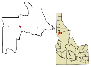
<span class="mw-page-title-main">Craigmont, Idaho</span> City in Idaho, United States

Craigmont is a city in the northwest United States in Lewis County, Idaho. Located on the Camas Prairie in north central Idaho, it is within the Nez Perce Indian Reservation. The population was 501 at the 2010 census, down from 556 in 2000.

<span class="mw-page-title-main">Portage, Utah</span> Town in Utah, United States

Portage is a town in Box Elder County, Utah, United States. The population was 245 at the 2010 census. The town received its name from Lorenzo Snow, an apostle of the Church of Jesus Christ of Latter-day Saints. He named it Portage after his birthplace of Portage County, Ohio.

<span class="mw-page-title-main">Trenton, Utah</span> Town in Utah, United States

Trenton is a town in Cache County, Utah, United States. The population was 512 at the 2020 census. It is included in the Logan, Utah-Idaho (partial) Metropolitan Statistical Area.

<span class="mw-page-title-main">Wellsville, Utah</span> City in Utah, United States

Wellsville is a city in Cache County, Utah, United States. The population was 4,060 at the 2020 census. Wellsville is located at the base of the Wellsville mountain range. It is included in the Logan, Utah-Idaho Metropolitan Statistical Area.

<span class="mw-page-title-main">Wellington, Utah</span> City in Utah, United States

Wellington is a city in Carbon County, Utah, United States. The population was 1,605 at the 2020 census. The community was settled in 1878 by a band of thirteen Mormons led by Jefferson Tidwell. The town was named for Justus Wellington Seeley, Jr., of the Emery County Court. Many residents commute to nearby Price for their jobs, or work in one of the various coal mines in the area.

<span class="mw-page-title-main">Meadow, Utah</span> Town in the state of Utah, United States

Meadow is a town in Millard County, Utah, United States. The population was 254 at the 2000 census. Originally called Meadow Creek, the town is located about eight miles south of Fillmore.

<span class="mw-page-title-main">Junction, Utah</span> Town in the state of Utah, United States

Junction is a town in and the county seat of Piute County, Utah, United States. The population was 191 at the 2010 census.

References

  1. "2019 U.S. Gazetteer Files". United States Census Bureau. Retrieved August 7, 2020.
  2. 1 2 U.S. Geological Survey Geographic Names Information System: Lewiston, Utah
  3. 1 2 "U.S. Census website". United States Census Bureau . Retrieved January 31, 2008.
  4. Climate Summary for Lewiston, Utah
  5. "Census of Population and Housing". Census.gov. Retrieved June 4, 2015.

Further reading