Hyde Park, Utah

Last updated

Hyde Park, Utah
Lee House Hyde Park Utah.jpeg
The John E. Lee House is listed on the National Register of Historic Places.
Cache County Utah incorporated and unincorporated areas Hyde Park highlighted.svg
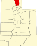
Location in Cache County and the state of Utah
Coordinates: 41°47′55″N111°49′10″W / 41.79861°N 111.81944°W / 41.79861; -111.81944
Country United States
State Utah
County Cache
FoundedApril 16, 1860
Incorporated January 16, 1892
Named for William Hyde
Area
[1]
  Total4.358 sq mi (11.287 km2)
  Land4.358 sq mi (11.287 km2)
  Water0.00 sq mi (0.00 km2)
Elevation
[2]
4,537 ft (1,383 m)
Population
 (2020)
  Total5,234
  Estimate 
(2022) [3]
5,584
  Density1,201.01/sq mi (463.72/km2)
Time zone UTC-7 (Mountain (MST))
  Summer (DST) UTC-6 (MDT)
ZIP code
84318
Area code 435
FIPS code 49-37390 [4]
GNIS feature ID1441964 [2]
Website hydepark.utahlinks.org

Hyde Park is a city in north-central Cache County, Utah, United States. The population was 5,234 at the 2020 census. [3] It is included in the Logan, Utah-Idaho Metropolitan Statistical Area.

Contents

History

The first settlers were Latter-day Saints who moved from Lehi in 1860. Hyde Park was officially organized by Ezra T. Benson on July 1, 1860. The settlement was named in honor of William Hyde, one of the first settlers to arrive in the area on April 23, 1860. The name choice also evoked Hyde Park in London, England which was the homeland of many early settlers. It was at this same meeting that Hyde was also appointed as Bishop of the members of the Church of Jesus Christ of Latter-day Saints in Hyde Park. [5] Hyde served as branch president from 1860–1872 and then as bishop from 1872–1874, when he died. [6]

Hyde Park was surveyed in 1864 and homes on city lots began to replace the earlier fort-style dwellings. The first post office was established on June 15, 1864 and the first town elections were held on September 7, 1864. [7] The first school and church meetings were held in a one-room log structure built in the summer of 1863. [8] As the community grew, church meetings were moved to the new, larger Rock Meeting House constructed in 1866. [9] Early settlers also had to deal with the problem of bringing water to the area for their crops. The first irrigation canal was built in the summer of 1860 and was known as the “Old Ditch.” [10] A second canal known as the Logan-Richmond Canal was constructed in 1865 to help with the increasing demand for water. [11]

In 1874, a census of Hyde Park showed a population of 445 individuals. Hyde Park was incorporated on January 16, 1892 with Charles G. Hyde as president of the board of trustees. [9]

In 1930 the population of Hyde Park was 757. [12]

Geography

Hyde Park is located at 41°47′56″N111°49′9″W / 41.79889°N 111.81917°W / 41.79889; -111.81917 (41.7988, -111.8191). [13] It lies in between the cities of North Logan and Smithfield, approximately five miles north of the county seat, Logan.

According to the United States Census Bureau, in 2019 the city had a total area of 4.358 square miles (11.29 km2), all land. [1]

Demographics

Historical population
CensusPop.Note
1870 343
1880 48340.8%
1890 4911.7%
1900 61926.1%
1910 69912.9%
1920 491−29.8%
1930 61926.1%
1940 73518.7%
1950 644−12.4%
1960 6440.0%
1970 1,02559.2%
1980 1,49545.9%
1990 2,19046.5%
2000 2,95534.9%
2010 3,83329.7%
2020 5,23436.6%
2022 (est.)5,584 [3] 6.7%
U.S. Decennial Census [14]

As of the census [4] of 2000, there were 2,955 people, 763 households, and 678 families residing in the city. The population density was 923.5 people per square mile (356.5/km2). There were 779 housing units at an average density of 243.4 per square mile (94.0/km2). The racial makeup of the city was 98.00% White, 0.14% African American, 0.07% Native American, 0.37% Asian, 0.10% Pacific Islander, 0.47% from other races, and 0.85% from two or more races. Hispanic or Latino of any race were 1.59% of the population.

There were 763 households, out of which 60.3% had children under the age of 18 living with them, 81.3% were married couples living together, 6.0% had a female householder with no husband present, and 11.1% were non-families. 9.8% of all households were made up of individuals, and 5.1% had someone living alone who was 65 years of age or older. The average household size was 3.87 and the average family size was 4.18.

In the city, the population was spread out, with 40.3% under the age of 18, 11.5% from 18 to 24, 25.1% from 25 to 44, 17.5% from 45 to 64, and 5.5% who were 65 years of age or older. The median age was 24 years. For every 100 females there were 101.7 males. For every 100 females age 18 and over, there were 95.2 males.

The median income for a household in the city was $51,750, and the median income for a family was $54,545. Males had a median income of $42,868 versus $25,000 for females. The per capita income for the city was $15,487. About 3.7% of families and 3.4% of the population were below the poverty line, including 3.0% of those under age 18 and 5.9% of those age 65 or over.

Notable persons

See also

Related Research Articles

<span class="mw-page-title-main">Franklin County, Idaho</span> County in Idaho, United States

Franklin County is a county located in the U.S. state of Idaho. As of the 2020 Census the county had a population of 14,194. The county seat and largest city is Preston. The county was established in 1913 and named after Franklin D. Richards, an Apostle of the Church of Jesus Christ of Latter-day Saints. It is the only Franklin County in the United States that is not named after Benjamin Franklin. Franklin County is part of the Logan, UT-ID Metropolitan Statistical Area.

<span class="mw-page-title-main">St. Charles, Idaho</span> City in Idaho, United States

St. Charles is a city in southern Bear Lake County, Idaho, United States, that is located near the northwestern shore of Bear Lake. Its population was 131 at the 2010 census, down from 156 in 2000.

<span class="mw-page-title-main">Dayton, Idaho</span> City in Idaho, United States

Dayton is a city in Franklin County, Idaho, United States. The population was 463 at the 2010 census. It is part of the Logan, Utah-Idaho Metropolitan Statistical Area.

<span class="mw-page-title-main">Franklin, Idaho</span> City in Idaho, United States

Franklin is a city in Franklin County, Idaho, United States. The population was 641 at the 2010 census. It is part of the Logan, Utah-Idaho Metropolitan Statistical Area.

<span class="mw-page-title-main">Garland, Utah</span> City in Utah, United States

Garland is a city in northeastern Box Elder County, Utah, United States. The population was 2,589 at the 2020 census.

<span class="mw-page-title-main">Perry, Utah</span> City in Utah, United States

Perry is a city in Box Elder County, Utah, United States. The population was 4,512 at the 2010 census.

<span class="mw-page-title-main">Amalga, Utah</span> Town in the state of Utah, United States

Amalga is a town in Cache County, Utah, United States. The population was 488 at the 2010 census. It is included in the Logan, Utah-Idaho (partial) Metropolitan Statistical Area.

<span class="mw-page-title-main">Clarkston, Utah</span> Town in the state of Utah, United States

Clarkston is a town in Cache County, Utah, United States. The population was 666 at the 2010 census. It is included in the Logan, Utah-Idaho Metropolitan Statistical Area. The community celebration is held in June each year and is known as The Pony Express Days.

<span class="mw-page-title-main">Cornish, Utah</span> Town in the state of Utah, United States

Cornish is a town in Cache County, Utah, United States. The population was 288 at the 2010 census. It is included in the Logan, Utah-Idaho (partial) Metropolitan Statistical Area.

<span class="mw-page-title-main">Hyrum, Utah</span> City in Utah, United States

Hyrum is a city in Cache County, Utah. The population was 7,609 at the time of the 2010 census, with an estimated population of 8,403 in 2018. It is included in the Logan metropolitan area.

<span class="mw-page-title-main">Mendon, Utah</span> City in Utah, United States

Mendon is a city in Cache County, Utah, United States. The population was 1,282 at the 2010 census. It is included in the Logan, Utah-Idaho Metropolitan Statistical Area.

<span class="mw-page-title-main">Newton, Utah</span> Town in the state of Utah, United States

Newton is a town in Cache County, Utah, United States. It was founded in 1869 by pioneers of the Church of Jesus Christ of Latter-day Saints. The population was 789 at the 2010 census. It is included in the Logan, Utah-Idaho Metropolitan Statistical Area.

<span class="mw-page-title-main">North Logan, Utah</span> City in Utah, United States

North Logan is a city in Cache County, Utah, United States. The population was 8,269 at the 2010 census and estimated to be 11,176 according to the 2018 Census. It is included in the Logan, Utah-Idaho (partial) Metropolitan Statistical Area. The city is mainly composed of residential sub-divisions and is a suburb of the county seat, Logan.

<span class="mw-page-title-main">Peter, Utah</span> Census-designated place in Utah, United States

Peter is a census-designated place (CDP) on the west-central edge of Cache County, Utah, United States. The population was 324 at the 2010 census. It is included in the Logan, Utah-Idaho (partial) Metropolitan Statistical Area.

<span class="mw-page-title-main">Providence, Utah</span> City in Utah, United States

Providence is a city in Cache County, Utah, United States. The population was 7,075 at the 2010 census. It is included in the Logan, Utah-Idaho Metropolitan Statistical Area.

<span class="mw-page-title-main">Richmond, Utah</span> City in Utah, United States

Richmond is a city in Cache County, Utah, United States. The population was 2,733 at the 2020 census. It is included in the Logan metropolitan area.

<span class="mw-page-title-main">Kaysville, Utah</span> City in Utah, United States

Kaysville is a city in Davis County, Utah. It is part of the Ogden–Clearfield metropolitan area. The population was 27,300 at the time of the 2010 census, with an estimated population of 32,390 in 2019.

<span class="mw-page-title-main">Mayfield, Utah</span> Town in the state of Utah, United States

Mayfield is a town in southwestern Sanpete County, Utah, United States. The population was 496 at the 2010 census.

<span class="mw-page-title-main">Spring City, Utah</span> City in Utah, United States

Spring City is a city in Sanpete County, Utah, United States. The population was 988 at the 2010 census.

The Logan Metropolitan Statistical Area, as defined by the United States Census Bureau, is an area consisting of two counties – one in Utah and one in Idaho, anchored by the city of Logan. As of the 2010 census, the MSA had a population of 125,442. As of the 2020 Census, the population had risen to 147,908, and further expanded to an estimated 155,362 as of 2022. The Logan metropolitan area is colloquially called Cache Valley, where most of the population resides.

References

  1. 1 2 "2019 U.S. Gazetteer Files". United States Census Bureau. Retrieved August 7, 2020.
  2. 1 2 U.S. Geological Survey Geographic Names Information System: Hyde Park
  3. 1 2 3 "U.S. Census Bureau QuickFacts: Hyde Park city, Utah". Census Bureau QuickFacts. July 1, 2022. Retrieved August 14, 2023.
  4. 1 2 "U.S. Census website". United States Census Bureau . Retrieved January 31, 2008.
  5. Kirby, Dale Z. (1997). History of Hyde Park in Utah's Cache Valley. Salem, Oregon: D. Z. Kirby. pp. 6–7.
  6. Andrew Jenson. Encyclopedic History of the Church. p. 349.
  7. Kirby. History of Hyde Park. p. 20.
  8. Kirby. History of Hyde Park. p. 17.
  9. 1 2 Jeppeson, Scott. "Hyde Park, Utah History" (PDF). Hyde Park City. Retrieved October 1, 2015.
  10. Kirby. History of Hyde Park. pp. 7–9.
  11. Kirby. History of Hyde Park. p. 28.
  12. Jenson. Encyclopedic History. p. 349.
  13. "Hyde Park". Geographic Names Information System . United States Geological Survey, United States Department of the Interior . Retrieved May 3, 2009.
  14. "Census of Population and Housing". Census.gov. Retrieved June 4, 2015.