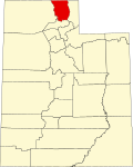
Peter, Utah

Last updated

Petersboro, Utah
Cache County Utah incorporated and unincorporated areas Peter highlighted.svg
Location in Cache County and the state of Utah
Coordinates: 41°45′39″N111°59′3″W / 41.76083°N 111.98417°W / 41.76083; -111.98417
Country United States
State Utah
County Cache
Settled1867
Founded bySylvanus Collett
Named for Peter Maughan
Area
  Total22.4 sq mi (58.0 km2)
  Land21.5 sq mi (55.8 km2)
  Water0.8 sq mi (2.2 km2)
Population
 (2010)
  Total324
  Density14/sq mi (5.6/km2)
Time zone UTC-7 (Mountain (MST))
  Summer (DST) UTC-6 (MDT)
ZIP code
84325
Area code 435

Petersboro is a census-designated place (CDP) on the west-central edge of Cache County, Utah, United States. The population was 324 at the 2010 census. It is included in the Logan, Utah-Idaho (partial) Metropolitan Statistical Area.

Contents

Geography

Petersboro is located at 41°45′39″N111°59′3″W / 41.76083°N 111.98417°W / 41.76083; -111.98417 (41.760838, -111.984191). [1]

According to the United States Census Bureau, the CDP has a total area of 22.4 square miles (58.0 km2), of which 21.5 square miles (55.8 km2) is land and 0.9 square mile (2.2 km2) (3.84%) is water.

History

Sylvanus Collett became the first settler in Petersboro in 1867. In 1876 Petersboro was designated District Six within the Mendon LDS Ward. Petersboro became a separate ward in 1887. [2]

The area is named for Peter Maughan, an early Mormon settler and church leader. Located outside of Mendon, historically the area has been closely tied with the cultural and religious communities located in the nearby town. Each year residents of Petersboro participate with Mendonites in their May Day celebration.

Demographics

Historical population
CensusPop.Note
1880 76
1890 337343.4%
1900 166−50.7%
1910 22233.7%
1920 32044.1%
1930 233−27.2%
1940 180−22.7%
1950 150−16.7%
2000 230
2010 32440.9%

As of the census [3] of 2000, there were 230 people, 69 households, and 60 families residing in the CDP. The population density was 10.7 inhabitants per square mile (4.1/km2). There were 71 housing units at an average density of 3.3 per square mile (1.3/km2). The racial makeup of the CDP was 100.00% White. Hispanic or Latino of any race were 1.74% of the population.

There were 69 households, out of which 52.2% had children under the age of 18 living with them, 71.0% were married couples living together, 7.2% had a female householder with no husband present, and 13.0% were non-families. 11.6% of all households were made up of individuals, and 4.3% had someone living alone who was 65 years of age or older. The average household size was 3.33 and the average family size was 3.62.

In the CDP, the population was spread out, with 38.7% under the age of 18, 7.0% from 18 to 24, 23.5% from 25 to 44, 20.9% from 45 to 64, and 10.0% who were 65 years of age or older. The median age was 32 years. For every 100 females, there were 111.0 males. For every 100 females age 18 and over, there were 107.4 males.

The median income for a household in the CDP was $61,250, and the median income for a family was $66,250. Males had a median income of $51,964 versus $28,750 for females. The per capita income for the CDP was $17,850. None of the population or families were below the poverty line.

See also

Related Research Articles

<span class="mw-page-title-main">Pine, Arizona</span> CDP in Gila County, Arizona

Pine is an unincorporated community and census-designated place (CDP) in Gila County, Arizona, United States. The population was 1,963 at the 2010 census. Pine was established by four Mormon families in 1879.

<span class="mw-page-title-main">Sells, Arizona</span> CDP in Pima County, Arizona

Sells is an unincorporated community and census-designated place (CDP) in Pima County, Arizona, United States. The population was 2,799 at the 2000 census. It is the capital of the Tohono O'odham Nation and the home of several of their tribal businesses, such as Tohono O'Odham Ki:Ki Association. Originally named Indian Oasis, by cattle-ranchers/businessmen brothers, Joseph and Louis Ménager in 1912. The Ménager brothers also built and ran the Indian Oasis Mercantile Store. The settlement took its present English name in 1918 to honor Indian Commissioner Cato Sells. The O'odham name means "Tortoise Got Wedged".

<span class="mw-page-title-main">Stanfield, Arizona</span> CDP in Pinal County, Arizona

Stanfield is a census-designated place (CDP) in Pinal County, Arizona, United States. The population was 651 at the 2000 census. Shamrock Farms operates a farm in Stanfield.

<span class="mw-page-title-main">Lakewood Shores, Illinois</span> Census-designated place in Illinois, United States

Lakewood Shores is a census-designated place (CDP) in Will County, Illinois, United States. The population was 665 at the 2020 census.

<span class="mw-page-title-main">Milford Mill, Maryland</span> Census-designated place in Maryland, United States

Milford Mill is an unincorporated community and census-designated place in Baltimore County, Maryland, United States. Per the 2020 census, the population was 30,622.

<span class="mw-page-title-main">Walker Valley, New York</span> CDP in New York, United States

Walker Valley is a hamlet located in the western part of the Town of Shawangunk in Ulster County, New York, United States, generally thought of as coterminous with the 12588 ZIP code. The population was 1,269 at the 2020 census.

<span class="mw-page-title-main">Monument, Pennsylvania</span> Census designated place in Pennsylvania, United States

Monument is an unincorporated community and census-designated place in Centre County, Pennsylvania, United States. It is part of the State College, Pennsylvania Metropolitan Statistical Area. The population was 150 at the 2010 census.

<span class="mw-page-title-main">Hartstown, Pennsylvania</span> Census-designated place in Pennsylvania, United States

Hartstown is a census-designated place (CDP) in Crawford County, Pennsylvania, United States. The population was 201 at the 2010 census, down from 246 in 2000.

<span class="mw-page-title-main">Newport, South Carolina</span> CDP in South Carolina, United States

Newport is a census-designated place in York County, South Carolina. Most of Newport is annexed into the city of Rock Hill, while parts are still located in unincorporated York County, but Newport is still considered to be a census-designated place. The census of 2010 showed the population to be 4,136. During the 2000 Census, the population was 4,033.

<span class="mw-page-title-main">Cache, Utah</span> CDP in Utah, United States

Cache Junction is a census-designated place (CDP) in Cache County, Utah, United States. The population was 38 at the 2010 census. It is included in the Logan, Utah-Idaho (partial) Metropolitan Statistical Area.

Cottonwood West was a census-designated place (CDP) in Salt Lake County, Utah, United States. The CDP was situated between the cities of Holladay and Murray, which by the mid-2000s had annexed virtually all of the area between them.

<span class="mw-page-title-main">Montezuma Creek, Utah</span> Census-designated place in Utah, United States

Montezuma Creek is a census-designated place (CDP) in San Juan County, Utah, United States. The population was 335 at the 2010 census, a decrease from the 2000 figure of 507.

<span class="mw-page-title-main">Tselakai Dezza, Utah</span> CDP in Utah, United States

Tselakai Dezza is a census-designated place (CDP) in San Juan County, Utah, United States. The population was 103 at the 2000 census.

<span class="mw-page-title-main">Woodland, Utah</span> CDP in Utah, United States

Woodland is a census-designated place (CDP) in Summit County, Utah, United States. The population was 335 at the 2000 census.

<span class="mw-page-title-main">Lake Shore, Utah</span> CDP in Utah, United States

Lake Shore is a census-designated place (CDP) in Utah County, Utah, United States. It is part of the Provo–Orem Metropolitan Statistical Area. The population was 817 at the 2010 census.

<span class="mw-page-title-main">Palmyra, Utah</span> CDP in Utah, United States

Palmyra is a census-designated place (CDP) in Utah County, Utah, United States. It is part of the Provo–Orem Metropolitan Statistical Area. The population was 491 at the 2010 census. Palmyra is located directly west of Springville and northwest of Spanish Fork.

<span class="mw-page-title-main">West Mountain, Utah</span> CDP in Utah, United States

West Mountain is a census-designated place (CDP) in Utah County, Utah, United States. It is part of the Provo–Orem Metropolitan Statistical Area. As of the 2010 census, the CDP population was 1,186. The town is at the base of West Mountain and bears its name.

<span class="mw-page-title-main">Markham, Washington</span> CDP in Washington, United States

Markham is a census-designated place (CDP) in Grays Harbor County, Washington, United States. The population was 111 at the 2010 census.

<span class="mw-page-title-main">Oljato–Monument Valley, Utah</span> CDP in Utah, United States

Oljato-Monument Valley is a census-designated place (CDP) in San Juan County, Utah, United States. The population was 864 at the 2000 census.

<span class="mw-page-title-main">Groton (CDP), Massachusetts</span> Census-designated place in Massachusetts, United States

Groton is a census-designated place (CDP) comprising the main village in the town of Groton in Middlesex County, Massachusetts, United States. The population of the CDP was 1,353 at the 2020 census, out of 11,315 in the entire town of Groton.

References

  1. "US Gazetteer files: 2010, 2000, and 1990". United States Census Bureau. February 12, 2011. Retrieved April 23, 2011.
  2. Andrew Jenson. Encyclopedia History. p. 652
  3. "U.S. Census website". United States Census Bureau . Retrieved January 31, 2008.